AT – NC Wayah Bald to Winding Stair Gap

Day 6: June 29, 2017

A quiet morning to hike.  Ten miles, then boom, my trip to North Carolina would be over. Back to Maryland, back to everyday life.  I was looking forward to getting back home even though the mountains in NC have been delightful to hike.

This hike had Momma Puma shuttling me to a trail head for the last time.  Afterwards, she would be off on her own adventure and we planned on meeting up at Google’s cabin in the evening.

A quiet morning with sounds of grass brushing against my hiking pants broken by the occasional cry of a bird or crunch of tires on the fire road.  I watched as the sky clouded up, to the point I thought rain was imminent, then, in a blink, the sun would break through and make the forest glow.

DSC01250

The trail passed by a campsite before the Bartram trail diverged to the right.  I took a little break there.  I sat back against a tree and thought about the week I’d had hiking here in NC.  The mountains are just so darn dramatic!

DSC01251

Rounding a corner near Wilson Lick trail, I heard a crash and looked up to see a bear butt running up hill! How exciting!

I moved on down the trail with a smile…yes, wildlife, finally!

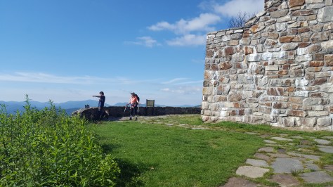
The AT crossed the fire road a few times before reaching the paved road at Wayah Gap.

Now, I was going to be headed uphill for awhile and hopefully, hopefully I wouldn’t miss the turn-off for Siler Bald!  More people, actually a lot of people were on this stretch of trail.  That made the trip up seem shorter and the variety of body types made me think this “up” wouldn’t be too bad.  The uphill did go up for a good ways, though! Definitely break worthy, so I found a nice log and had a snack.  It was getting humid, whew!

And I missed the turn-off for Siler Bald!!!  Unbelievable. I saw the sign for the shelter, but nothing for the bald.  So I backtracked. ugh! But I knew I would regret not going to the bald!

DSC01263

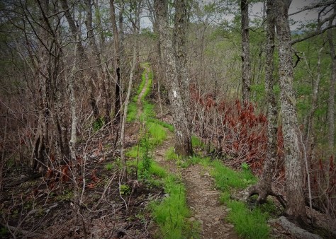
This is why I missed the turn-off. So overgrown! It got worse, before better…and I was separating grasses with my hiking poles to check for snakes before plowing through!

DSC01264

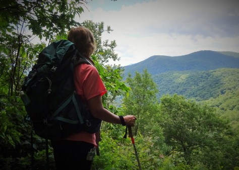
Once climbing to the top of Siler Bald, I was happy I had backtracked! What a view! I didn’t stay long because it was unbearably HOT in that field!

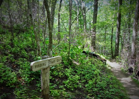
Having had my most excellent view from Siler Bald, I was ready to hoof it down to Winding Stair Gap.  However, I had to cross through Panther Gap first…and I was in a silly mood by then as I was on a very warm and humid mile 8.  Coming down into Panther Gap, I thought, “why do they have to call it Panther Gap?  Why not kitty cat gap? or Hello Kitty gap?…what if there really are panthers in Panther Gap? Wait, is a panther the same as a cougar? a mountain lion? I wonder if they are black?…”

DSC01268

Then I stopped to stretch my neck…too much looking at the ground.

OH. MY. GAWD.  I looked hard, not believing what I was seeing.  Tan color…Is that a bobcat?  No, that is a long droopy swinging tail!!!  The cat, kitty, panther, cougar, mountain lion, whatever you want to call it was about 25 yards in front of me casually walking down the AT away from me!!! Holy moly!!!!!!!!!!!!!!  He paused for a moment to look over its shoulder at me.  A sweet little head with rounded ears, no tufts, definitely NOT a bobcat,…I quickly inhaled then clicked my hiking poles together.  (No need for him to get too curious.)  He turned back around and began to trot down the trail.  I waited, gave him time to find a safe spot before I walked on.

He was no where to be seen when I passed through.

I felt so blessed, wow, so, so blessed to have this cat make his presence known.  exhale. We all share this one world.  All creatures great and small.

Hike on.

AT – NC Wayah Bald to Tellico Gap

Day 5: Wayah Bald to Tellico Gap, June 28, 2017

“I’ll just hike a little ways with you”

Words from Momma Puma as we pulled into the Wayah Bald parking area.  I barely heard her as my senses were overtaken by the sheer jaw-dropping vista this morning at Wayah Bald.

20170628_092934

The Wayah Bald fire tower, substantial as it is, sustained a clear amount of damage from the fires.  It’s majestic nature has not been affected in the slightest, I am happy to report!  The interior chamber of the fire tower on the ground level would be a great hiding place in a storm.

20170628_093151

Done exploring at the fire tower, we headed north on the AT and downhill.  We passed the sign for the shelter, then promptly, went the wrong way!  I figured the sign for the shelter meant it was a blue blaze, twenty minutes later I am shaking my head as it seemed we were headed around the mountain and below the fire tower.  The one time I have used technology on the trail to actually check my location…and a good call!  Guthook’s guide app showed that we were indeed off the Appalachian Trail…it didn’t show what trail we WERE on (a drawback to the app is that it doesn’t show all the intersecting trails) but we knew we were on the Bartram Trail.  It was encouraging to see that I was correct in where I thought I was…anyway, we backtracked…ugh.

DSC01230

You know some people get off trail because there is no signage…me…sign right in front of me, but I assumed it meant a blue blaze to the shelter. 😀 Extra credit miles today.

Once back at the intersection, Mama Puma, decided she didn’t want to climb back up the hill to her car.  Too funny! So she joined me, for better or worse, to Tellico Gap.

The woodsy trail was a delightful change from the rugged, eroded trail into the NOC I’d hiked the day before.  Lush green engulfed us all of the way to Tellico Gap.

DSC01231

It was a long hike with my pesky blisters making themselves heard with every step after four miles.  At the shelter I sat down for a break…a real break…and changed the bandages on the blisters.  After about 25 minutes, Momma Puma indicated we needed to get moving, so I regretfully pulled on my boots.

DSC01235

Momma Puma

The new bandages were helpful, but as we neared Tellico Gap I was singing “Tellico, Oh Tellico, these old boots have got to go” as my feet screamed for freedom.  You do whatever gets you down the trail!

Yes! The light at the end of the tunnel was NOT an oncoming train!!! After being teased with peeks at the fire road for a mile or so, we reached the parking area at Tellico Gap.  Flip flops here I come!

DSC01246

In my trusty RAV4 once again, we drove down the not scary side of the mountain, then made two more stops: 1) back to Momma Puma’s truck at Wayah Bald, then 2) repark my car at Winding Stair in preparation for my last hike for this trip…Wayah Bald to Winding Stair.

Blisters be quiet because I am hiking on!


AT – NC Tellico Gap to NOC

Day 4: Tellico Gap to Nantahala Outdoor Center 6/27/2017

Backpack between Deep Gap and Winding Stair complete, Momma Puma let me know that she could not continue hike due to the knee injury she acquired climbing up Albert Mountain.

hmmm…

hmmm…

You know that sound a video game (and I am so dating myself right now), the sound right before the end, 

Insert deep foreboding voice, GAME OVER!

Anyway, that was what played in my head as Momma Puma told me this news.

***

Then I started planning for how I could continue the trek.  I came down to NC to complete the section from Deep Gap to the Nantahala Outdoor Center, or NOC, and gosh darn it, I would find a way!  Momma Puma graciously extended the offer to shuttle (thank you, thank you).

I was willing to backpack it alone, but needed more information on the trail.  I sent out feelers to hiker friends in the area.  Ann L. texted back, stating there wasn’t anything harder ahead than I had already encountered and no more Albert Mountain-like stuff.  My hiker friend Google (remember her from my GA, MD, and PA sections?) got back to me with a sweeter offer.  Stay at her cabin in Hiawassee and day hike from Winding Stair to the NOC.  She had split it up into three sections that would make the shuttling easier: 1. Tellico Gap to NOC (leaving my car at Tellico Gap), Wayah Bald to Tellico Gap (pick up my car at Tellico Gap and repark at Winding Stair Gap), then the last section would be Wayah Bald to Winding Stair.

Great plan, Google!

So here we were climbing the fire road (Tellico Road) to Tellico Gap, me in my RAV4, and Momma Puma in her big ass truck.  Holy Moly, people…that road is ridiculous!  I kept thinking “jees, this should be a one-way stretch. God forbid, I meet someone coming the other way!”  It was one lane, dirt/gravel, with a massive drop off that became visible at every hairpin turn.  Momma Puma had to actually back up to maneuver around one particularly tight turn in the road. Pretty sure she was holding her breath!

At the top, we parked the cars, exited our respective vehicles and silently (well, almost silently) mouthed “Holy shiiiiiiiiiit” to each other. That was crazy!

IMG_20170711_084205

Look! Another RAV4 🙂 🙂 🙂 Great little mountain climbers

Gathering my day hiking gear, I set off headed north to Wesser Bald Fire Tower.  It was a gorgeous day, sunny with a temperatures that were going to climb no higher than the mid-70s. 🙂 🙂 🙂 Lucky me!

LM1

And off I go!

The climb was a long one, but not especially strenuous.  The trail was flat, not a lot of rocks, and it moderately climbed to the fire tower.  I pulled over for a break under the fire tower.  The fire towers I passed in this section of North Carolina are so cool.  I love climbing up and taking in the view from the top.

However, something weird happened on this trip that is new to me…vertigo on the fire tower steps.  Never had that happened before.  At Albert Mountain, I got to the second platform and stopped.  Here at Wesser Bald, I made it half way up the second flight of steps, then had to sit down. I could of butt climbed the rest of the way to the top, but since I had a good view where I sat, I decided to stop there.

IMG_20170711_084420

Wesser Bald Fire Tower

After my break I headed down towards the shelter.  The trail started to narrow dramatically after passing the shelter.  Fire damage and erosion has taken an immense toll on this section of trail.  Most of the day I was on a narrow strip of trail, the sides of the mountain falling off on either side of me.  I watched my step!

DSC01199

Skinny trail just past the shelter

The damage to the trail came to a head at the “jump-off”.  I was flabbergasted at the condition.  I had thoughts running through my head like, “I shouldn’t even be walking on this.” and “Holy mother of God, is this the trail???”  Just below the jump-off, the trail was about 10 inches wide on an otherwise precariously steep slope that had seen some slide damage due to erosion.  There was a place where a tree had fallen or shifted, leaving a gaping hole in the trail that needed to be stepped over.

This slideshow requires JavaScript.

I was happy to leave that part of the trail behind as I continued steeply downhill!  I found a nice log to sit on down the trail a bit and had some lunch, while texting Momma Puma my approximate time of arrival to the NOC.  The rest of the trail down to the NOC was steep in places, and there were signs of erosion, but nothing like what I experienced at the top.  I was soon down and headed across the Nantahala River to don my flip flops and relax in an Adirondack chair while waiting for Momma Puma to show up. Bliss, I tell you!

The NOC has free Wifi, so I tapped into it.  After sending another message to Momma Puma, I checked out Facebook.  and there I saw it…Momma Puma was having a beer somewhere here at the NOC! What???? Beer??!!

Apparently, even though I had Wifi, my text messages weren’t reaching her…travesty when there is celebratory beverages concerned!  …oh, I found her pretty quickly after that… 😀

Grab a cold one and Hike on!


AT – NC Deep Gap to Winding Stair

Day 1 Deep Gap to Carter Gap Shelter 6/24/2017

Oh how fitting, how absolutely perfectly perfect in a way that is just not cool, not cool at all!! When I finished the Georgia section (a few years back) I ended by splashing down the trail turned creek into Deep Gap.

On Saturday morning, my hiking buddy, Momma Puma, and I set off for Deep Gap in a heavy, dripping fog.  You know the kind.  It wets the roads, damps down sound, and makes mountains disappear.  I dropped my car at Winding Stair, then jumped in with Momma Puma for the ride down to Deep Gap on the fire road.  We wound around on that road so long that we both were convinced we had somehow missed Deep Gap!

A magical, if a little messy, start to our traverse from Deep Gap to Winding Stair (then eventually the NOC).  “Welcome back” I heard the woods whisper as I slipped past the first white blaze.

I glanced back at Momma Puma a couple of times.  This was her first long distance backpack and she was visibly excited! I remember that feeling…the awe, the nervousness, then the reality of climbing the first big hill.  The loss of confidence, the gaining of confidence, then the reality that every hike, every backpack, no matter how many I have completed, brings the loss and gain of confidence…every.single.one. ! 😀

DSC01093

Momma Puma

The first day was a gain in confidence for me.  Standing Indian is not as hard a climb as it looks on the map.

LM5

credit to Momma Puma for this pic!

Before we knew it we were cruising into the Carter Gap Shelter while still early in the afternoon. And just in time…soon after we arrived so did the rain.  A few others came in after us and then…Torrential for about 10 minutes.  I was feeling pretty dry, happy, and quite literally, smug, until I realized the shelter was leaking ON MY BAG.  Could this get any better?

DSC01138

Cozy until my bag got wet. 😦 Darn drippy shelter!

After the rain, a few more hikers showed up.  And let me tell you, this was the worst bunch of shelter mates I have ever had, in terms of bear safety, that is.  No one was going to hang their food.  These two younger guys were literally going to leave their dirty dishes in the shelter (near to where I had put my sleeping pad, mind you!).   A man with a dog was throwing chunks of cheese to his dog…who missed several times and would not eat the crumbs off the ground.  SERIOUSLY???  NO. NO. NO!!!!! Momma Puma and I were incredulous.  Speechless.  Are these people for real????

We, Momma Puma and I,  contemplated putting up our tents down the hill…but with the rain threatening, decided we would stick with the shelter.

We began reciting every story we knew of a bear coming in because someone had barely sneezed cheese crumbles in their tent. hahaaaa! 🙂 🙂

DSC01139

Bad hiker leaving dirty plates in shelter until we told so many scary stories they were at least shamed into getting this crap out of the shelter.

Thank you to Laralee Bliss for the recent story about the tent snooping bear in Shenandoah NP.  It did the trick.  I don’t know how they hung their bags and don’t care.  They all got their food out of the shelter.  And we had a quiet night…for the most part.  There was talk of an animal crashing through by Momma Puma, but I heard nothing in my Benedryl induced slumber.

Day 2  Carter Gap to Long Branch Shelter 6/25/2017

We were up and moving the next morning as others in the shelter were just starting breakfast and I was happy to move on…hoping the food offenders would not show up at the next shelter!

The trail was quite exciting between  Carter Gap and Long Branch.  I was hoping to walk through some of the fire damage from last fall’s fire and boy, did we ever.  Miles of burned out areas left us in an indescribable state.  I was floored.  I have never seen anything like the fire damage we hiked through.

DSC01146

DSC01150

View from the charred ridge

Just after Mooney Gap, there is the area I will just refer to as the land between the fire roads.  It started off innocently enough with a nice climb through rhododendron bushes, but then circled the mountain and became a cliff side walk…one wrong step…haha! And then, the big event of the day…Albert Mountain! I was looking forward to this in the same way I was looking forward to Lehigh Gap when I hiked Pennsylvania.  However, I knew less about Albert Mountain.  Was it really a rock scramble?  It was fitting that I was set to climb it on my dad, Albert Cross’ birthday! What a way to celebrate, too bad there was no birthday cake at the top for me! 🙂

DSC01167

Momma Puma in the land between the fire roads

DSC01165

View from a slightly scary place on the trail in the land between the fireroads.

Albert was a combination of rock scramble and stairs.  Without a backpack on, it would have been a lot more fun, for sure!  With the backpack, it made me nervous, then made me feel like a badass. I would definitely climb it again! At the top, sans birthday cake, was a great fire tower with great views.  Wonderful payoff!

LM9

Hugging the white blaze on Albert. Happy Birthday Daddy! (credit to Momma Puma for this pic)

DSC01173

Momma Puma on Albert Mountain

DSC01177

A just reward!


It began to sprinkle while we were taking a break at the fire tower.  To don the rain poncho to not…

We descended the mountain, passing the old location of the shelter.  It was a rough, but exciting day of hiking!

DSC01178

We were plum tuckered out when we reached the Long Branch.  Thoughts of my dinner kept me going…I packed an avocado! Downright exciting! Dinner was Capellini with tuna and avocado…and it was exceptional!!!  Afterwards I crashed in this most beautiful of shelters. 🙂

Day 3 Long Branch to Winding Stair Gap

Morning came and I set out to retrieve our bear bags.  No one else was awake so I sat out on a stump and watched far off mountains go from black to purple to pinkish to blue.  I stretched out my legs and my arms.  I felt so at home here in the woods this morning.  It was so quiet.

DSC01185

Greeted with new blooms this morning!

We made the last day of our first section without incident.  We were both sporting new aches…Momma Puma strained her knee on Albert… and I had a few raw spots on my heels from blisters.  The blisters irritated me.  I had hiked several miles on rockier terrain than this with no blisters before this hike.  The only thing I can think is that the added weight of the pack caused my feet to rub differently.  Oh well, the NOC is calling…wrap them up, put on those boots and hike on!

DSC01194

The end of the first leg of our hike