Finding the Sun

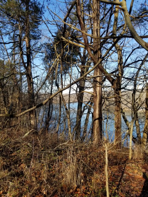
I don’t know what I was hoping to find, or hear, or think, or see. All I knew was, after dropping my sewing machine off to be serviced in sunny Martinsburg, WV, I was not going immediately home to Frederick, MD where thick gray mist still covered the entire valley. I found myself pulling into Yankauer Nature Preserve .

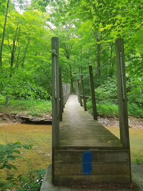
My first steps, on a trail covered in soft pine needles still cushy from recent rain showers, took me into a forest glittering with raindrops.

Each sunlit drop clung precariously, and in futility, before beautifully releasing to the Earth. Rejoined with all the other droplets, waiting for the sun to regenerate and empower them to rise once more! To be immense and visible to all who gaze up into the billowing towers of clouds… the gathering of millions and millions of droplets.

The trail mimics a labyrinth, winding to the west, then east, then around again. I am walking into blinding light of the sun, then a few moments on, I find only dark shade in front of me and the warmth of the sun on my back.

Around one turn in the trail I spy a hawk. It spots me too….and takes flight over the Potomac River, then circles back and around until he finds a suitable alternate roost far from me.

Strange, this period between Winter Solstice and New Year’s. Yes, timeless, but more than that. For me, it has been a time of seeing myself as if Picasso had painted me. All angles of my life at once, past, present, even my future self, all vividly present at once.

Too much time and not enough either. I think about how we all get stuck sometimes and wonder whether struggling through is really the right approach to get unstuck. Maybe, like the rain droplets, we need to put our trust in the universe, to a certain extent, and let go.

So…with that said…Goodbye 2019, I release you! It was a hard year, for me and for the world.

Hello 2020! Let me have more sense, show more compassion, and act more responsibly. Let me be regenerated and empowered to take on life!

Hike on!

Pine Lick Trail – Green Ridge State Forest

Green Ridge State Forest is, as yet, untapped hiking opportunities for me. I set out to scout the Pine Lick Trail with a couple of other hike leaders from the Maryland Trail Dames.

After meeting at Forest HQ off of I-68, we piled into my car to find the beginning of the trail.

Google maps got us to an approximate location, then we were on our own. Luckily, we spotted a blaze from the car! Nothing that looked like a trail…yet.

Dropped pin
Near Pennsylvania
https://maps.app.goo.gl/2NrhSACYwG25eUQ37

Spotting a trail sign down in the woods, I high stepped over some poison ivy and other brush to investigate. Success! We had found the trail!

Now to park…sketchy at best.

The Pine Lick Trail meets up with the MidState Trail here. The MidState Trail goes north to Buchanan State Forest in Pennsylvania.

We took a pic at the Mason Dixon Line, then set off going south. It was 6 miles back to HQ. We were excited to see what we would find!

A few small hills, then level, flat, soft trail. What a delight!

There were several trail signs to keep us motivated and frequent blazes. 😀 Very easy to follow the trail, even though it was overgrown in many places!

What the heck does “SNAG” mean?

We passed a massive, lovely campsite…and it only costs $10 a night!!!

Just after, a beautiful meadow, then we descended to the bottom lands near “Fifteen Mile Creek”. The trail follows, and crosses, the creek many times. This included rockhopping, crossing on one super sloping bridge (a sign later on said this bridge was closed), and some log crossings.

Just before the super slopey bridge, we had come across a swimming hole that looked mighty inviting. Making plans for a “Dog Days of August” hike and swim adventure!

I was surprised that we did not see any bears! We flushed out a wild turkey accidentally, crossed paths with a few newts, salamanders, lizards, and one Wolf Spider…but no bears.

Coming upon the Pine Lick Shelter, we stopped to check it out. The area behind the shelter looked like a jungle.

We stopped for lunch at a backcountry campsite on the banks of the creek. Then it was up, up, up a very eroded hill. It felt like if we made on wrong move we would slide all the way back down!

As we neared I-68, and yes, the trail gets so close to the highway you could literally jump over the guard rail!

Before that, however, we again met with overgrown trail.

Parting the way with my hiking poles, we slowly made our way through. No snakes, yay!

On the other side of the bridge we lost the trail for about 10 minutes because it was so overgrown. However, we knew we were in the right area, so once we did find a blaze, we backtracked to see if we could determine where we had gone the wrong way. We are pretty confident it was just after coming under the bridge. The trail goes left up the hill, we had continued to follow the creek. (Our way was less overgrown…I do not regret our path!)

Up, up, up again!

Three hot climbs later and we were happily, finally, back at the car! We recorded our trek at 7 miles. Here are the official specs…hike on!

Blockhouse Point Conservation Area

Blockhouse Point is a great little park in Montgomery County, Maryland.  Sidekick Pauli helped me scout this hike so I could lead a group here.  By the way, those of you who read the last post of mine know that Sidekick Pauli went in for surgery for a lump that grew rather quickly on her neck.  Her surgery went great and they were able to get all cancerous tissue out!!  So it was cancerous, but prognosis is fantastic!  She will probably be scouting hikes with me for a long time to come! 🙂 🙂

I visited Blockhouse Point on three different occasions to get the feel of the place since it was brand new to me.  The first time my son and niece tagged along.  Of course, we were caught up  in conversation and got off on the wrong trail.  We had wanted to loop, but this trail did not do that.  Turns out we had gotten on the last leg of the Muddy Branch Trail! Made a note to look this trail up later for future adventures in MoCo!

img_20160104_123316.jpg

The second time was better planned out and Sidekick Pauli was in tow!  We headed down the Canyon Trail, crossed over to Blockhouse Point Trail, then out to Blockhouse Point.  This was before Sidekick Pauli’s surgery and she was delighted to pull me along the trail smelling all things new and exciting.  I was expecting a little more of an overlook, but the views of the river were tremendously satisfying!  Pauli was a little antsy, so I let her lead us back to the car instead of heading out to the second overlook on the Paw Paw trail.  It looked a bit cloudy and felt like a storm was moving in. Sure enough as soon as we got to the car, the skies opened up!  Thank you, Sidekick Pauli, for keeping me dry!!!

2016-01-10-14.44.51.jpg.jpg

The third visit I practically ran down the trails.  I wanted to scout out the Paw Paw overlook.  I am so glad I did.  It is definitely the nicer overlook.  Expansive views of the river to the northwest.  Very understandable why this point was used in the Civil War.  Another neat feature is the C&O Canal is just below the bluffs, so you can “spy” bicyclists, walkers, and horse riders all day if you like while you sit high above on the rocks.  haha!

img_20160122_152348.jpg

20160206_104204.jpg

20160206_094841.jpg

I do need to advise that the Turkey Fan Trail has been rerouted.  This caused me a little confusion the first time out there… not hard to figure out…just weird trying to put together where exactly you are on the Blockhouse Point Trail if you have never been to the area.  So a heads up!

Also, I’ve heard there is a way to do a big loop by following an unmarked trail behind Calithea Horse Farm, then pick up the C&O Canal.   Walking south on the canal to Pennyfield Lock, then up the Muddy Branch Greenway Trail.  Hmmm…more trails to explore!

And while I do like winter…I think I will wait for Spring! Hike on!