Follow the Potomac River west from Washington, D. C., oh, I’d say about a hundred miles, or so, and you will come to a sweet, little river town that was once in the running for the capital of the United States. Williamsport, Maryland was reviewed by none other than George Washington for a possible location for the United States capital!! Even though it wasn’t chosen as the capital…well, I am sure it was an honor just the same!
I headed to Williamsport to do some flatland hiking since it was way too hot and humid to climb a mountain today (for me anyway 😉 ).
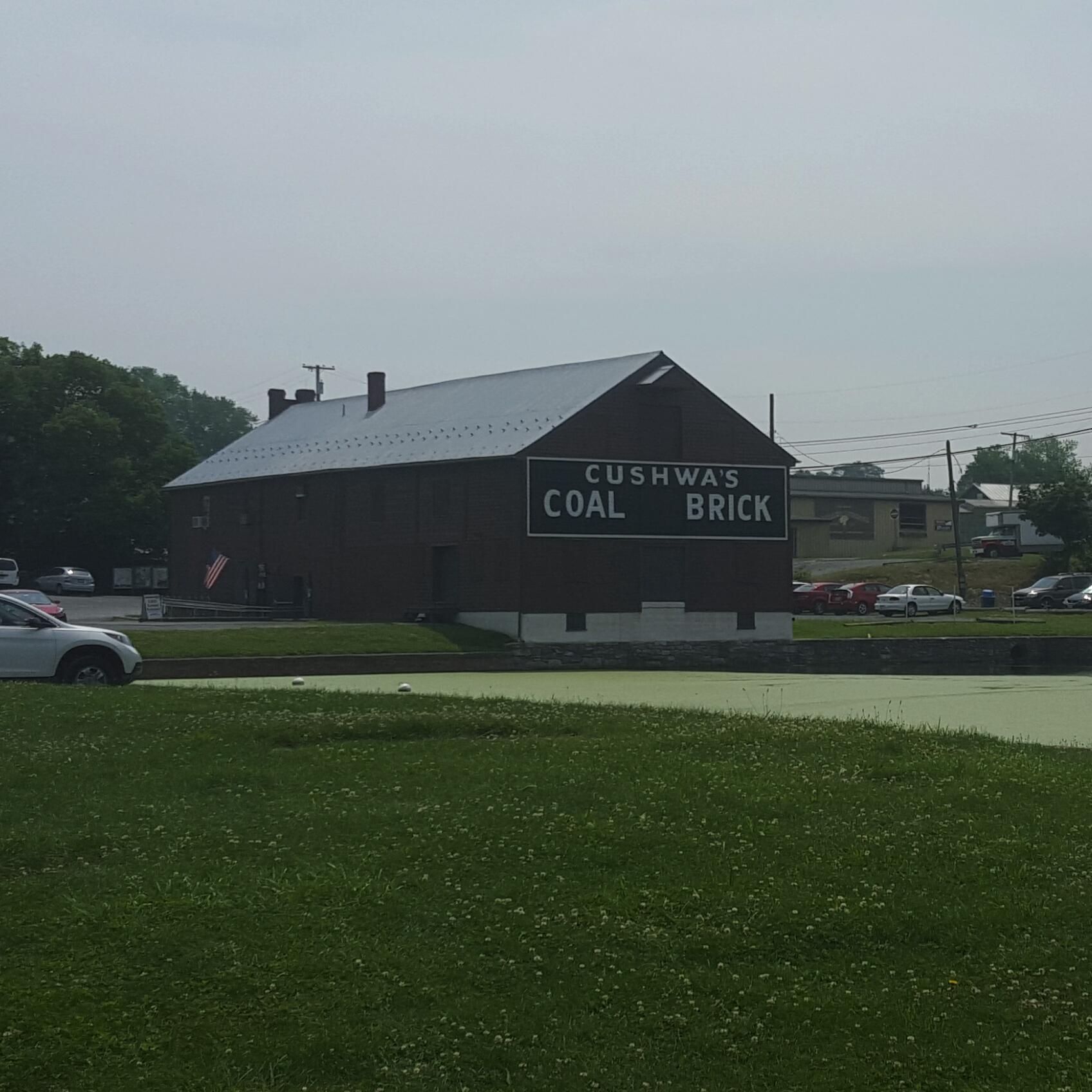
Williamsport is a cool river town with the Potomac River forming a natural boundary on the west and Conococheague Creek hemming it in on the north. The C&O Canal runs along the Potomac River. Many bikers were already on the Canal or taking a break at picnic tables when I rolled into the parking lot.

Museum & Parking Area-Picnic tables and bathrooms!
Another large group of young folks were on their way to the river’s edge with fishing poles, buckets, and bait ready for whatever the river might bring them today. It was quite a bucolic setting to behold. I changed out my flip flops for walking shoes then set off to stroll upstream along the C&O Canal.
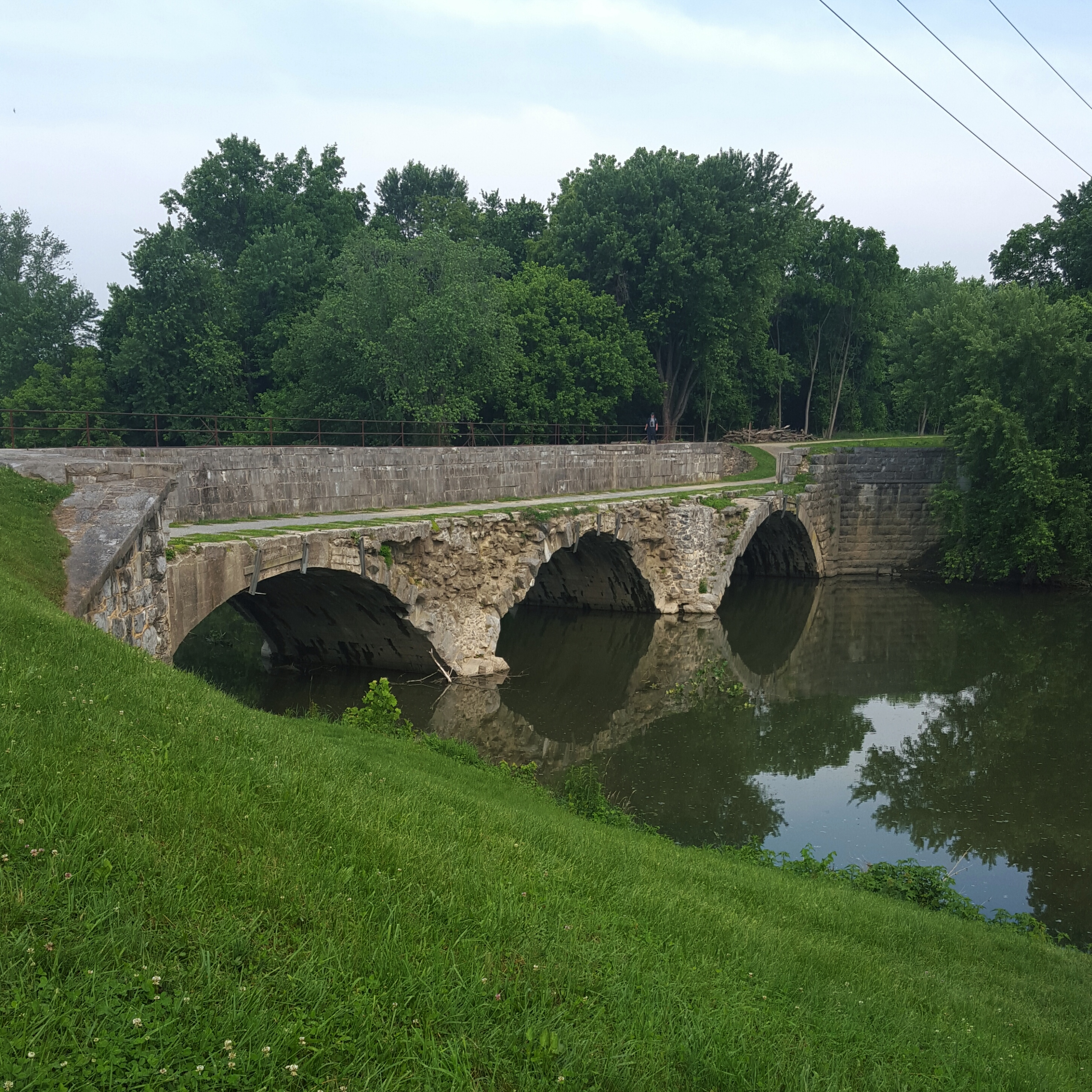
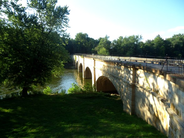
Of special interest is the crossing of the Conococheague Aqueduct. The aqueduct is currently undergoing restoration but is still part of the C&O Canal so can be used during restoration.

Conococheague Aqueduct
One convenient aspect of the Canal is having mileage markers! Walkers, bikers, or horse riders can keep track of how far they have gone. I planned on hiking 6 miles, so I noted the first mileage marker, and knew I would need to turn around at mileage marker 103. Side note…One of drawbacks of the Canal is usually having to retrace your footsteps in the opposite direction to get back to your car.

First Mile Marker…100!
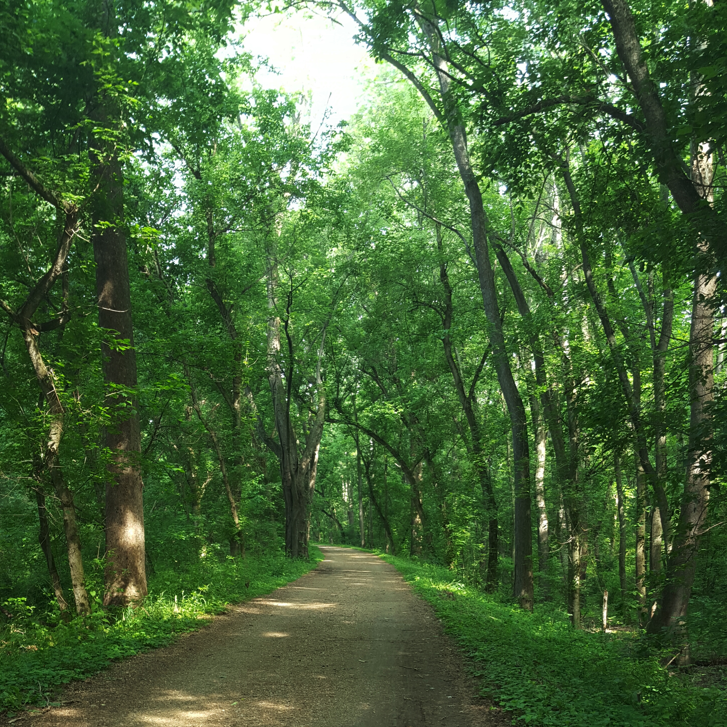
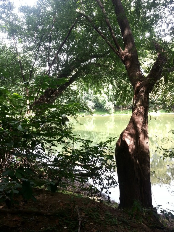
It was a hot morning and I could feel the heaviness of the air settling over the river and the Canal. Occasional breezes which made the towering trees rattle their leaves did little to alleviate the heat and humidity that seemed to surround me. I am indebted to the birds that distracted me with a variety of melodies and, lucky me, an owl also hooted a welcome!

Big Trees, Shady Path
Each section of the Canal takes on its own personality. At the beginning of my hike, and probably for a mile or so, there was farm land on my right and the Potomac River to my left. A farmer was out on a tractor… Oh, I cannot tell you how welcoming it is for me to hear a tractor out in the field! I hail from southern Indiana and this sound takes me back to a place in my childhood that brings a feeling … of what…happiness? well being? comfort? love?…hard to describe, but good, good, good! 🙂
Then the farmland disappeared and all I could see is a huge rocky wall. Boulders have fallen into the Canal here and the whole place takes on a rugged look. I thought about whether it would be possible to climb to the top of the rock wall, just to see over to the other side, but it looked rather overgrown and vertical. And I was hot…well…that energetic, rock star moment didn’t last long. 🙂 Back to putting one foot in front of the other!

Towering Rock Wall
Quite a few bikers with packs were making their way down the Canal today. I enjoyed the whoosh of air that accompanied them as they flew past me in groups of two, four, and more. I was hoping for more as I neared my car and the end of my hike!

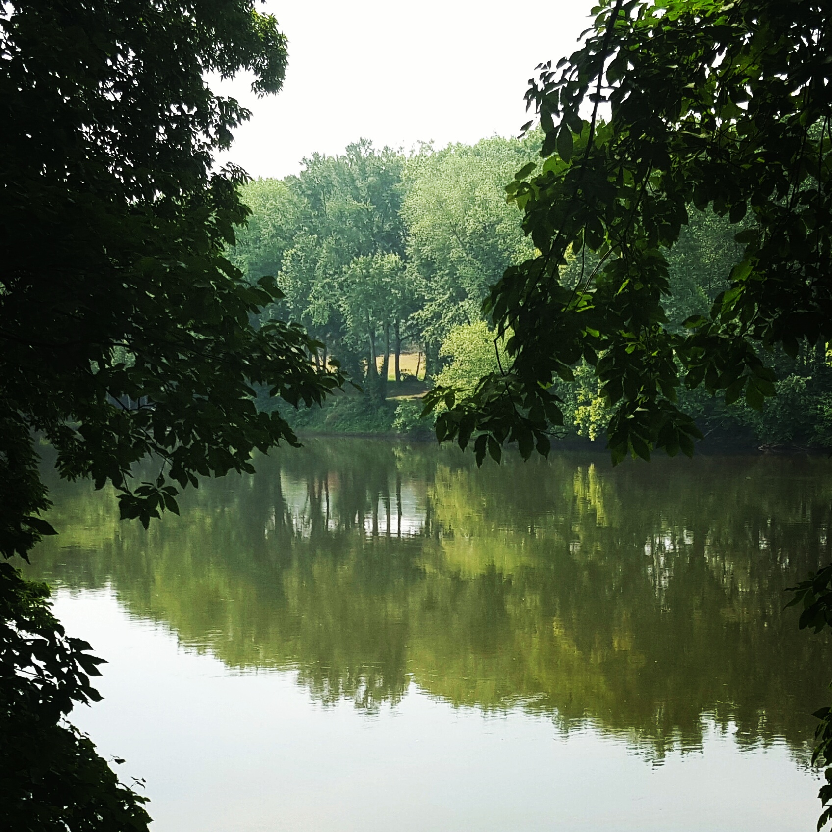
Potomac River on a Hot & Humid Summer Morning
I trudged up the short incline to my car and ripped off my shoes and socks. I could not put my flip flops back on fast enough!
Hot and Sweaty…Hike On!