January, hast thou forsaken us?

Here in the mid-atlantic, the sometimes chilly, but mostly not, January weather has kept me guessing on when to hike, what to where, or whether Old Man Winter is staying at my sister’s house in Minnesnowta this year.

January is named after Janus, a Roman god, who among other things, presided over transitions…so maybe the days of spring aren’t totally out of the question? 🤔

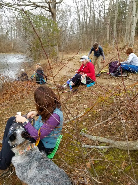
Anyway, I have enjoyed three more lovely hikes this month. An outing at Seneca Creek State Park, with the Maryland Trail Dames, and two romps with Sidekick Pauli, one at Monocacy National Battlefield and the other at Antietam National Battlefield.

At Seneca, the weather was mild enough for us to take an extended sit-down, picnic-style, break on the banks of Clopper Lake. Lovely, if not slightly odd, for January!

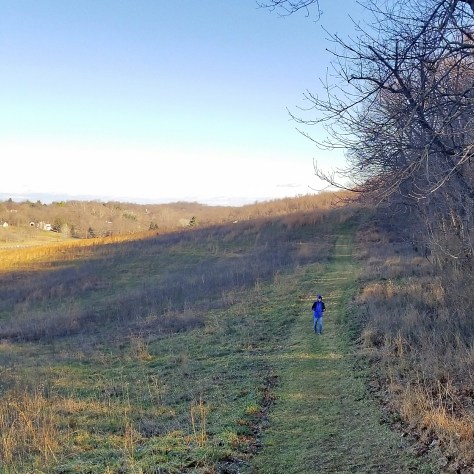
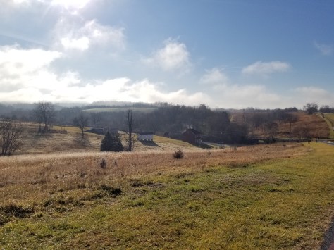
The next outing at Thomas Farm (part of Monocacy NB) with Sidekick Pauli, gave us warm, breezy weather, more like March than January. Pauli was delighted and pulled me from one groundhog hole to the next! Her message of “Get up, you fools, it’s Spring out here” was ignored by plump, warm, sleeping groundhogs who I could imagine replying “WE, only WE, get to decide whether spring is come. Go away silly dog!”

Oh well, Pauli was not deterred, and continued to spread the news, welcome or not. 🐾

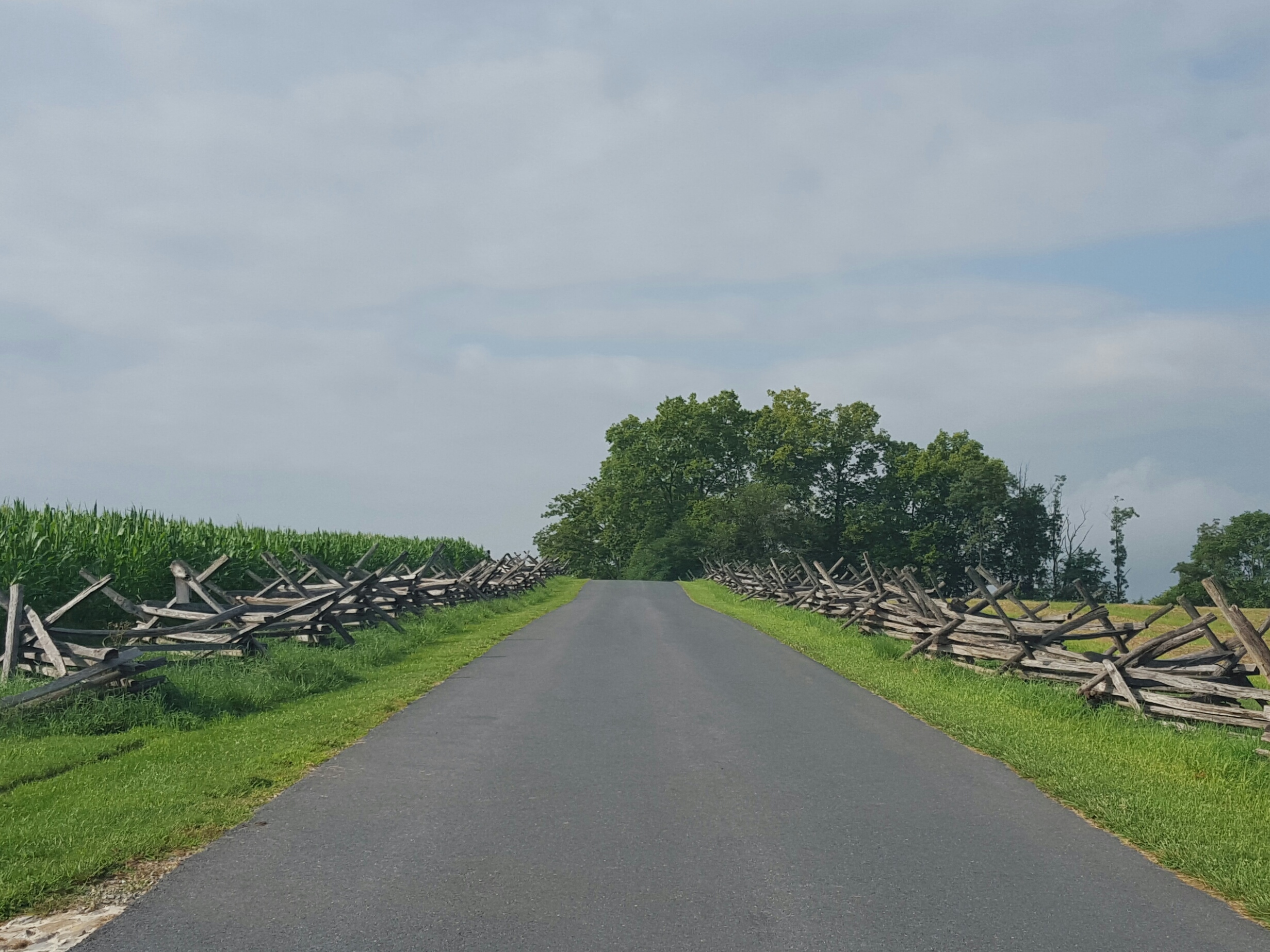
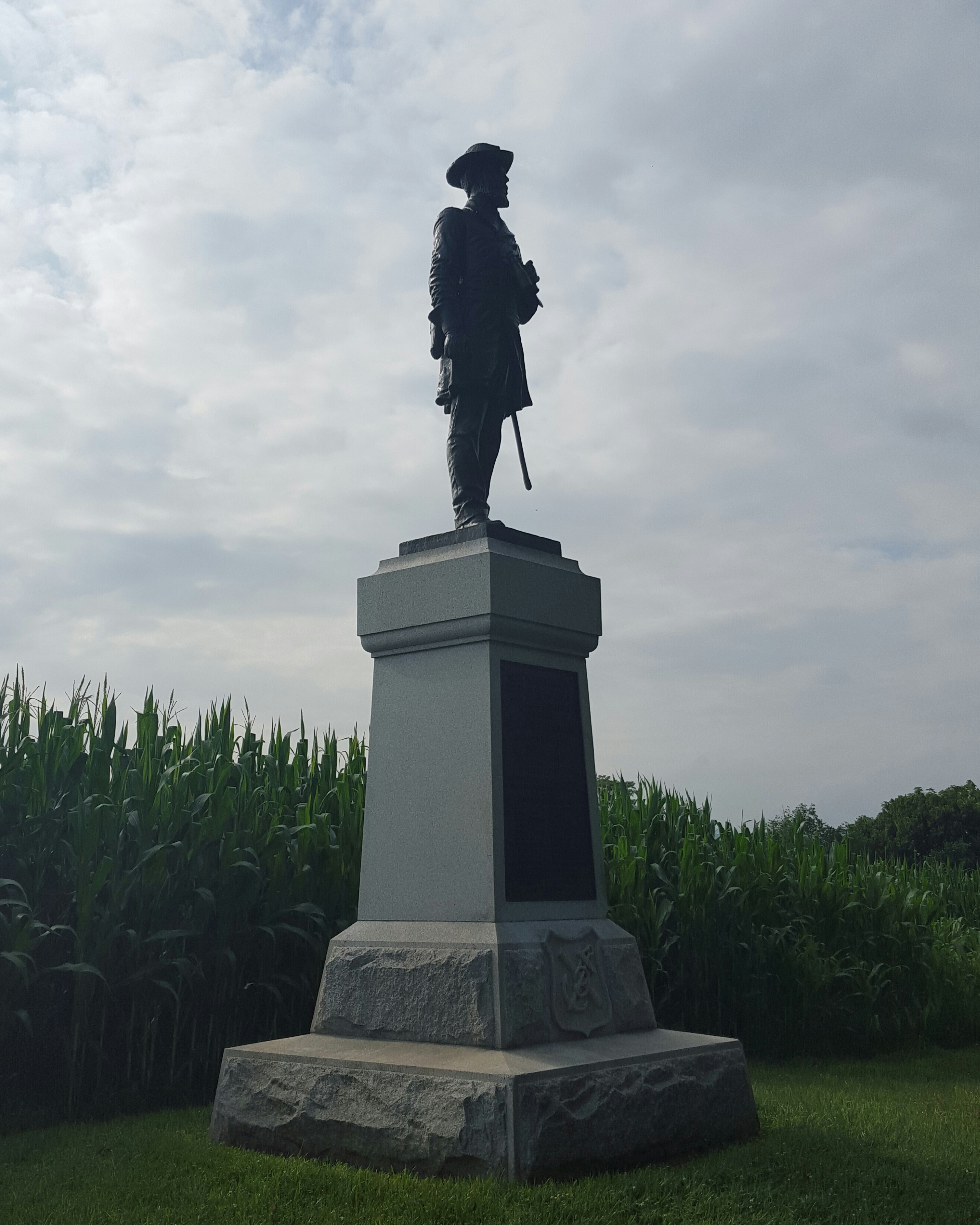
The third hike, to Antietam, was on a damp morning following a rainy night. Fog was rolling over the mountains and rising from parts of the battlefield. A magical beginning!

Sidekick Pauli and I walked down Rodman Ave headed to Burnside Bridge. Small tidbit about Janus…he also presided over transitions from war to peace, so Antietam seems a good choice for a January hike!

Birds raucously chatted with one another and swooped across the road in front of us so close that their eyes, intent on the mission, were clearly visible. Hawks and vultures soared high overhead, appearing, then disappearing into the fog as they searched for breakfast.

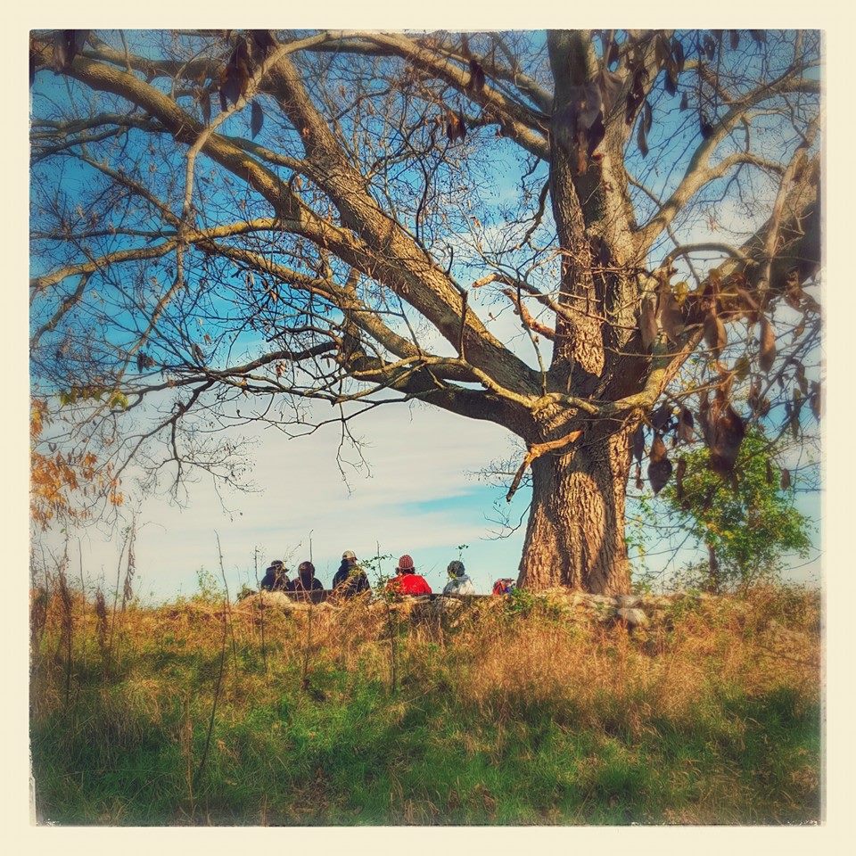
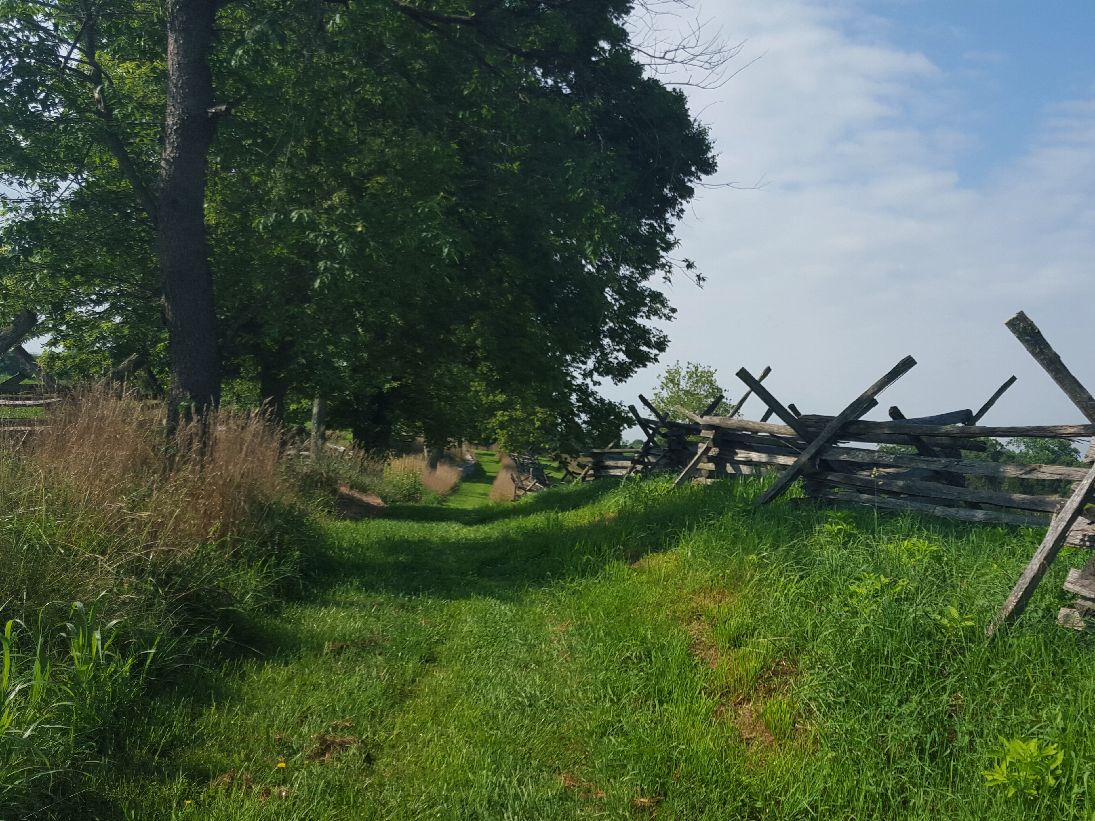
The bridge beckoned as we rounded the last bend in the road. We diverted off the pavement onto the gravel path, then walked across the bridge to look up into the branches of the Witness Tree.

This is a place I always come back to several times a year. There is just something about this huge Sycamore, the keeper of tales untold, that keeps me in awe, in wonder, in reverence, …, I am searching for the right word but it eludes me. I stand under that tree and can feel the non-linearity of time.

It is incredibly powerful.

Hike on.

Got 30 Minutes To Spare?

Bolivar Heights is a wonderful short trail to stretch your legs. Especially, if you are waiting for Harper’s Ferry only Vegan restaurant, Kelley Farm Kitchen, to open!

We took the loop starting on the ridge, then circling down to the battlefield, then back up. About a mile, perfect to while away a half hour.

The trail is gentle with the bonus of great views! We spooked a herd of deer on our way across the ridge.

And a spectacular sunrise greeted us as we climbed back up to the ridge.

Now at the top, my stomach reminded me that I had not eaten breakfast…time for lunch!

A BBQ Jackfruit sandwich with a side of mac & cheese, yassss! Hike on!

Lovely Morning at Antietam

Well, this has been a winner of a morning in western Maryland! Crisp, I kid you not, CRISP air greeted me as I followed Sidekick Pauli out into the yard this morning. Like Autumn…what an absolute blessing after the pea souper of a week we have had!

Sweetie and I headed over South Mountain for a walk at Antietam National Cemetery. I have been to the battlefield many times, but never the cemetery. It did not disappoint.

I sought out the graves for Indiana soldiers killed in battle and perused for last names that I knew from home. The only one I found was ‘Evans’. I moved on through the pines and circled around to the other side of the cemetery. Here I found a grave that seemed oddly out of place.

This grave belongs to Goodloe Byron, a member of the U.S. House of Representatives from 1971-1978. His term ended when he died of a heart attack while running on the nearby C&O canal. He was an avid runner having completed several marathons…and seemed to believe he could eat whatever he wanted. Unfortunately, not so.

He ignored warnings from his physician who told him that treadmill tests from 1974 to 1978 indicated his coronary arteries were gradually closing. The last treadmill test in January 1978 indicated severe abnormality and was positive for heart disease. The physician advised Byron to stop running until further tests could be done.

Hmm, okay…let that be a lesson to us all!

Anyway, interesting story, but still not sure why he is buried with civil war soldiers.

Exiting the cemetery, we drove down to Burnside Bridge and stolled down the Final Attack trail and Union Advance trail.

Refreshing cool breezes kept us perfectly content with life as we rounded through sunny fields and then into cool dark woods. We found plump ripe rasberries, a variety of wildflowers, and blue birds.

Ahh, this is the kind of morning that makes me want to live forever! Heed that lesson from G. Byron’s premature death and Hike on!

Oh Fall…slow down!

I looked at the date of my last post…a sharp intake of breath…a month ago!!!

It has been an unforgettable fall season. 🙂  Lots of hiking, lots of working, lots of going to school…not a lot of time for writing unless it is for one of those reasons!

So a quick recap of the highlights. 🙂

Shenandoah River State Park

Shenandoah River State Park

October 17: We headed down to Shenandoah National Park in early October to leaf peep.  After seeing the line at the northern entrance, we gladly diverted and visited Shenandoah River State Park instead.  Lovely park and a very good decision!  We visit Shenandoah National Park all the time and quite honestly, prefer it without the traffic. 🙂

White Rocks, north of Gathland State Park on the AT in Maryland

White Rocks, north of Gathland State Park on the AT in Maryland

October 25: Sidekick Pauli and I took an afternoon hike to White Rocks on the AT in Maryland.  I realized I had been doing way too much desk sitting as I climbed up to White Rocks!!  We had a lovely lunch at the rocks before walking back to Gathland State Park. 🙂 🙂 🙂

2015 October 31 Antietam Battlefield

Antietam Battlefield

October 31: Led the Trail Dames on a walk among the lost souls at Antietam Battlefield. Perfectly beautiful day to enjoy and be thankful for all we have been given.

Wet, wet, wet on the Rose River Trail in SNP

Wet, wet, wet on the Rose River Trail in SNP

November 7: Rose River Falls Loop in Shenandoah National Park with the Trail Dames  IN THE RAIN.  Sidekick Pauli didn’t mind the rain and neither did I.  I wasn’t leading this hike so I walked along carefree as can be!  And we finished by celebrating a fellow dame’s birthday with blackberry cobbler and ice cream! Yes!!

Star Party at Sky Meadows State Park, VA.  Just look at those set ups!

Star Party at Sky Meadows State Park, VA. Just look at those set ups!

November 14: Let’s all go to a Star Party!! Kudos to the Northern Virginia Astronomy Club (NOVAC) for sharing their super high caliber telescopes with us at Sky Meadows State Park.  I saw Jupiter, Uranus, a double star, the craters on the moon, and a lot, lot, more! So awesome. 🙂

Thomas Farm...my go to after work!

Thomas Farm…my go to after work!

I have enjoyed being outside this last month and am soooooooo looking forward to my Thanksgiving break!

#OptOutside on Black Friday! Hike On!

A Morning at Boliver Heights Battlefield

The mysteriousness of a heavily fogged in morning.  It feels both calm and spooky, like something is about to happen.  Battlefields are especially moving in the early morning and add in the fog…well, walking through it, having it swirl around me and swallow me up…left me feeling as if I had entered a magical place where it was possible to transcend time.

image

Looking towards Schoolhouse Ridge

Sidekick Pauli walked with me this morning up the the hill from Schoolhouse Ridge.  I looked back at the car once finding it hard to see in the mist.  I looked back twice and it was gone.  A thick misty white wall moved across the field in no hurry to rise into the sky.  We headed on up the hill and eventually emerged from the fog. How beautiful the opposing Schoolhouse Ridge looked.  We turned back to enter the woods and climb up to Boliver Heights.
image

The climb was gentle and several deer greeted us with a quick glance and a flip of the tail as we made our way up.  Then the beauty of the ridge!

image

Sunrise at Boliver Heights

Looking down to the Potomac & Shenandoah Rivers … rivers still hidden at this early hour.  Absolutely stunning!

image

Looking down into Harper's Ferry

Headed back down into the woods after walking along the ridge enjoying the views. The trail here was a little rough with several blowdowns. At one point I wondered if I had gotten off the trail, but there was a definite path in front of me so I continued.
image

Coming to a fork in the trail, someone had tied ribbons to indicate which way to go. Downhill, well, that makes sense. So down we went! More blowdowns, then into a pawpaw patch we followed the ribbons.
image

image

“Yay!” I thought, catching site of the field as we climbed over our last log. Entering the field, we were about 100 yards away from a farmhouse. I heard a man’s voice yell up to me, “Are you lost?” Um…um…awkward! I didn’t think so, but apparently this was someone’s private property!! After talking, well, yelling back and forth with the guy, we had no choice but to follow the ribbons back up the hill! I don’t know who marked that trail, but ergh.

image

Dead end!!!

image

Back on the ridge, but the fog is gone

A lovely morning to explore, though! And hey, eventually I will find the right trail down the hill! 🙂

Happy Friday and take the weekend to hike on!

Morning Stroll at Antietam Battlefield

I understand, I think, why the battlefields are made for auto traffic…but to really get a sense of what a Civil War soldier might have felt you might want to get out of the car and walk.  I only say “get a sense” because there is no way for me (with no battle experience) to really understand on any level what a soldier, who is carrying all his stuff, wearing a wool uniform, eating whatever is in the ration can, and who might be miles away from home, is going to feel lugging himself through some muggy, hot farm field in Maryland to fight in a war he may or may not understand.

When I began my walk this morning on Rodman Avenue (just off Route 34 east of Sharpsburg, MD), it was a pleasant 75 degrees.  Probably about the same temperature on September 17, 1862, the bloodiest one day battle in American history.  23,000 soldiers were killed, wounded, or missing at Antietam…wrap your head around that number.

Walking down Rodman Avenue

Walking down Rodman Avenue

Along the road, are monuments, similar to Gettysburg.  If in a car, there is no place to park along Rodman Avenue or even pull over in order to get out and read the about the monument…of course this is why they have a podcast…so one will NEVER, EVER, have to get out of the car.  Great for those who truly need it, but come on America, many of us are able to get out and walk!! Um…okay, I’ll stop now.

Colonel Benjamin C. Christ - Monument to the 50th Pennsylvania Volunteer Infantry (1st Brigade, 1st Division, 9th Corps)

Colonel Benjamin C. Christ – Monument to the 50th Pennsylvania Volunteer Infantry (1st Brigade, 1st Division, 9th Corps)

It is beautiful walking up the road.  To the left are views of the mountains and Sherrick Farm and to the right are meadows blooming with wildflowers.  It is an easy road walk and this morning it was pretty quiet.  The birds chattered and flitted from the field to the meadow and back again, sometimes resting on the fence line before taking off again.  There was a nice breeze, but I could feel the humidity bullying its way in and knew in a few hours this walk would be unbearable.

Good Morning Mountains!

Good Morning Mountains!

Bucolic Sherrick Farm

Bucolic Sherrick Farm

The fields were already heating up so I decided to hike those first, then dip down towards Antietam Creek.  At the end of Rodman Avenue, turn left and continue to Burnside Bridge.

Burnside Bridge

Burnside Bridge

I passed the bridge and continued to the “Final Attack Trail” as this traversed through many open, sunny fields.

Along the "Final Attack Trail"...I love those fences...

Along the “Final Attack Trail”…I love those fences…

Leaving the ridge on the "Final Attack Trail"

Leaving the ridge on the “Final Attack Trail”

However, there are spots of shade to find respite!  Sidekick Pauli and I found a wonderful tree under which to take a little break before heading back out into the field.

Then we were blessed with a longer walk through the woods.  Nice and cool!

Sidekick Pauli's Saturday Smile!

Sidekick Pauli’s Saturday Smile!

We stayed in the woods for much of the time as we wound our way down to the “Snavely Ford Trail”.  Turn to the right at this trail junction in order to walk along Antietam Creek.  Sidekick Pauli very much wanted to go to the creek as it meant she would be able to get in and cool off!!

Where are my hedge clippers when I need them?

Where are my hedge clippers when I need them?

The trail is a bit overgrown at the moment and I sort of wished I had on long pants.  That thought only lasted for a moment though as I was soon hot, hot, hot, climbing back up the hill to reconnect with the trail to Burnside Bridge.

We crossed the bridge and rounded out our hike by meeting up with the “Sherrick Farm Trail”.  This trail is quite nice and passes a genuine swimming hole complete with a swinging rope!

Sidekick Pauli crosses Burnside Bridge

Sidekick Pauli crosses Burnside Bridge

Beginning of Sherrick Farm Trail

Beginning of Sherrick Farm Trail

After the swimming hole, the trail goes uphill to meet the Burnside Bridge road.  Take a left, cross the bridge, then take a right and continue on the trail.  At this point, “Sherrick Farm Trail” starts to resemble a real, meaning more rugged, hiking trail and may not be for everyone…it is not bad, just a little slanty with roots and a few rocks.

It doesn’t last long!  Sidekick Pauli and I were back at the car in no time!

This hike was about 4.5 miles long and included road walking, easy trail walking through rolling cornfields and along Antietam Creek.  It is a beautiful way to spend an early summer morning.

So get out of the car and Hike On! 🙂