Laurel Highlands Hiking Trail – Jersey Hollow to Ohiopyle!

The Laurel Highlands Hiking Trail (LHHT) runs from Laurel Ridge State Park to Ohiopyle State Park in Pennsylvania. The elevation profile for the entire 70 – miles of the trail is fairly level, with the ends having elevation a bit more extreme, and miles 0 – 11 having the MOST extreme elevation changes of the entire trail.

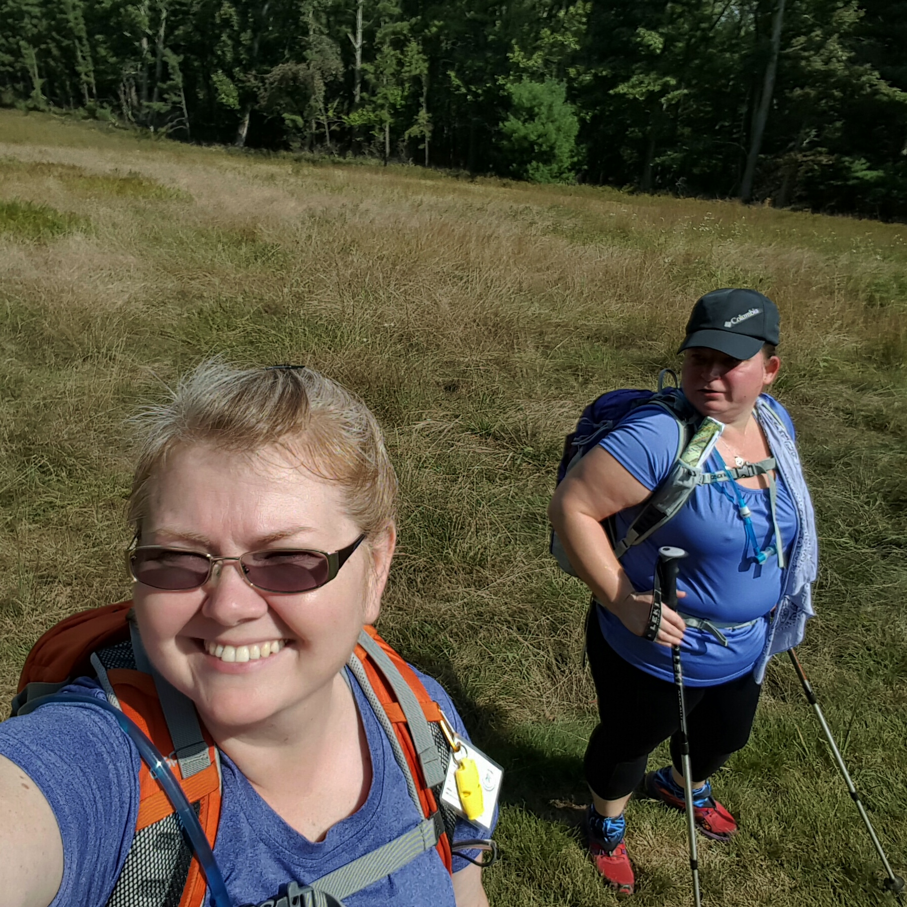
So, guess where I initiated myself to the LHHT? 😁 Along with Queen V, who is up for all the adventures…better or worse.

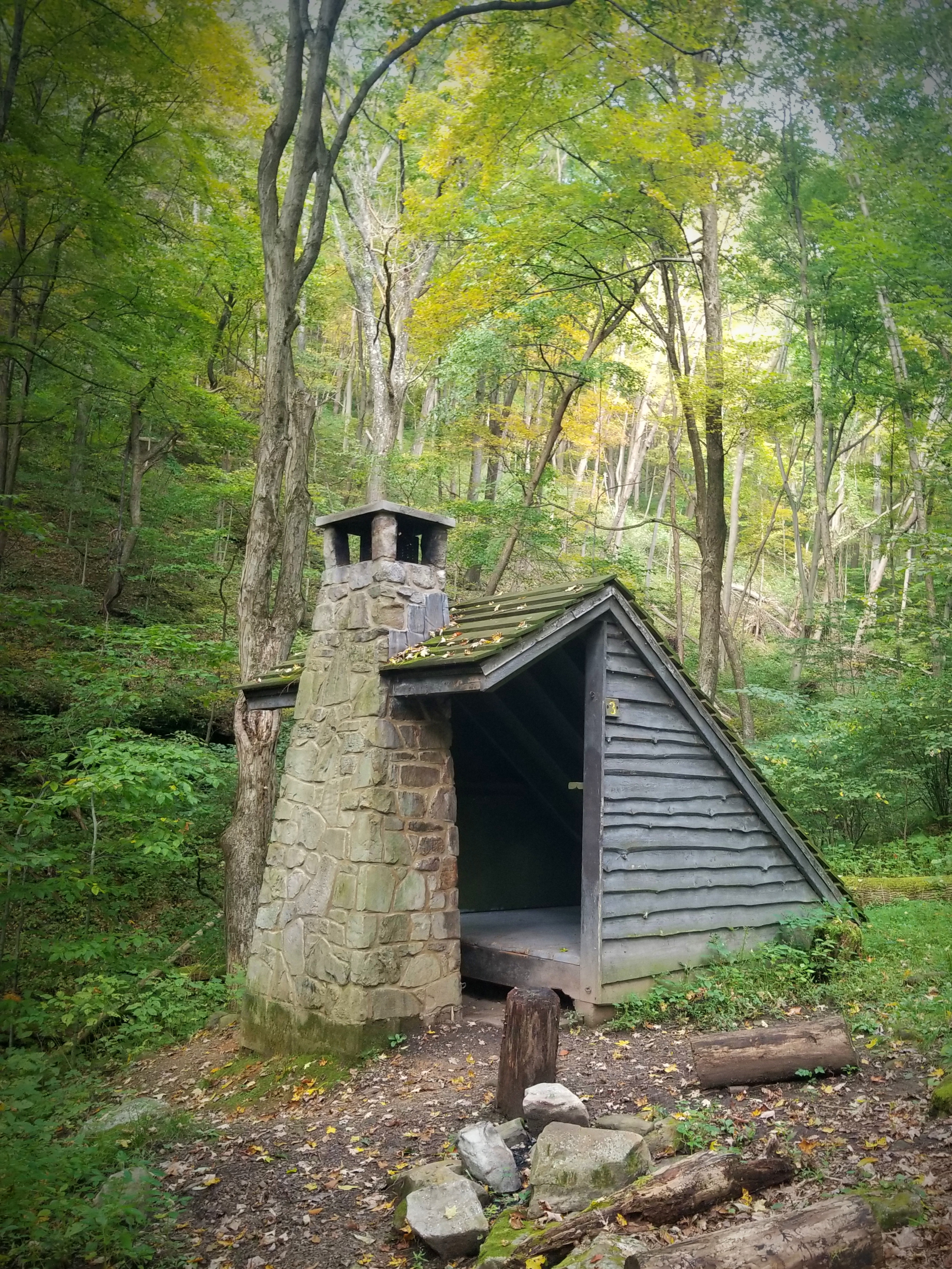
Hiking the LHHT requires preplanning as one needs to reserve the shelters for overnight use. It will cost a small fee to reserve, but it is worth every bit! You can have the entire shelter to yourself! Each shelter has a fireplace, plenty of hooks to hang items, and even a place to put up a hammock. The shelter area includes a nice pit toilet with separate building for men/women, trash cans, a pump (non-potable water), and a wood splitting area stocked with firewood. If you are a backpacker, can you imagine such a glamping setup in the backcountry?!! I mean…you don’t have to pack out your trash! I dropped trash into the bin at least five times in the span of twelve hours just because I could!!

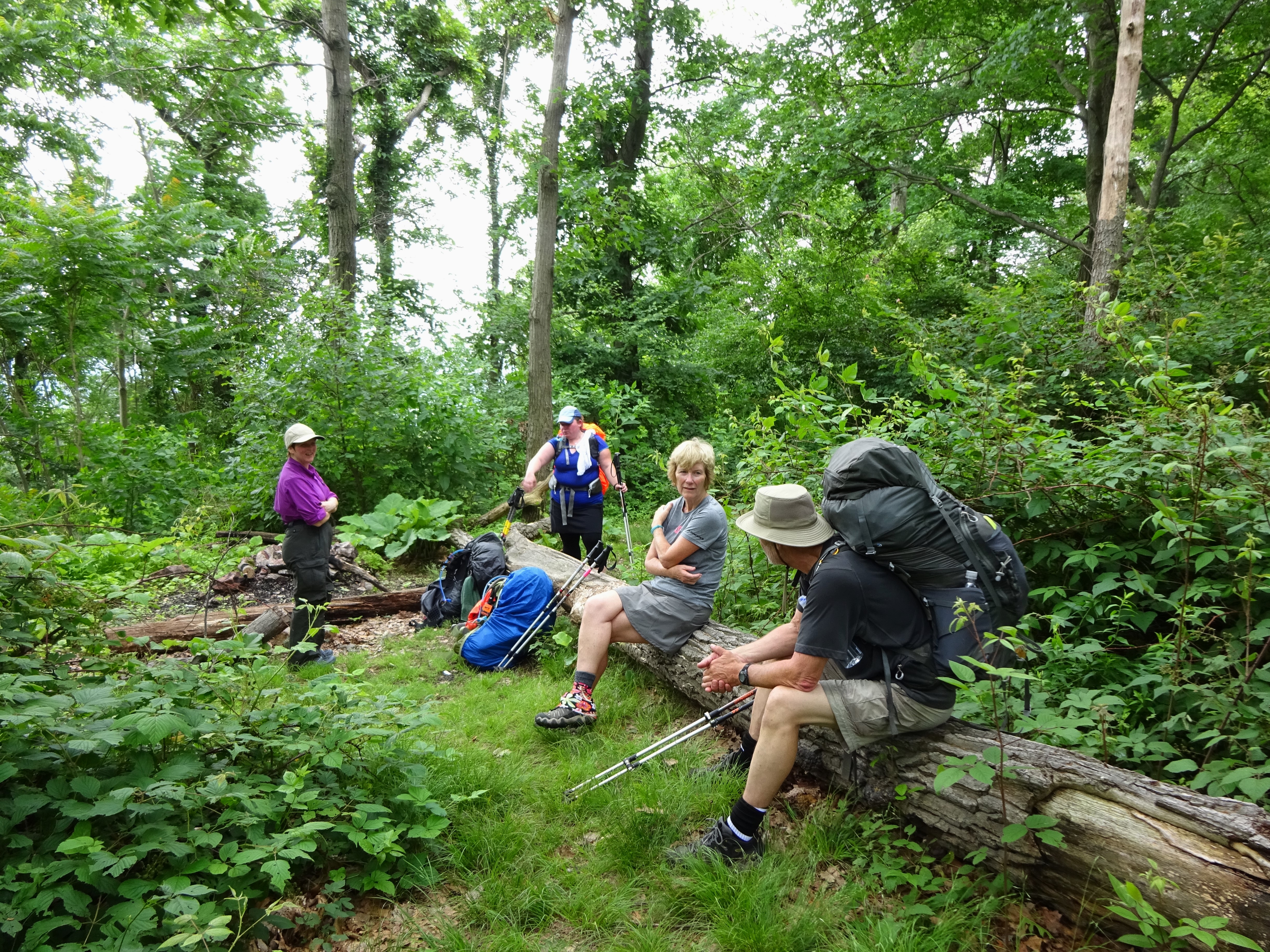
Planning this overnight backpacking trip back in April I reached out to my backpacker gal pals to see who wanted to go…seven of them were like HELL YEAH, SIGN ME UP! And I did, reserving two shelters for us. Reflecting on this now, I won’t reserve for everyone next time. Why? Because life intervened to a point where five of those who had signed up could not come along. The reservation system is easy to navigate and this trail is not as populated as say, the Appalachian Trail, so next time each can make their own reservation. Just makes it cleaner if they need to cancel.

Another hiking friend, Cathryn, wanted to go last minute which was great…because we had PLENTY of room! 😄 More importantly, neither Queen V or myself had hiked with Cathryn in a while and looked forward to reconnecting with her.

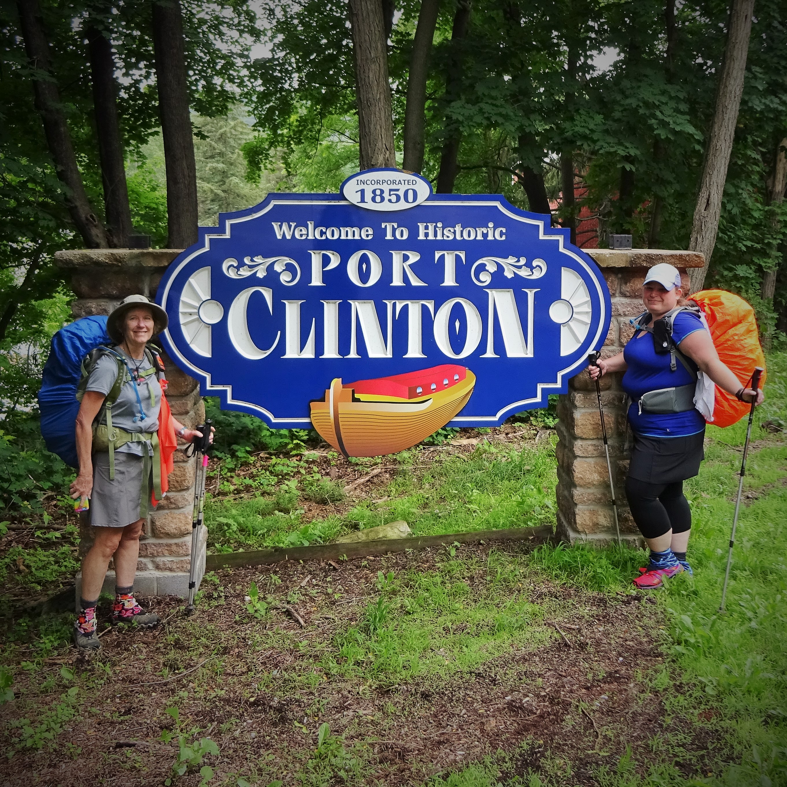
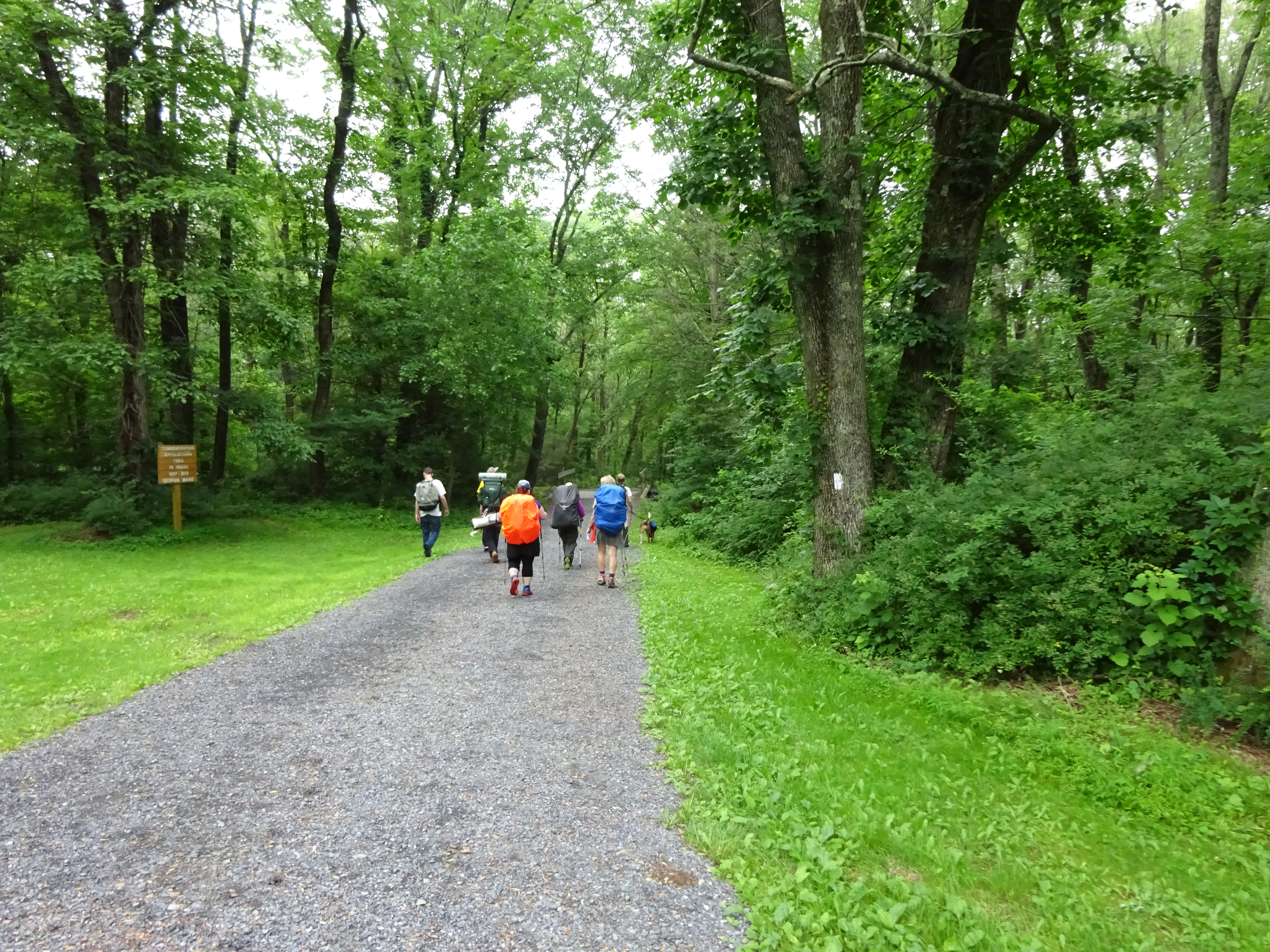
We met up at Ferncliff parking area in Ohiopyle, the southernmost trailhead for the LHHT at MILE 0, then I shuttled the three of us to Jersey Hollow parking area, MILE 11-ish. A trail kiosk, that had paper maps of the LHHT available, greeted us, and we each greedily snatched one. Honestly, you would have thought we’d won the lottery or something. Ka-ching! Seriously, though, having a paper map is a good idea for this trail as we did not have cell service for most of our trek back to Ohiopyle.

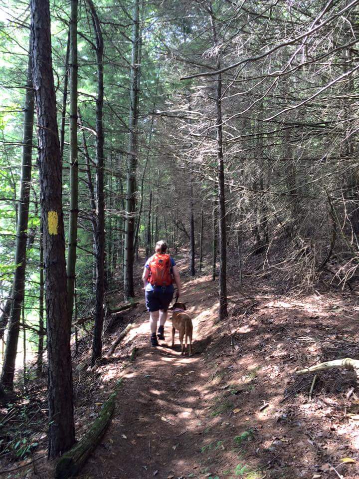
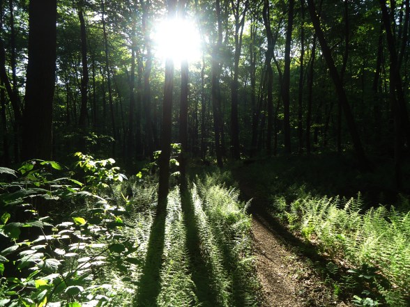
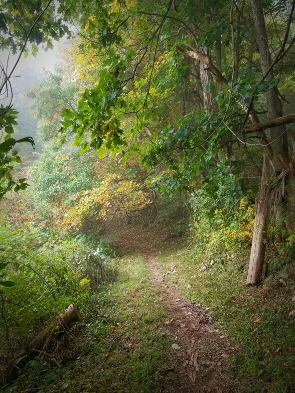
Storing our coveted maps, we started down the trail towards the Ohiopyle Shelter. What a fantasy land! A dense fog laden woods with large boulders covered with ferns and moss. Water dripped from the ends of the moss that hung over the sides of boulders. Add the reds and golds of trees and other foliage that have turned as Autumn enters…and ohhhhhhhh, such hobbit-like lushness!

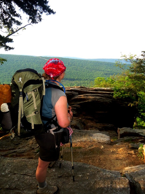
Early fall foliage added so much value to this hike! And I was incredibly thankful for something to be thankful for as my knees took a beating on the downhill to the shelter. Good lord almighty, that was long, steep, downhill littered with little rolling rocks and acorns. Slow going and demoralizing! I was elated to see the shelter sign…but that elation was short lived as my head turned from the sign to the side trail. Only the top of the trail was visible! Down, down, down. My thought, my actual thought, as I stood there, almost paralyzed, was I should have packed more Ibuprofen! Then I put one foot in front of the other and went on down.

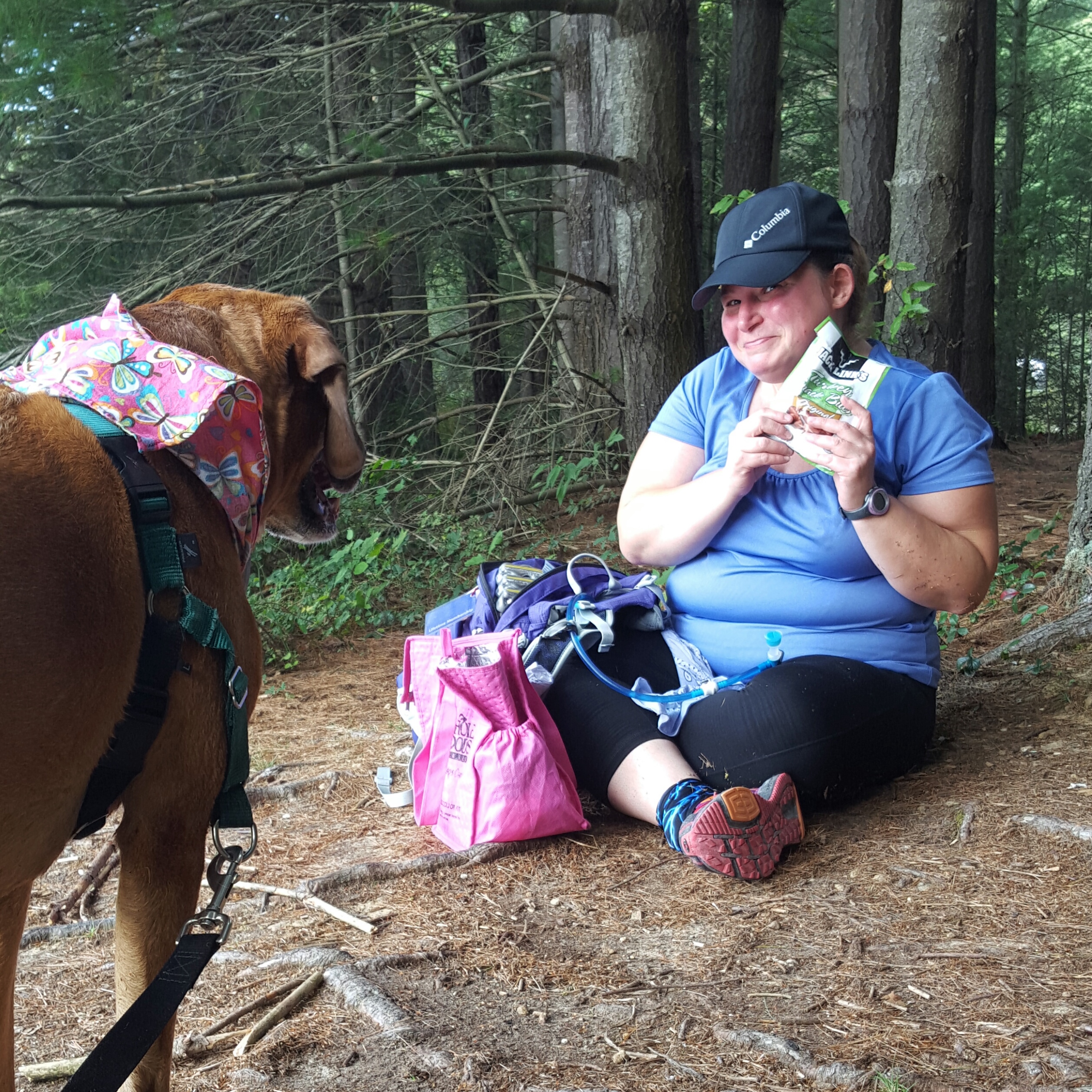
We thoroughly enjoyed our time at the Ohiopyle Shelter area. Arriving early-ish in the day, we had a lot of time to relax, set up camp, and eat. Queen V brought a Red Velvet moon pie that she shared with me and that sugar buzz was better than any ibuprofen! Later in the evening the ranger came up to check on permits. He asked us where the rest of the people on the reservation were and jokingly said, “Please tell me I don’t have to go looking for them!” In our chat with him, he asked where we had started, where we had parked cars…the usual stuff. When I told him we had a car parked at Jersey Hollow, he paused and looked up. Oh no, I thought, what is wrong with Jersey Hollow…”What? Is it not safe?” I asked. He replied, “no, not that, but overnight parking is not allowed there.” Oh crap … crap, crap, crap! “Are they going to tow my car?” This is my first question and all I can think is that I am going to pay this man any amount of money to drive me to Jersey Hollow so I can move my car!

He let me know the worst that would happen is IF the game warden checked the lot, then it would be a ticket, like a $5 ticket. *whew* crisis averted!!!

The rest of the evening was delightful. I had my tent set up in my shelter and stayed cozy all night. There were some aches and pains as I carefully navigated each move of my body, but otherwise good!

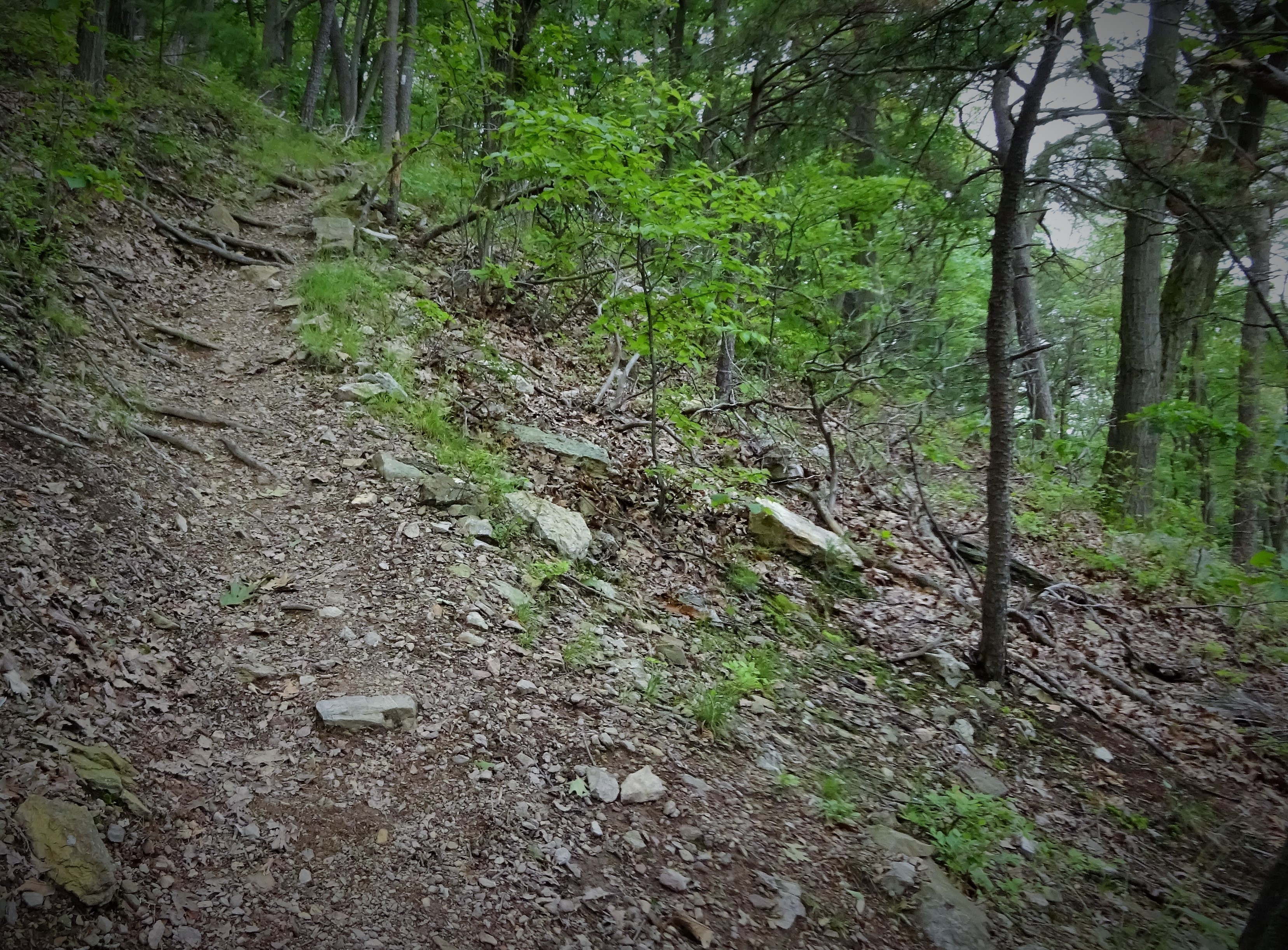
Next morning the climb out of the shelter area was not as bad as anticipated and we were on our way once again! This trek was not as grueling as that downhill had been (Queen V’s opinion may differ 😏). It was a hard day, but not as soul crushing…except for the climb coming up to the MILE 5 marker. STEEP and the elevation on the profile did not match Queen V’s Garmin or how we felt! My strategy was to make sure to break when needed, drink lots of liquids to keep all my muscles well hydrated, and make a conscious effort to look up and enjoy the beauty that surrounded me. It worked!

Trudging back into Ohiopyle, we found lunch right on the trail at Falls City Pub & Restaurant. I downed two glasses of Pepsi before my meal of salmon wrap and onion rings arrived. That Pepsi hit the spot and the food was delicious! Full tummy and completely caffeinated and sugared up, I was in high spirits as Queen V shuttled me back to my car. On arrival, we all scanned for a parking ticket, and gave a unanimous whoop when one could not be found! 🙌🙌🙌

Twenty-ish hours later, I am still able to walk and all I have is love for the LHHT. So much so I am already planning the next section of the LHHT with Queen V.

One foot in front of the other, hike on!

Rock Hopping with the Dames

Big rocks are where it is, friends!

A Maryland Trail Dame’s hike on the Appalachian Trail between Rt. 233 and Caledonia State Park (Pennsylvania)

Tailgate of my RAV4 open, I sat, legs dangling, phone in hand, mindlessly swiping through Pinterest as I waited on the Dames. A blessedly cool morning, I thought, as I swung my legs back and forth, and kept swiping. A car turned off of Rt. 30. Someone was yelling from their car as it was driving by. What the…? It took a minute for me to drag myself from a cute backyard firepit setup that I had been getting ready to pin, so I only heard “…have to pooooo!” Ahh…Queen V had arrived. Well, almost. 😂

A good bathroom is a godsend at a trailhead. Especially for women hikers. Yes, we can go in the woods and do…but a nice bathroom at the beginning. It’s a plus!

Once we had everyone together, we piled into two cars, rode down to the Rt. 233 trailhead, and began our hike up and over Rocky Mountain. We all agreed that the weather was an awesome change from the hot and muggy swamp weather we had been having previously.

This hike is mostly regular dirt trail, but just after the cut-off to Rocky Mountain Shelter, it goes through some spectacular rock formations. OH…and in my previous post, I stated that Dames always stop at the shelters. I should have added IF and only IF (that’s IFF for you math folks) the shelter is a reasonably short distance from the trail! 😁 The Rocky Mountain Shelter is 0.3 miles from the trail, so that was a no go!

The Dames did great along this stretch of the AT. Their comments were it was a shock to the body to get out of the car and immediately be expected to go steeply uphill. AND that Queen V was so not truthful about it being just one climb up, then the rest of the way down. 😆 For the record, I never made any such claim! 😏

After the initial climb, the trail was easy walking until just after the shelter cut-off. Then the trail turns right, climbs a short hill, and we entered the jumble of boulders that make this hike one of my favorites.

We slowed down, picking our way through the rocks carefully. Stopping frequently to take in the wonder of these big rock formations, we theorized how they had come to be. No conclusions, as none of us on this hike are geologists. However, none were necessary. It is enough to be in awe of these phenomenal formations.

Coming down off of the rocks, we descended into what was becoming a hot and humid day. Summer is back. We kept our spirits up and our feet moving by chatting about wading in the creek at Caledonia, then going for ice cream. You do what you gotta do!

The creek was as amazing as we thought it would be! So, so, so good!

The ice cream, friendly service, and cute decor at the Caledonia Cafe was a perfect way to celebrate! Highly recommend if you are in the area. 🍦🍨🧁

Enjoy a Reel with more pics of our adventure!

Hike on!

AT-PA Rt. 501 to Swatara Gap Rt. 72

The last section of Pennsylvania!!! Woot!

It wasn’t clear whether I was going to be able to get this state done before the end of the year.  I was determined, however, and put an all out call to any of my Facebook friends who might want to do this last 12 miles with me…and one of them said YES!!!!

My friend, Lola, and I opted outside on Black Friday!  I had to leave pretty early from Frederick, Maryland to get to Swatara Gap by 8:15 am.  I pulled up beside the iron bridge with time to spare…only to notice that there are new signs declaring cars will be towed.  Well, this is new to me.  The last time I was here it was okay to park on the side of Rt. 72…NO MORE!  So when Lola cruised in behind me a few minutes later we backtracked, going around to the back of the creek, on the old State Road, in order to park in the “real” parking lot.  Just an fyi folks…no parking on Rt. 72 anymore! (maybe it was always illegal…but lots of people did it, including me, and never got a ticket or anything)

img_20151127_192248.jpg

Ready to go! Last section of PA underway!

With one car properly parked, we headed to 501 to begin the last section of PA for me!!! This day was meant to be.  Warm temps, blue skies, …Black Friday?  Felt like an early spring day!

img_20151127_192513.jpg

We were greeted with a fantastic view just south of 501.  After that it was pretty decent hiking (with the understanding that it is Pennsylvania and there are the regular amount of rocks along the way).

A nice sunny spot was waiting for me at the William Penn Shelter.  I took the opportunity to soak up the sun while chomping on a crisp apple…oh the delights of fall.  “What the heck?…Oh, my phone.”  It was in my right pocket and digging into my hip in a way that was none too comfortable, so I rolled to my left hip and yanked it out.  Apparently, my chapstick felt the need to also exit my pocket in a leap for freedom and promptly fell through a crack in the floor of the shelter to the ground below.   The one item I hated to lose.  *sniff*  “Bye-bye chapstick…so sad you are gone.” 😦

img_20151127_193352.jpg

Moving on, the trail resumed the regular rocky until after the old powerline view.   For about a quarter mile there are some bigger rocks which required a bit of rock hopping.  “Come on rocks, dance with me!” I muttered under my breath as I tipped forward, then backwards, on one of the looser specimens.  At this point, I looked to my left and right.  I stopped, calling back to Lola, who was doing a bit of dancing of her own.  “Look at that” I exclaimed, pointing to the woods beside the trail.  “Do you see ANY rocks over there???”  It was a rhetorical question, as there were NO rocks to be seen anywhere EXCEPT where we were walking…teetering…whatever. Oh, Pennsylvania, you amuse me…

img_20151127_193312.jpg

1000 miles going southbound!

It seems my feet have gotten soft since my backpack in PA this summer.  As we approached the steep downhill into Swatara Gap, they were quite vocal in their disapproval of this 12 miles!  When I stepped onto the road, after following the trail underneath I-81, it felt so good! Level ground, no rocks!

Whelp! PA section is complete!

img_20151127_195806.jpg

Yessss!!!! FINALLY FINISHED PENNSYLVANIA!

It wasn’t as hard as I thought it would be, and there are some sections I would love to do again!  I loved this state most for the people who hiked it with me.  Dirigo, Python, Google, CanDo, Queen V, Lola and many other women I met through Trail Dames.  Also, my brother, Albie, who hiked a portion of the trail between Pine Grove Furnace and Caledonia SP with me. He showed me that I could do a 15 mile day! Brothers are awesome!! 🙂 🙂

On to Virginia and softer trails! Hike On! 🙂


Caledonia State Park, PA…Put it on the short list!

Caledonia State Park is quite possibly one of the prettiest state parks near Frederick, Maryland.  The air is scented with pine, the creek bubbles and gurgles as it curls its way through the park, and the towering pine trees leave me with the most serene, peaceful feeling every time I visit.

Labor Day Weekend I was invited up by Queen V.  She was spending the weekend at the park and decided to come out of her tent to hike with me!  I haven’t seen her since the backpack in June and was looking forward to hearing about her hike in Sweden.  One of these days I will go on a hike somewhere in Europe…but until then I depend on my international hiker friends, like Queen V!!

Stopped at the visitor center to pick her up, then headed to the Hosack Run area to pick up the Greenwood Road Trail.  We walked through the woods catching up on the summer and on Queen V’s adventure on the Fjallraven Classic.

BoobOnARock and Queen V take to the trail...oh it's on!

BoobOnARock and Queen V take to the trail…oh it’s on!

We were hiking to the Long Pine Run Reservoir in Michaux State Forest.  September was here and the start of the day had been crisp!  I could feel a hint of autumn in the air!

Queen V is a great person to hike with because it is so easy to carry on a conversation with her as we hike.  I am not much of a talker, but it seemed as if the miles flew by as we gossiped, caught up on each other’s adventures, and generally, just rambled about whatever. 🙂

Lunch by the lake. :)

Lunch by the lake. 🙂

The terrain was perfect for my recovering knee (injured last weekend dodging a bee…).  There were no big step downs, which are still giving me a bit a pain.  But more than that, there are so many pine trees that the trail is pretty soft in spots…love it!  We stopped for lunch in one such spot.  Sinking into the ground we started pulling out our goodies…oh, what’s that? Queen V brought Sidekick Pauli’s favorite…summer sausage!  Lucky, lucky dog!

Oh, it's summer sausage time by the lake! :) :)

Oh, it’s summer sausage time by the lake! 🙂 🙂

Thanks Queen V for the photo! Me & Sidekick Pauli in the Pines

Thanks Queen V for the photo! Me & Sidekick Pauli in the Pines

Rounding the reservoir, we found many places for Sidekick Pauli to get her feet wet. 🙂  My dog is getting older now, 8 years old last May, and while she is not much of a swimmer, she does love to splash!  We rounded back around the lake and took another siesta on the rocks.  Sidekick Pauli made a friend with a very little yorkshire terrier who was just smitten with her. 🙂

Splash!

Splash!

Sidekick Pauli makes a very tiny friend, Rocko

Sidekick Pauli makes a very tiny friend, Rocko

Thank you to Queen V for including me in her Labor Day weekend getaway!  This was awesome!

Grab a good friend and Hike on!

AT-PA Port Clinton to Windsor Furnace Shelter 6.1 miles

Day 1: June 20, 2015

Google, Bag Lady, CanDo and I met up at our hotel on Friday, June 19.  We cruised by Cabela’s in Port Clinton since CanDo had a last minute gear issue, then had a great dinner before returning to our hotel for the night.

In the morning, it was raining.  Pouring actually.  Oh, to start a section hike in the pouring rain would be demoralizing, not to mention just plain crappy.  We got in our cars and headed up to Lehigh Gap.  We were leaving two cars at the east parking lot in the Gap.  After getting each car parked and our gear into Google’s car, we headed back down to Port Clinton.

Then, glorious divine intervention! The rain stopped!

Google parked in the lot just south of town on Rt. 61.  CanDo decided to hike the Blue Blaze to the AT, while Google, Bag Lady and I took the longer route through town.  The barbershop already had a few thru hikers hanging out in front and they called out a friendly hello as we passed by.  The barber tried to distract us with cookies, but we were focused, determined, and ready to hike!

Continuing down the street, a cute beagle let us know we were on his territory as we walked by his fenced yard!  Turning the corner we were now on the AT and soon saw CanDo waiting for us at the gate.

Google & Bag Lady

Google & Bag Lady

We were now officially on our way!  The walk along the Schuylkill River is very pleasant, although there were a few muddy spots this morning.  We chatted about Scott Jurek.  He was currently about 35 miles behind us…Bag Lady had been tracking him all week.  We had all been discussing the possibility of seeing him during our trek, and now it looked like he might pass us somewhere on the trail today!!

When we started climbing Blue Mountain out of Port Clinton conversation all but stopped as the terrain became steeper.  Google and CanDo pulled ahead, while Bag Lady and I kept a more casual pace (translation: slow as molasses but not as sweet).

Climbing Blue Mountain

Climbing Blue Mountain

Bag Lady & I found Google & CanDo waiting for us at the top!

Bag Lady & I found Google & CanDo waiting for us at the top!


It was a long climb with a full pack, but eventually the endorphins kicked in leaving me giddy! Suddenly, everything was great…the weather, the view, the trail, being outdoors, life, oh…I thought someone was going to slap me I felt so good! 🙂

The trail from the top of Blue Mountain to the shelter was surprisingly decent.  There were some small rocky spots, but plenty of smooth trail too.

Descending around the rocks

Descending around the rocks

Pocahontas Spring sign

Pocahontas Spring sign

Consulting the Map

Consulting the Map

Not a bad trail!

Not a bad trail!

A little more rocky, but still decent!

A little more rocky, but still decent!

Back to sweet trail

Back to sweet trail

Hamburg Road

Hamburg Road

Windsor Furnace Area

Windsor Furnace Area

Our packs were covered in case of rain, but we arrived at the shelter high and dry!  We set up, ate dinner, and checked in to see where Scott was on the trail.  He was approaching Port Clinton!  Then the tracker showed he had stopped for a while.

Waiting for Scott

Waiting for Scott

We checked in a while later, Scott was still in Port Clinton…and it had begun to rain.  Then it started storming…Scott was still in Port Clinton at 8:30 pm…guess he was spending the night.

One more check in…yep, still in Port Clinton!

Headed to bed, but by all means feel free to hike on!

Getting Ready for PA: Pack Weight & Water

Woohoo!!! Headed to Pennsylvania tomorrow for a section hike on the AT! We will be out 8 days, with a hotel stop in Lehigh Gap.  I have been working on my pack all week, you know, so it wasn’t completely overwhelming here on the day before I leave. I have a Dana Designs Mazama pack. Not the newest or the lightest, but it is my backpack and I love it.  It has a lot of pockets and helps me organize my stuff! image As you can see I actually have it fully packed this morning.  It’s a good idea to check the total weight before slinging the pack on for that first big climb out of Port Clinton, PA! Here is what is in the pack:

In the mushroom cap:
First Aid
Headlamp &Extra batteries
Pocket knife
Map
License/$$$

In the Main Cavity: Sleeping Bag
Pad
Cooking Stuff including Esbit stove/fuel tabs
Food for 4 days
Extra Clothes-Exofficio lightweight bug pants, long sleeved lightweight pullover, extra socks, and a windbreaker pullover.
Water bladder & water bottle

In the Outside Middle Pockets
Sunscreen
Bug spray
Water Filter
Toilet Paper/Hand sanitizer
Gatorade bottle

In the Bottom Pockets Poncho Pack
Cover Hat

In the Back Net
Tent
Camp shoes

Total weight = 31 lbs

I always come in at about 30. I am okay with this weight.

************************************

During the summer water sources start to dry up. This is the case with the section we are hiking. Most of the time we are on a ridge with little opportunity to access a water source. Since the temps are going to soar into the upper 80s and 90s each day we need to be sure we can stay hydrated. I have space to carry 4 liters plus 20 Oz of Gatorade…but that may not be enough over a full two day period. We have the advantage of having 3 cars with us. We are planning on buying a few jugs of water and placing a car with the jugs in the most critical areas. This should solve the problem…and, honestly, if nothing else, just make us feel better!

************************************

So now I am ready. At this point I need to stop thinking and start hiking! Up to the rocks we go! Hike on!

AT-PA Peter’s Mtn Shelter to Duncannon 9.3 miles 5/27/14

This gallery contains 11 photos.

May 27, 2014 Last Day Peter’s Mountain Shelter to Duncannon Rain was in the forecast, with possible thunderstorms so we got moving early hoping we could get to Duncannon before the rain!  I ate a quick breakfast of Clif bars and hot tea before heading out.  We made good time and decided to make a […]

AT-PA Yellow Springs Village to Peter’s Mountain Shelter 5/26/14

This gallery contains 3 photos.

May 26, 2014 Yellow Springs Campsite to Peter’s Mountain Shelter 13.5 miles,  Staying at shelter   Something like sciatic nerve pain, but down the front of my leg, kept me tossing all night.  Add that to continuously sliding off my mat and you have all the makings for an early rise! I had fallen asleep […]

AT-PA Darlington Shelter to Duncannon 10.9 miles 5/24/2014

This gallery contains 3 photos.

Day 2 Saturday May 24, 2014 Darlington Shelter to Duncannon, PA (Staying at the Stardust Motel) I fell today.  Yes, a sacrifice to the trail gods was necessary before the descent into Duncannon.  As usual for me it was on the least rocky section of trail…I loosen my focus for 2 seconds…skinned my right knee […]

AT-PA Trindle Road to Darlington Shelter 10.2 Miles 5/23/2014

This gallery contains 6 photos.

Day 1 Friday May 23, 2014 Trindle Road to Darlington Shelter  (Staying in shelter) This day! Wow! Easiest hiking I have ever done on the AT if you exclude the part just before Darlington Shelter. Google and I left Trindle Road at about 10 am this morning and got to Darlington about 4:30 pm.  The […]