Living it Up on the Loudoun Heights Trail

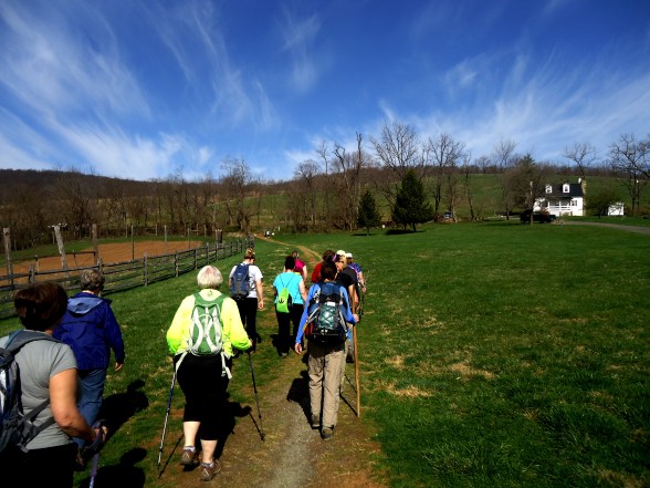
Mid-Week hikes are a luxury.  While the rest of the world shuffles off to work, the Maryland Trail Dames were getting ready to cross the 340 bridge by pulling our gloves, hats, and layers into place.  The crossing of the bridge would be the killer with traffic whizzing past blasting us with cold air and fumes.  A necessary evil in order to start climbing Loudoun Heights on the other side of the Shenandoah River.  At 10 am Wednesday morning it was bitter cold, yet bright and sunny, so we anticipated shedding some of those layers as we climbed almost 1000 feet to ridge!

The parking lot is a fee area, so pay the $10 bucks to support the NPS.  The pass is good for three days, so after I finish this post I might head back for another hike in the area! 🙂

20160106_143943.jpg

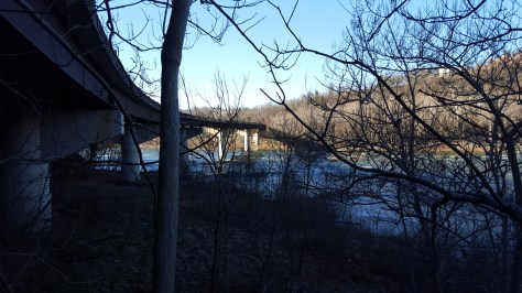
340 Bridge over the Shenandoah River looking towards West Virginia side

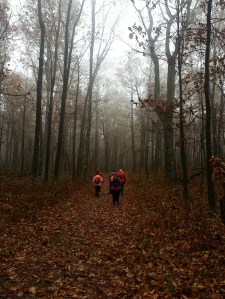
Once we crossed the bridge, we climbed the AT up, up, and up and as AnnaMarie would say “Suck it up, Buttercup”!  As expected a few layers came off!  Thelma, a fellow Trail Dame, suggested we take the orange trail first, then loop back on the blue trail.  Great suggestion!  The orange trail was extremely pleasant! It was a nice change from constantly going up.  It is level and well marked which allowed us to make good time with little effort!

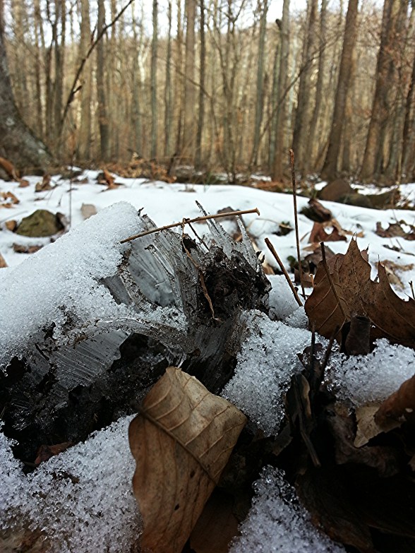
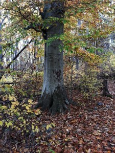
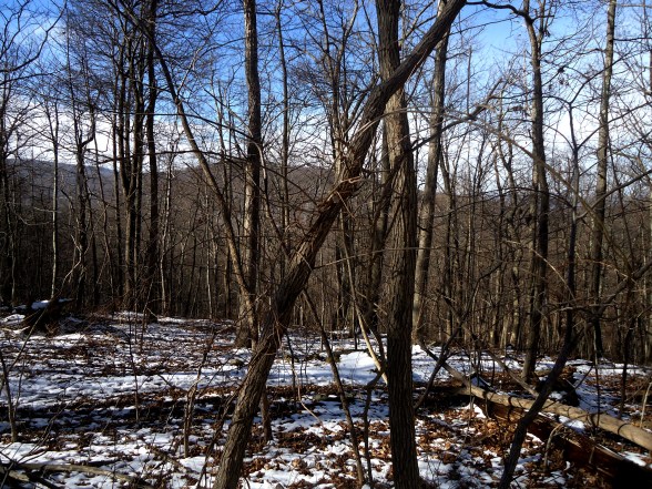
In the summer, this hike would have only the views marked on the map…two at power lines, then another at Split Rock.  But in winter? Ahhhh…all the views you could want!  No leaves make mountain hikes even more glorious.

20160106_112545.jpg

Holy crap! I think my lips are purple! 🙂

The path became more rolling once we met up with the blue trail.  We went to the left, headed for Split Rock.  It all seems so easy…because the trail is going down to Split Rock.  The view here though is worth it!  and the women on the trail with me were so funny!

“Suck it up, Buttercup!”  became a repeated joke as we met each hill with gusto.  At each overlook we had a micromanager or two when it came to picture time…after being asked to tilt the camera this way and that way, and move to the right, then to the left I busted out laughing…”What is your job anyway???” Snorts of laughter permeated the air. 🙂  and don’t even let me start with the selfie stick…oh jees’…It was a good thing no one else was on the trail!

2016-01-06-15.58.09.jpg.jpg

Looking across at Maryland Heights

20160106_122928.jpg

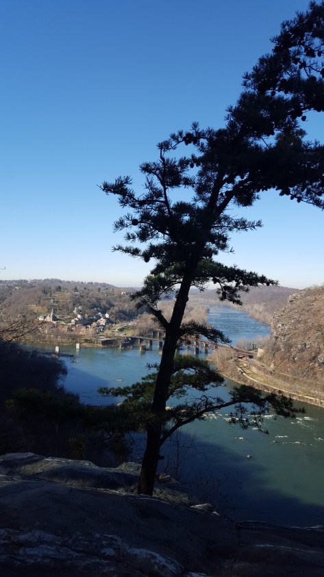
View of Harper’s Ferry from Split Rock

img_20160107_084114.jpg

Like a Model Train Set!

After lunch at Split Rock, we climbed up to the ridge once more.  There were some sweaty faces in that last push to the ridge!  Then it was easy, a little rocky, but easy sailing on the blue trail and a quick trip down the AT back to the 340 bridge.

20160106_135420.jpg

Looking calm, cool, and collected…like they hadn’t even exerted themselves. 🙂

In the whole time we were on the mountain, we did not see any other hikers! So if one is looking for solitude on this hike, go on a weekday.  I have heard that on the weekends it can be crowded at Split Rock.  I totally get that because it is such a great place!

We finished at 2:30 and the sun never really made it over the ridge.  Still seemed like morning with the long shadows filling the valley.

Off to more chilly adventures! Hike On!


Hiking in Winter by a Chunky Middle Aged Woman

First of all, let me say that I have not always been a fan of winter hiking.  In fact, up until a few years ago, as soon as that first cold wind blew, I went into hibernation mode, staying inside nurturing other hobbies like reading, sewing, drinking hot chocolate…embracing the chunky until Spring came around again.

I don’t know when it changed.  Trail Dames had something to do with it for sure.  I found out I could and would hike in winter IF I just signed up to attend a hike with Trail Dames.  Fast forward to NOW!  I love winter hiking.  The silence, the crunch of snow, the briskness of the air, NO BUGS, NO STICKY HOT HUMID AIR!!!

DSC03177

Along the Appalachian Trail in Maryland

And the views! I can see through the trees and see the distant mountains!

No "green tunnel" here!

No “green tunnel” here!

And anyone for waterfalls???

White Oak Canyon in SNP

White Oak Canyon in SNP

But to love it I had to figure out how to happy in the cold.  That was my challenge!

Layering:

Everyone tells you to layer in the Winter, but what does that mean?  Well, don’t buy any cotton layers, that is for sure.  No cotton tshirts, no cotton long underwear…Cotton gets wet with sweat, which will chill you beyond belief and possibly right into hypothermia!  No cotton!!!  Here is how I layer…

  • Start with a moisture wicking base layer on both top & bottom.  I have a lightweight base layer and a heavyweight base layer.  If the temps are 30 – 50 I use the lightweight, anything below 30 and I choose the heavyweight.  It is a matter of choice…and only experience will tell what is comfortable for you!
  • For my legs, after the base layer, I put on wind pants (like gym pants).  This is enough on bottom for 99% of my hikes here in the MidAtlantic.  For the other 1% (when it is God-awful skin lashing cold) I put fleece pants on after the base layer, then the wind pants.
  • For my core (top), I follow the base layer with a typical short sleeved hiking shirt.  Then a long sleeved hiking shirt with a hoodie, then a fleece jacket, and finally a wind breaker.  That wind breaker is a key piece of the layering for me.  Wind can flippen freeze me to death…Do not underestimate the power of wind chill.
  • Okay, now let’s talk about head wear, and yes, you better have a good hat.  Not some chintzy piece of crap made out of fibers that won’t keep you warm.  Try a good wool hat…know why? Because wool will insulate even if it gets wet!  Also, make sure that hat pulls down over your ears, or even better, invest in a balaclava because you are going to need something around your neck!
  • My hands are covered with glove liners as well as a heavy glove.
  • For my feet, I just use my usual wool hiking socks with silk liners and a waterproof hiking boot.  My feet generally stay plenty warm (sometimes they even get hot).

So you are all layered up nicely and ready for your first winter hike!  Where do you go? My advice, so you can try out your layers is to pick a route, either on a trail or in the neighborhood, that is around two miles.  In two miles, you will know whether your layers need adjusting.   You do NOT want to find out that you have inefficiently layered on a long hike!!  If you get too warm, that is fine…because you can shed a layer or two as you warm up.  But if you are too cold, then you need to start off with better layers…either heavier weight or more layers.

View from Washington Monument, Boonesboro, MD

View from Washington Monument, Boonesboro, MD

Water:

Okay, the layers are working, yay! What’s next?  Let’s talk about water and staying hydrated.  In the winter you may not feel as thirsty as you do on a hot summer day. You might need to force yourself to take a drink of water as you hike down the trail. Camelbak has a neat hydration calculator you can use to give you an idea of how much water you should be taking in as you are hiking.

Sidekick Pauli and BoobOnARock at Possum's Rest along the AT in SNP

Sidekick Pauli and BoobOnARock at Possum’s Rest along the AT in SNP

Food:

Yes. Yes, take food.  Yummy stuff high in calories…you get to splurge here!  On a five mile hike I usually take a pb&j sandwich on multigrain bread, trail bar, m&m’s, and something salty, like pretzels.  Sometimes I carry a thermos with a hot beverage, which makes my break extra nice. If you hike with a canine companion, then bring snacks for him/her as well.  🙂

Not all winter hikes are snowy...30 degrees...Sidekick Pauli takes a break in Gambrill SP!

Not all winter hikes are snowy…30 degrees…Sidekick Pauli takes a break in Gambrill SP!

Take Breaks:

Definitely!  I usually hike on the Appalachian Trail, so there are shelters where I can stop, get out of the wind and relax while eating my lunch.  Try to plan your hike so there is a good break place in the middle somewhere.  If it is super cold, an emergency blanket can keep you comfortable so you don’t have cut your break short.

Jim & Molly Denton Shelter on the AT in VA...Nice break spot.

Jim & Molly Denton Shelter on the AT in VA…Nice break spot.

In addition, take little breaks along the way.  You might want to take along a pad to sit on…otherwise you could find yourself sitting on an icy log or in the snow!!

Sometimes I get so warm hiking some of the layers come off...like my hat and gloves.

Sometimes I get so warm hiking some of the layers come off…like my hat and gloves.

That’s it!  Seems like a lot, but with each hike out the prep gets easier!  I usually keep many of these items handy, either in my pack or a designated drawer in my dresser so they are ready to go when I am.

Have fun, stay safe and Hike on!

AT – VA Compton Gap to US 522 with the Trail Dames

I will remember this day as hiking through the sky with Dames, then descending into the valley with Angels.

Before all of this, however, was donuts.  Tenacious D was driving and I had hitched a ride to the trail head since my car is no longer to be trusted on long trips.  I felt very grateful to have a ride down to Virginia for this section hike and stopped at Dunkin Donuts on my way to meet Tenacious D for coffee and donuts as a token of appreciation for the ride.

Wow, it was raining. and cold. and windy.  Glad I put gloves and hat in the back pack before I left!

We were the last to arrive at the trail head…Tenacious D says being a bus driver for so many years makes her just drive slow all the time!  I didn’t mind, we weren’t more than 3 – 4 minutes late, and the drive had been lovely.  We pulled over and rolled down the window as Dirigo (the hike leader today) approached. She asked “Can you all help shuttle?” “Sure!”  Another Dame jumped in and away we went up into Shenandoah National Park.

We met up with everyone at Compton Gap trail head, about 10 miles into the park.  Donning our layers, rain jackets, hats, gloves, and grabbing our hiking poles we set off into the foggy woods.  Pretty easy walking, although it began to rain making me wish I hadn’t left my big red poncho back in my car before riding down with Tenacious D.  Oh well, my rain jacket, plus layers did a fine job anyway!

wpid-img_20141101_072122.jpg

Tenacious D enjoying the trail!

The forest was magical with the heavy fog.  Lines between heaven and earth were smudged giving everything a soft ethereal glow.  It felt like we were part of the sky.  Then my eye would catch a tree with its brilliantly colored leaves in the forest reminding me that the sky had descended on the mountain, we had not risen to the sky.

We reached Possum’s Rest, which on a clear day has a beautiful view, without much trouble.  Today, all one could see was the fog.  Coming down from Possum’s Rest was a little tricky!  We were climbing down from the ridge and it was a sharp decline, even with the switchbacks, littered with wet leaves and rocks.  It was slow going…but no one fell, no one slipped!

Just before reaching the Tom Floyd Wayside, we heard barking.  Lake Front Royal is a neighborhood which backs up to the AT, so the dog was probably over there.  Happy to get out of the rain we sat down for lunch at the shelter.  A PB&J and half a bag of cheezits later I was feeling quite content.  I stretched out my legs and sat there looking out into the mist.

Tom Floyd Wayside

Tom Floyd Wayside

There is was…that barking again…louder this time.  We discussed where the dog could be, then brushed it aside as we packed up and left the shelter.  Headed downhill, then all of the sudden there it was, a small older beagle, lost, cold, wet, shivering, and very scared.  She came right up to me.  It was clear she needed help.  At first we got her to follow us, but soon realized she needed to be carried as her paws were rubbed raw.  I carried her for awhile,

then Python cleared out her backpack and together we fit her inside.  She loved that! So cozy!  And that is how Python packed her out.  As we continued towards Rt. 522 we passed directly by a few houses in Lake Front Royal.  Python asked a guy out on his deck if he knew anyone who had lost a beagle.  He didn’t but turned to get his wife.  Turns out the wife works in a vet clinic and offered to take the dog so they could follow up on the license number and scan for a microchip.

So you see, the Dames had become Angels arriving at just the right time and place for this lucky little pup.  I am ever so happy she spent the night inside, safe and warm.

A Journey Taken

A Journey Taken

Hike on.

AT – PA Pine Grove Furnace SP to Trindle Road

This gallery contains 2 photos.

March 16, 2014 Two days and a night at Milesburn cabin with the Trail Dames?  Oh, Let’s go! 🙂 Trail Dames Maryland had rented Milesburn cabin, a PATC cabin, in Michaux State Forest for the weekend. I had signed on for Friday and Saturday with planned hikes on the AT each day. So north on 15, west on […]

5/3/2014 Locked Bathrooms & Trails Turned to Creeks at Catoctin Mountain Park

This gallery contains 3 photos.

This day.  Oh goodness, THIS DAY! Hiking at Catoctin has never been this much of an adventure…but I WAS with Bag Lady and other Trail Dames… I arrived a little early and saw that B^2 was already in the parking lot.  I gave her a quick wave and told her since the visitor center wasn’t […]

Spring Spectacular! Two Hikes with the Maryland Trail Dames

This gallery contains 2 photos.

Spring is finally here! I welcome the blue skies, green grass, spring flowers, and happy birds more than ever after the crazy winter we have had here in Maryland. So with a literal spring in my step I have headed out more than a few times over the last couple of weeks to take it […]

3/29/14 Another Cancelled Hike for the Trail Dames? Argh!

Well…this has turned out to be a hiking week BUST!

I had two hikes planned this week for the Maryland Trail Dames, one for Dames looking for a challenge and one for beginning hikers.  Both, yes, both got cancelled due to the weather!

On Wednesday, I had scheduled an 8.5 mile loop hike at Catoctin Mountain Park.  This is a strenuous loop which allows hikers to visit Chimney Rocks, Wolf Rock, Thurmont Vista, Hog Rock, and Cunningham Falls.  It is a beautiful stretch of trail.  On Tuesday, like much of the eastern seaboard, a weather system brought in snow.  It wasn’t very much snow, like 3 inches, but it froze overnight when the temperatures dropped into the teens.  This would make the steep climbs absolutely horrendous for those of us without microspikes.  On Wednesday, winds also became a factor with wind chills dropping to near zero.  So SLASH, SLASH, and it was cancelled.  So disappointing. 😦

But this is what we would have seen if we would have been able to go! 🙂


Chimney Rocks

Chimney Rocks

Today, Saturday, I had planned a nice gentle hike for Dames at Worthington Farm (part of the Monocacy Battlefield). When I scheduled the hike I imagined warm spring breezes, sunshine and spring flowers popping up along the trail.  In my head I could see the river flowing in a lazy fashion while birds flitted about singing to each other as they built their nests.  But NO, we have to endure this outlandish rainy weather that has resulted in flood warnings!  Guess hiking next to the river was out of the question. SLASH! Another one bites the dust!

However, let me just give you a little glimpse of what delights awaited us if we could have gone!

View of Baker Valley

View of Baker Valley


I am so bummed!  Just itching to get out with the Dames on an adventure!  Our next hike is scheduled for April 12 at Sky Meadows SP in Virginia.

If you are on the trail that day and see a bunch of women having the time of their lives, then stop and say hi! Guaranteed that bunch would be us!! 🙂 🙂 🙂

But you know what would be even better (if you are a woman over 18)?  You could join us!  http://www.meetup.com/Maryland-Trail-Dames/

Hike on!


AT – VA Rt. 605 to Snickers Gap (Rt. 7) March 8, 2014

This gallery contains 3 photos.

On this gloriously soon to be warm morning, I met up with backpacking buddy and fellow dame, Boomerang to carpool to our meeting spot on Route 7 in Bluemont, Virginia.  We hadn’t seen each other since the fall AT backpack across Maryland, so it was nice to catch up! I was getting some new AT […]

Planning out Loud…Five months to go!

Officially planning for a backpack in May!  As I sort through my books…and I got a new one (insert happy squeaky voice)…I am sort of talking through the backpack.  The dogs are giving me the “oh god, again?” look and the cats are quite distracted as they have found the corner of my books are quite fun to rip apart.  Oh well, shoo cats, I have work to do. 🙂

So I think I will try to do 70 miles in 6 days…hahahahahaaaa….chortle, guffaw and all that nonsense. What am I thinking?  I prefer 8 mile days…But I am sticking to this plan for the moment.  I mean I have 5 whole months to prepare…

The elevation profiles are from my new book (yes, squeaky happy voice again 🙂  )  The ALDHA AT Thru-Hiker’s Companion.  Still love AWOL’s book, but the elevation profiles are a bit more detailed in the ALDHA book. Either book is a super resource to have when planning.   I take the official AT maps on the backpack.

Anyway, here’s the plan:

During the Trail Dame Camp Out: Section between PA94 Mt. Holly Springs and Pine Grove Furnace SP ~10.5 miles

Section A

The following week I will return to the area to backpack ~70 mile section.

Day 1: PA94 Mt Holly Springs, PA (1104.3) to Backpackers campsite (1112.5) 8.2 miles

Section 1

Day 2: Backpackers campsite to Darlington Shelter (1127.2)  14.7 miles No camping allowed in between!!

Section 2

Day 3: Darlington Shelter to Duncannon, PA.  (1138.5)  11.3 miles Stay in hotel.   Resupply as needed.

Section 3

Day 4: Duncannon, PA to Peters Mountain Shelter (1149.8) 11.3 miles

Section 4

Day 5: Peters Mountain Shelter to Yellow Springs Trail (Clearing with trail register, camping) (1163.3) 13.5 miles

Section 5

Day 6: Yellow Springs campsite to Swatara Gap, PA 72 Lickdale, PA (1174)  10.7 miles

Section 6So here’s to planning on a frigid winter day! Now I am going to sit back, have another cup of Peppermint tea and figure out how I am going to day hike all of Shenandoah National Park during 2014! Hike on! 😀

AT – VA Blackburn AT Center to Snickers Gap

This gallery contains 2 photos.

What a delightful day with the Maryland Trail Dames!  This day was December 21, the winter solstice, and it was WARM!  Yes, a balmy 65 degrees! We met at the lot on Rt. 7 in Snickers Gap, then Dirigo shuttled us back to the Blackburn AT Center to begin our hike.  The first uphill from […]