Not Quite Spring, Not Quite Winter! A Stroll in Shenandoah NP

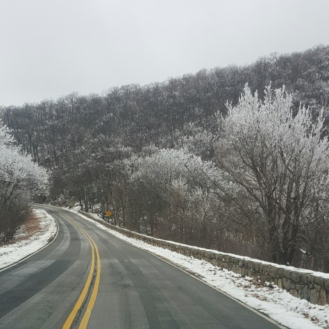
Cruising along Skyline Drive it occurred to me that maybe this hike wasn’t going to be the hike I had conjured up in my mind yesterday.  At that time, I sat on the edge of my bed, maps spread out around me and Sidekick Pauli sprawled  beside me catching rays from the afternoon sun.

Now I found myself facing mountains that still showed vestiges of winter.  I  pulled over no less than three times along the drive just to look, gaze in wonderment, lost in the beauty of Shenandoah.  I decided we would hike where the snow still lingered.

img_20160305_194713.jpg

I want to go there! Right there, on top of that snowy mountain!

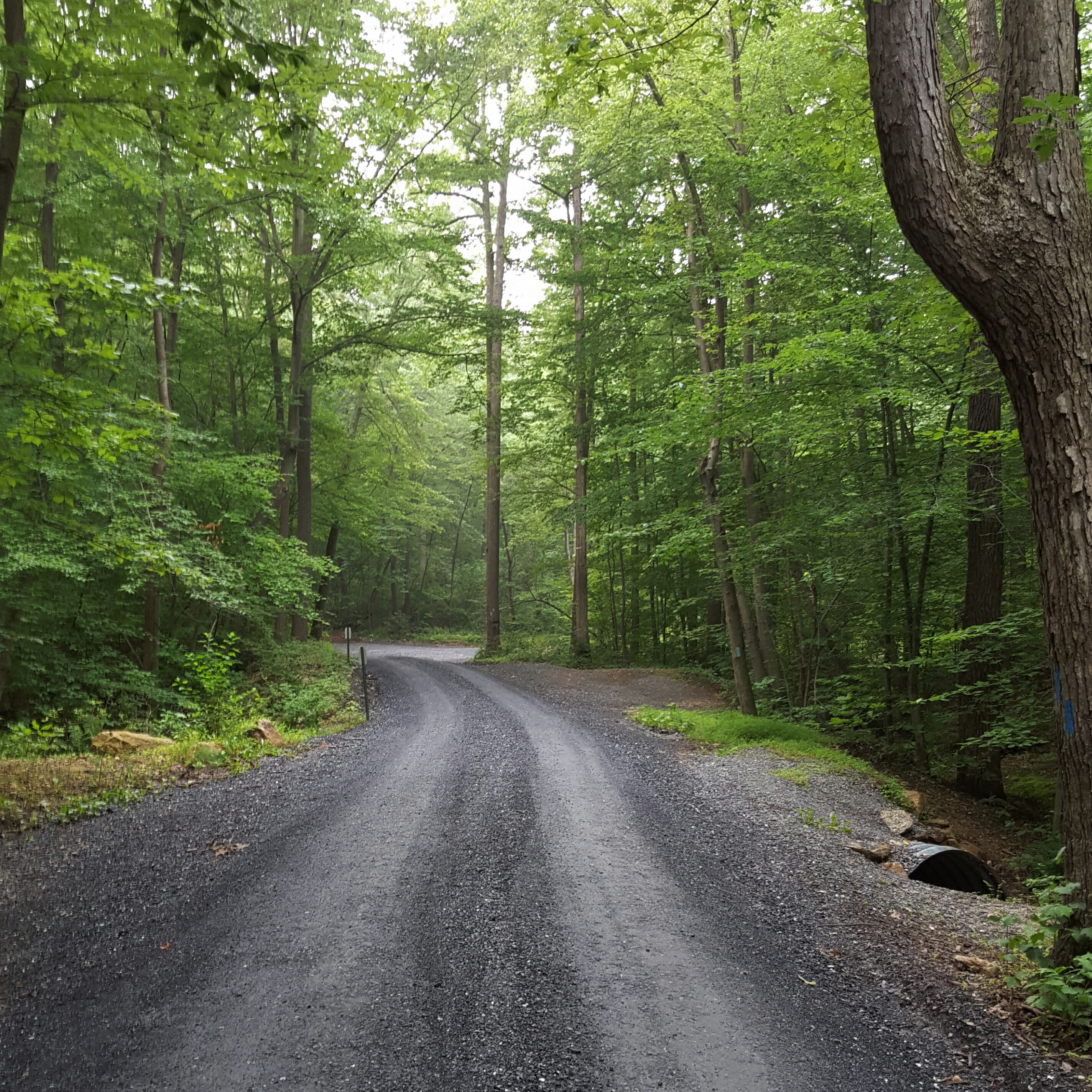
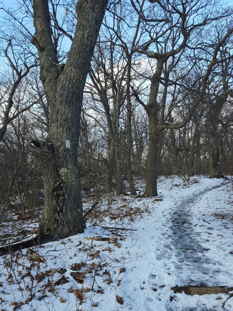
I had been headed to Elkwallow Wayside, but stopped short when I got to Overall Run Falls trail head.  Yes!  We ARE STOPPING RIGHT HERE!!!  The trees were all sporting a fresh layer of rime and the trail was perfect with about an inch and a half of dry snow.  Oh, it was gorgeous! Like *gasp* gorgeous!

img_20160305_194849.jpg

Not the best pic…but the only good pic of the rime on the trees!

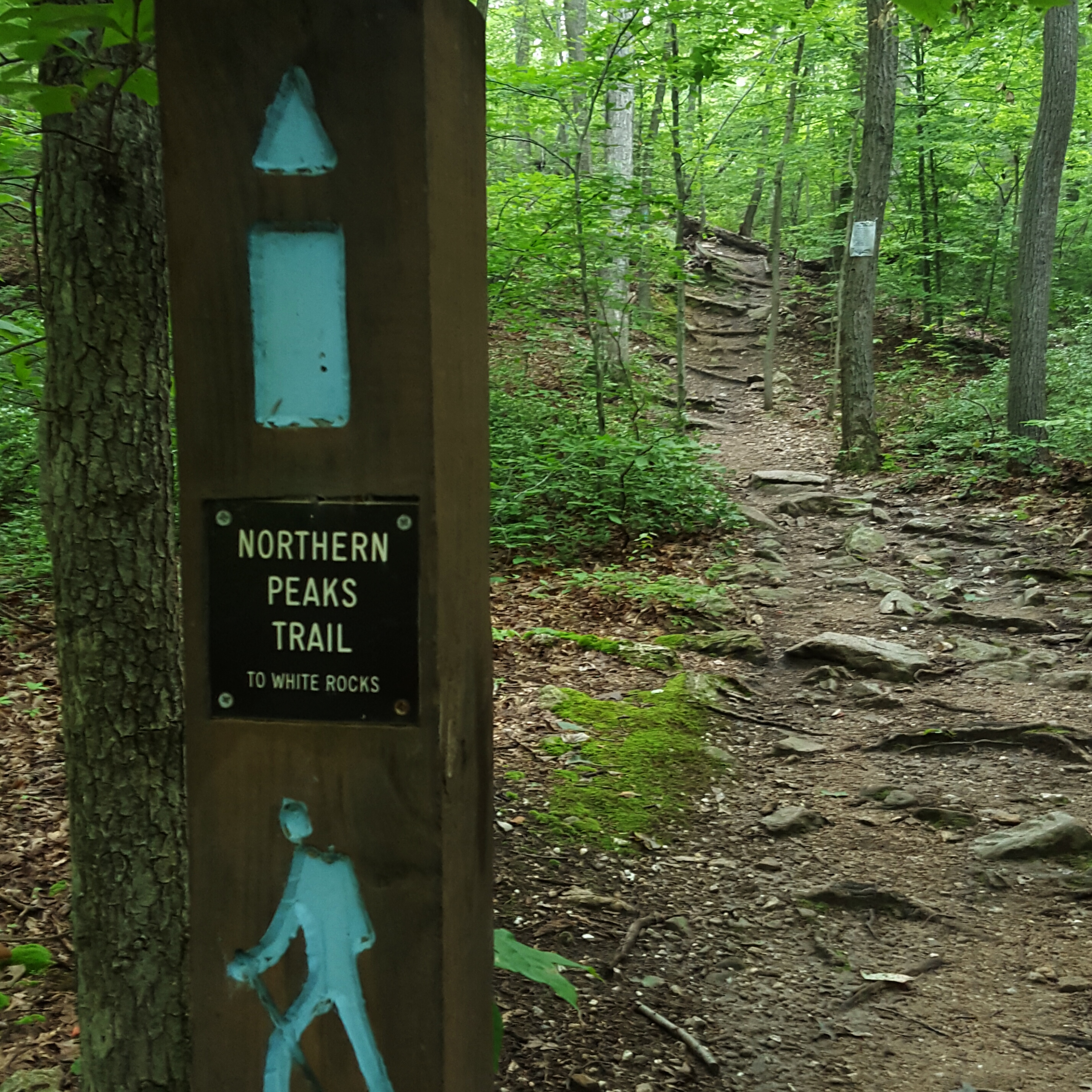
I took a look at the map and started down the AT to Elkwallow, I would decide whether to backtrack or loop once I got there.  Sidekick Pauli was hiking with me today and is still sporting a pretty good scar down her neck…so it just depended on how she was doing when we got to Elkwallow.

img_20160305_195026.jpg

Oh boy! Into the woods!

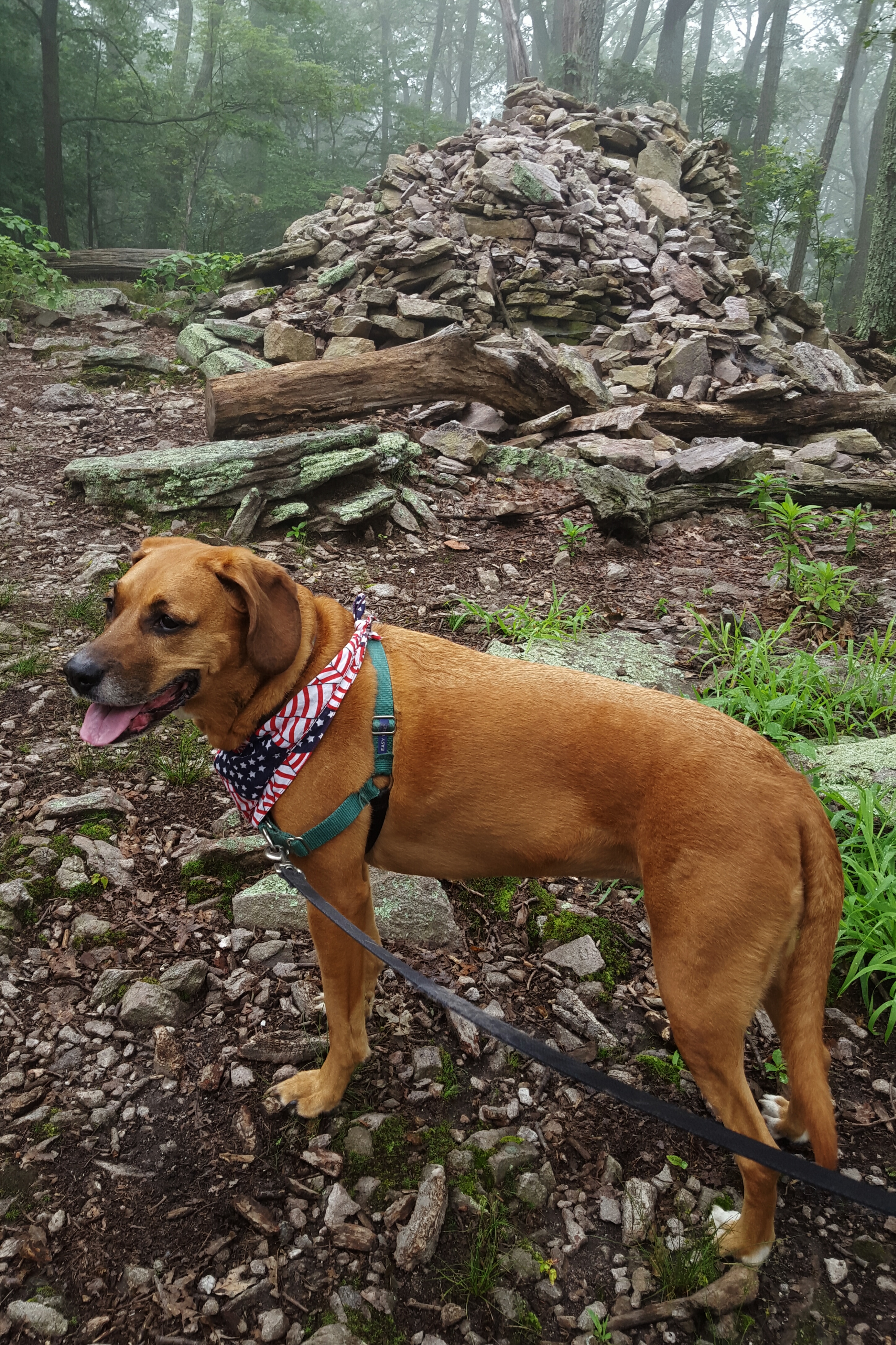
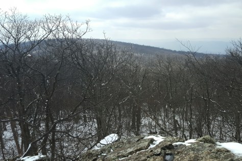
The AT to Elkwallow Wayside is a fairly moderate hike with a view that was nice!  Sidekick Pauli scrambled up the rocks and stared into the distance with satisfaction.  Oh, she was definitely happy to be back on the trail! This was our only overlook, although, there were nice forest views along the way.  We passed over Skyline Drive on the AT, then headed slightly up before passing the PATC Range View cabin and descending to Elkwallow Wayside.

img_20160305_195807.jpg

At Elkwallow, we took a detour down to the picnic area…for a pit stop.  While I was, um, otherwise engaged a family had driven up to also use the bathroom. Apparently, this was the only bathroom open in the area.  When Sidekick Pauli and I exited the bathroom they just lost it.  They were gabbing away in a language not understood by me.  They were simply in fits!!  I didn’t get it, what the heck, haven’t they seen something like this before???  I heard their laughter and felt their pointing until we disappeared into the woods.  Haha! Glad I could add something to their Shenandoah memory!! 😀

Sidekick Pauli was loving it!  I decided to loop down to Matthews Arm campground, then climb back up to the AT via the Traces & Tuscarora Overall Run Trails.  The weather had warmed a bit and there was no snow on the Elkwallow Trail down to the campground.  A nice picnic on a damp log awaited us!  Sidekick Pauli gobbled down several of Queen V’s home made doggie treats!!  I made do with a PB&J.  🙂

img_20160305_200311.jpg

I didn’t make it … but I didn’t destroy it either. I enjoyed the oddity of it as I made my way down the Elkwallow Trail.

The birds were rocking out while we sat there in the middle of the otherwise quiet woods.  Lovely to listen to but my butt was getting wet…time to move!

img_20160305_201813.jpg

YAY! we don’t have to rock hop across the creek. 🙂 I think Sidekick Pauli is disappointed…

Soon after crossing the bridge we reached Matthews Arm campground.  We found the Traces Trail after crossing the parking lot.  This trail starts to climb, and the climb goes on, and on.  Maybe it was because I left this piece of trail for last…but man, oh man,  that climb!  Between 800 and 1000 feet!  To say I was happy to reach the snow line would be an understatement! Whew!!

img_20160305_200718.jpg

Ahhh, yes! Finally! Jees…why did that hill feel so long? Oh, 800 feet of slippy, slippy…got it!

I reached the car and began getting ready for the drive home.  Took off the layers, traded out the hiking boots for sandals, did a few not helpful stretches, grabbed the cheezits…

While storing my bag, boots, and clothes in the back of the car, a ranger pulled up.  “Hey, just wanted to let you know there is some weather coming in overnight so we are going to be closing Skyline Drive.”

No problem, ranger! We are ready to go!  Hike on!

A Shorter Loop at Sugarloaf Mountain, Maryland

Rain, muggy, then rain again! My last week before returning to teach summer classes was less than ideal. While I got out for a few spins around downtown Frederick, I was missing the woods.  Sunday came with the gift of opportunity!  I chose to go to Sugarloaf Mountain!

Sugarloaf is a classic place to go hiking…translation…it can be super crowded and the port-a-potties always smell…

However, there are times when introverts like me can actually enjoy the mountain.  Go early and preferably on a weekday, although super early usually does the trick.  Park behind the mountain on Mt. Ephraim road and head up the Blue or Yellow trails.  It is a gravel road, but well packed down.  In addition, improvements have been made so the creek now flows underneath the road bed!

I was out the door with Sidekick Pauli at 6:30 AM, and after a few stops, was on the trail at 7:20 AM.  There was not a soul around!!! Yessssss!!!!

Mt. Ephraim Road

Mt. Ephraim Road

I parked at the usual spot on Mt. Ephraim road and headed up the Blue trail to White Rocks. The whole area was fogged in leaving the woods with mist hovering in the branches of trees and spider webs glistening with water droplets. Very moody, like something out of a BBC period production.  Too bad it doesn’t come out well in the photos because it was pretty outstanding!

Starting the Blue Trail just off Mt. Ephraim Road

Starting the Blue Trail just off Mt. Ephraim Road

It was also incredibly humid. Cool, but humid! Sidekick Pauli was delighted to find a spring dumping out directly onto the trail.  I was delighted to find a few stepping stones so I could hop over said spring!

Arriving at White Rocks, we found we were still fogged in.  We sat for a few minutes becoming part of the quietness that surrounded us.  When we got going again the birds were beginning to chatter to each other.  Ahhh, can’t beat being out here in the early morning!

No view at White Rock so Sidekick Pauli is searching for...?

No view at White Rock so Sidekick Pauli is searching for…?

wpid-img_20150705_094507.jpg

Foggy Woods

The Blue trail winds down, then up to one of the lesser summits at 1015 feet (Mt. Ephraim road is at 500 feet).  The summit is marked by a big rock pile.  I added a rock to the pile and kept on.

Lesser Summit 1015 feet

Sidekick Pauli at the Lesser Summit of 1015 feet

Coming down the mountain, it looked as if the trail has been rerouted to accommodate new switchbacks! Nice!  Soon after the switchback I spotted a dog barreling down the trail.  “I have a dog.” I called out in a stage voice that hasn’t gotten much use since high school.  The owners, thankfully, were able to call back their dog and get him on a leash. Sidekick Pauli is not fond of people or animals that intrude into her personal space without invitation!  Crisis was averted and we continued down the trail once the dog and its owners passed by.

wpid-img_20150705_100818.jpg

Having limited time and I chose to take the yellow trail back down to Mt. Ephraim Road.  A new trail to explore, a welcome change!  A nice trail too!  Even though this is the “Horse Trail” it was wide and easy to walk.

Great Trail! Just for horses? Looks like cars too.

Great Trail! Just for horses? Looks like cars too.

No obvious pock marks, not a lot of horse poo, but occasionally there was a disgusting, muddy puddle of water.  This was not unexpected after the rain in the area this week!

Yuck, Yuck, Yuck!

Yuck, Yuck, Yuck! Sidekick Pauli…DON’T even THINK about it!

The complete loop, Blue from Mt. Ephraim road to White Rocks, then to the Yellow trail back to Mt Ephraim road, was about four miles.  Long enough to get your mind in the right place, but short enough to not wear you out (just in case you have to go home and help with housework…)!

Grab the dog in your life and hike on! 🙂

AT – PA Rt. 501 to Rt. 183 5/28/2015

Up with the dogs at 5:30 am, then out the door at 6:30 am.  I thought I was leaving early, but didn’t anticipate rush hour in Harrisburg, Pennsylvania! I mean come on, why is the traffic stopped? It’s a burg for God’s sake. 🙂

Rounding Harrisburg on I-83, my accelerator foot got jittery from the seemingly endless riding of the brakes. My heart soared when I finally zipped down the ramp headed east on I-81… ecstatic to demonstrate some of my NASCAR talent!

On to meet hiker pal, Cindy, at Rt. 183. I pulled into the parking lot right at 9 am … on time! We left my car and drove back to 501 in Cindy’s.  The clouds were many shades of gray and hung low obscuring the ridges.  We discussed the possibility of rain…

image

Pulling up to the 501 lot I noticed two dejected looking backpackers sitting on the ground. I wondered what they were up to. “Good Morning! How’s it going?” Their response was indicative of a rough night. Gesturing to the foggy mountainside, I continued, “Did it rain this morning, or is this just coming in?” Now they let loose…they described a hellish night in a wicked thunderstorm. They had been hiking a few days and were now ready to take a day off to dry out in town! We left them waiting for their shuttle to arrive.

image

The trail rides the ridge of Blue Mountain which made for pretty nice walking, although a few rocky sections kept me humble. I quickly learned to teeter-totter on the loose stones! Ahhh, new skills…or is that skillz? 🙂
image

image

Here I am showing off those skillz! Thanks Cindy for the pic!

image

There were quite a few campsites along the trail. Sweet campsites! Small, but plenty of space for a couple of backpacking tents. We stopped for a long lunch (30 minutes!) at one such site.

image

It was great to stretch out…I rarely stop for long when I am hiking alone. I don’t know why…I just don’t! Cindy told me she is the same way. How about that? 🙂

There were also a few excellent views. This was taken by Cindy at Shikellamy overlook. I am somewhat embarrassed to admit that I still cannot pronounce Shikellamy correctly despite Cindy repeating it several times for me!

image

A cute little red spotted newt was hiking the trail today…that I stepped right over without noticing…thanks Cindy for pointing it out!

image

We came to Hertlein Campsite soon after the newt sighting. Wow! A beautiful place to camp! The stream was flowing freely. Afterwards, Cindy and I both wished we had filtered some of that fresh, clear, cold water to drink!

image

This section between 501 and 183 is interesting as it switches from rock jumbles to mountain laurel groves to blue berry patches…and then there are the FERNS! As far as the eye can see in all directions, ferns!

image

At one point we met up with another section hiker who had started at Delaware Water Gap and was coming south. She was ready to finish her section after getting caught in the aforementioned hellacious thunderstorm and almost stepping on a rattlesnake the day before! I don’t blame her! I kept an eye out for snakes the rest of the way to our car!

Our traverse crossed an old pipeline, then entered the woods again for a few more rocks. The trail looks to be in some stage of slight rerouting. It is easy to follow, however, so we were soon at the historical stone marking the location of an old fort.

This historical stone also meant we were nearing the end of our hike…and the crossing of Rt. 183. Whew! Had to take that crossing at a jog!! Blind curve…fast cars!

image

Despite a bit of humid weather and occasional distant thunder which kept reminding me that we might encounter our own little scary thunderstorm, this hike was a blast! And we stayed dry!

We exited the AT about a half mile after Rt. 183 to walk down the service road to the Gameland parking lot and my car.

image

image

image

We will return to do Rt.183 to Port Clinton next weekend. 🙂 🙂 🙂
Ankles beware!
Hike on!!!

AT – PA Swatara Gap – ??? It’s Hot, It’s a Ridge, and It’s Rocky…And I love it!

This gallery contains 4 photos.

This summer I am set to complete the Pennsylvania section of the Appalachian Trail.  I am about half way through the state, having completed Pen Mar through Swatara Gap in May 2014. In June I am backpacking a big section with my backpacking pals, Google & Cindy…but I can only go for a week.  This […]

AT – PA Shippensberg Road to Pine Grove Furnace SP 9/8/13

This gallery contains 6 photos.

So a little overlap here on the AT mileage…but picking up where I’d left off on Woodrow Road wasn’t really possible. Woodrow Road is pretty far back on a gravel road. This was a Trail Dame hike and I didn’t want anyone to get lost on the way to the trail head! The day started […]