Meandering at Blueridge Center for Environmental Stewardship

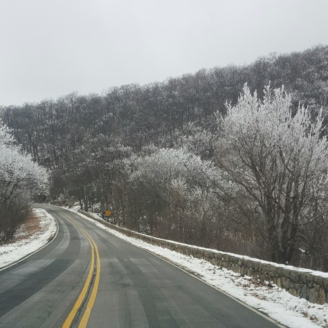
What are plans anyway? Originally, I was headed to Sky Meadows. Lack of gas in the tank and money in the pocket had me rethinking that decision while rolling down 340 towards Harper’s Ferry.  Oh…yeah…Blueridge Center, I haven’t been there in years!

Turn left at the gas station just after crossing the 340 bridge, then a couple more miles I’m there. Perfect!

image

There was a small parking spot left at the back of the lot. Okay, not really, but close enough! My car fit and I could open my door without hitting the car next to me…win!

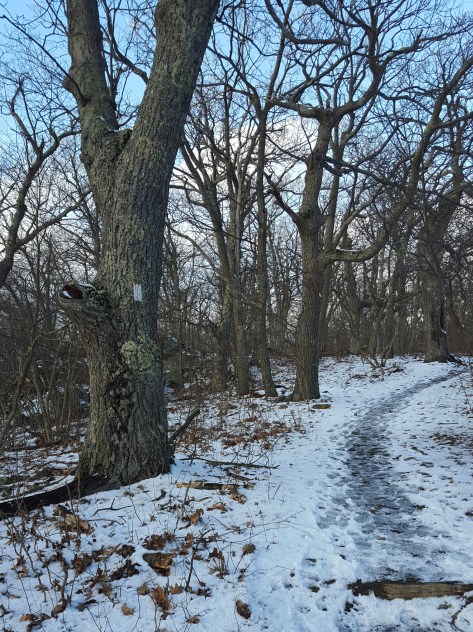
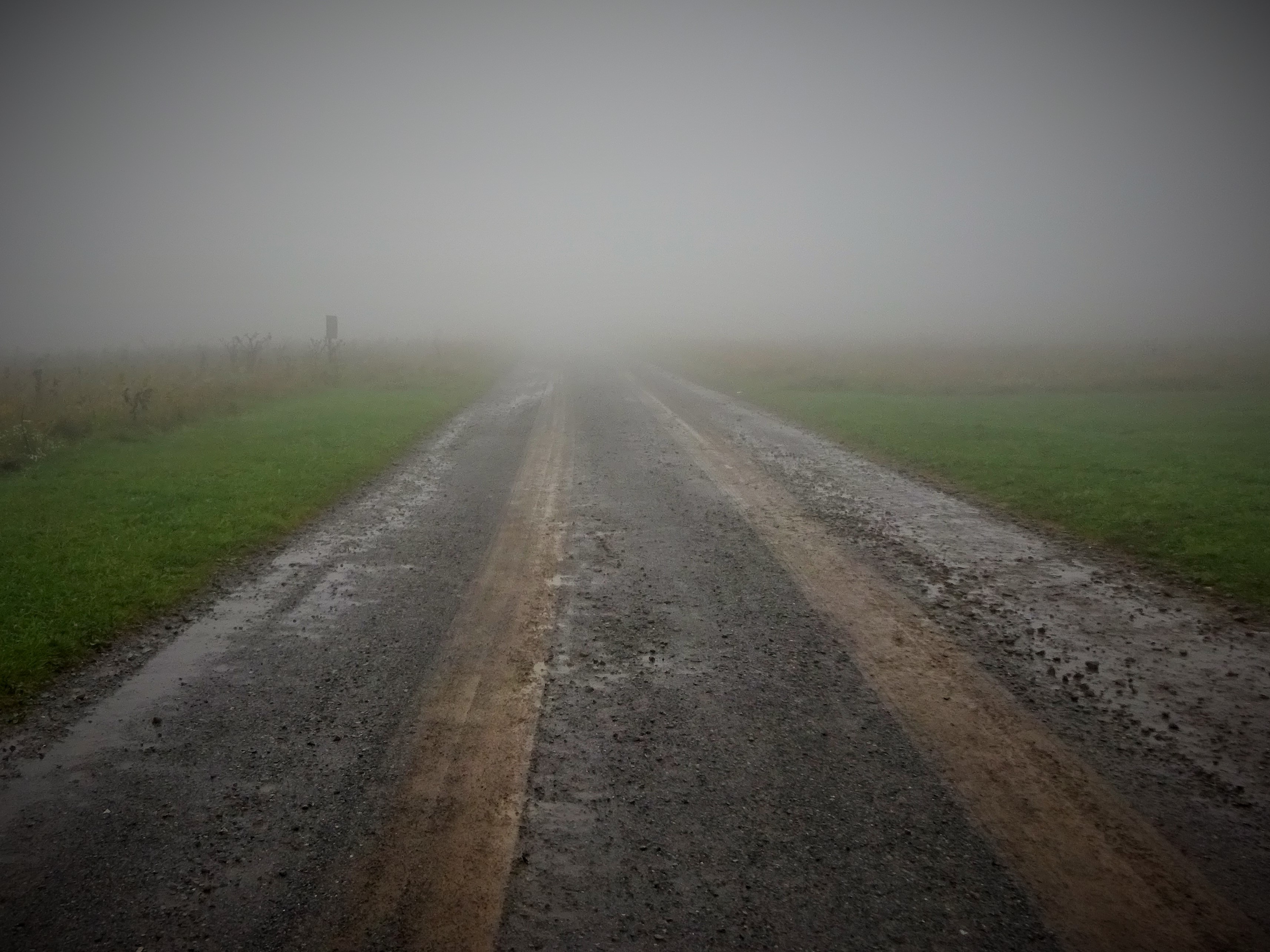
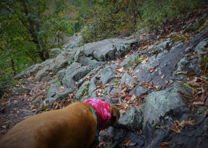
Decided to pull on the waterproof boots since the trails had to be muddy.  Seriously, after a week of rain some things are a no brainer.

Fyi, good decision…you can applaud. Haha!

image

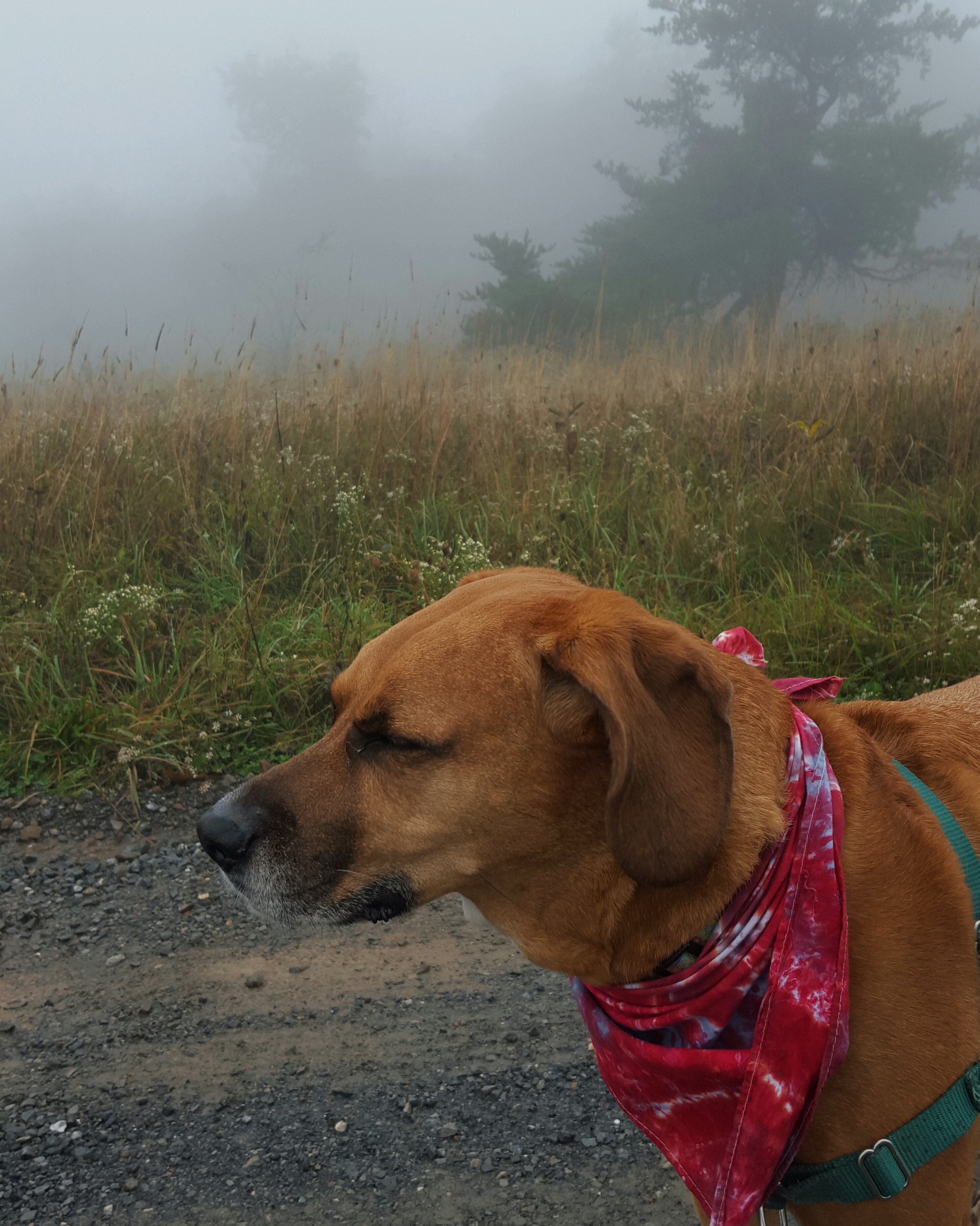
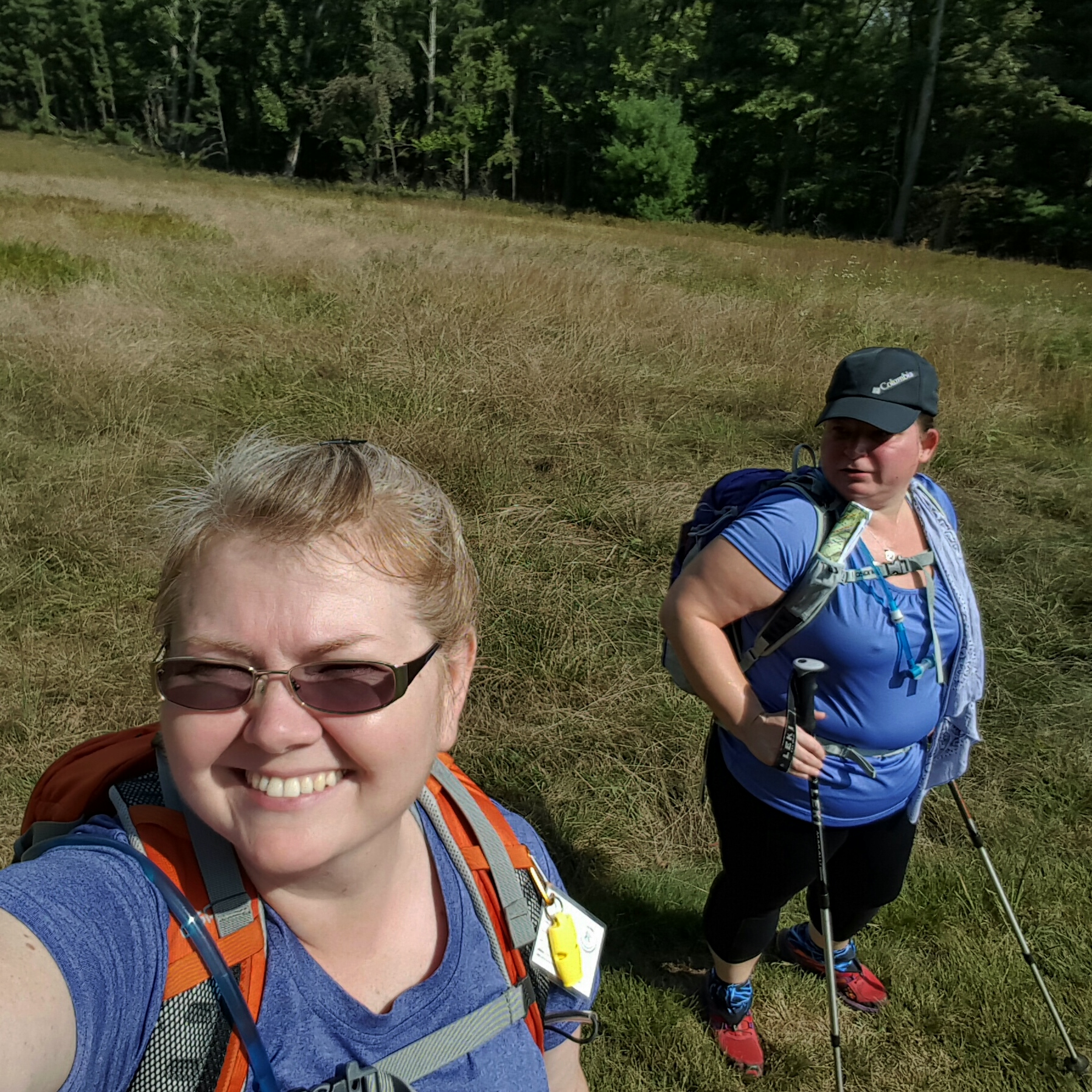
Signed the trail log,and everyone, please do this, it helps them with getting grants, then down the Farmstead Loop Sidekick Pauli and I went.

We passed a small pond and an old homestead.  What’s that? Dappled sunlight on the trail! Hallelujah,  the sun is back!

image

I figured we would follow Farmstead to the bridge at the creek, cross the bridge and picnic up by the bigger pond.

image

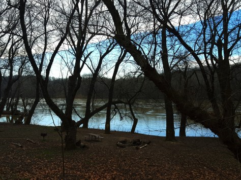
Um, where’s the bridge? Well, I wasn’t so committed to the picnic by the pond after being so bluntly affronted by Mother Nature’s handiwork. Hmmm,  I’ll continue on Farmstead!

I did look to see if there was a better place to cross upstream, but no. Not today.  I am curious what this creek looks like when there hasn’t been a week of rain!

image

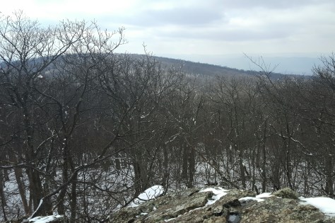
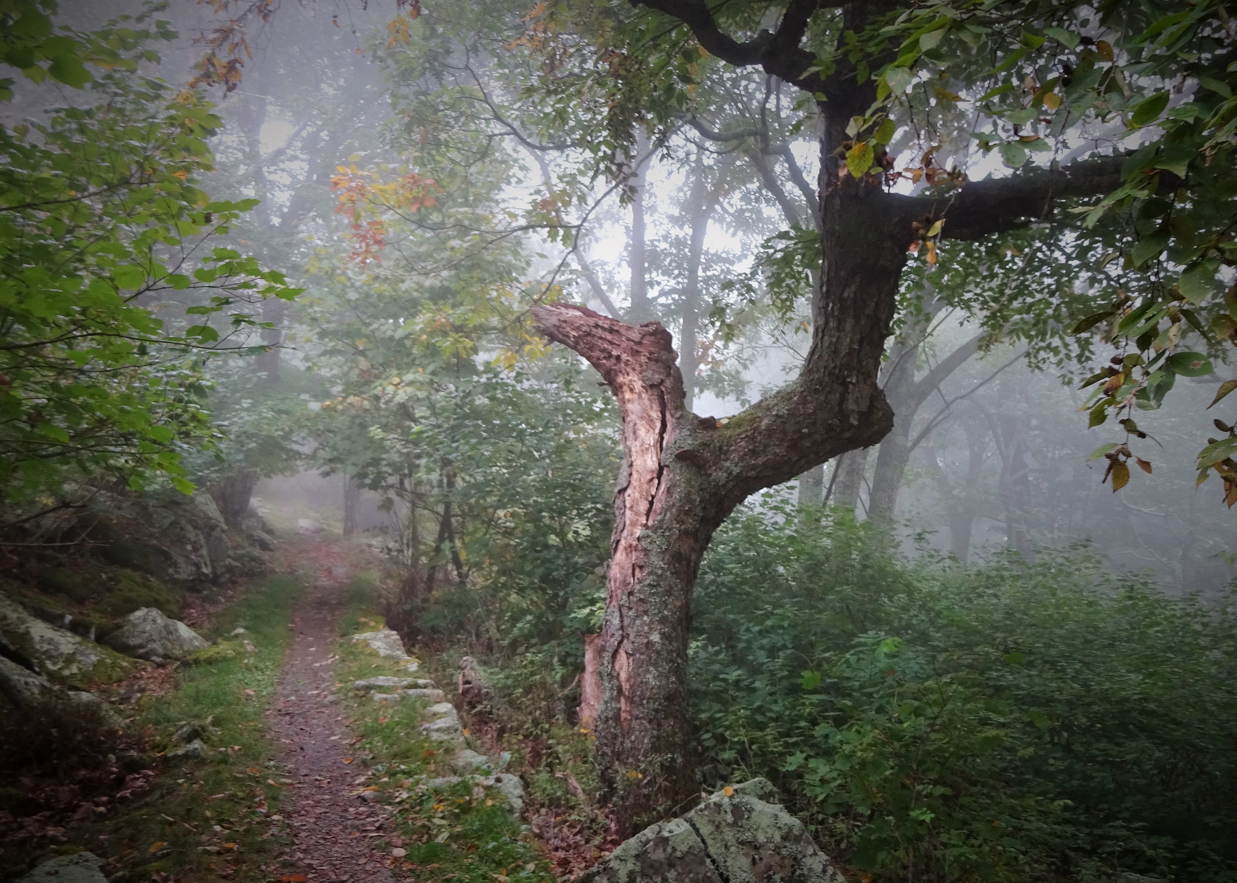
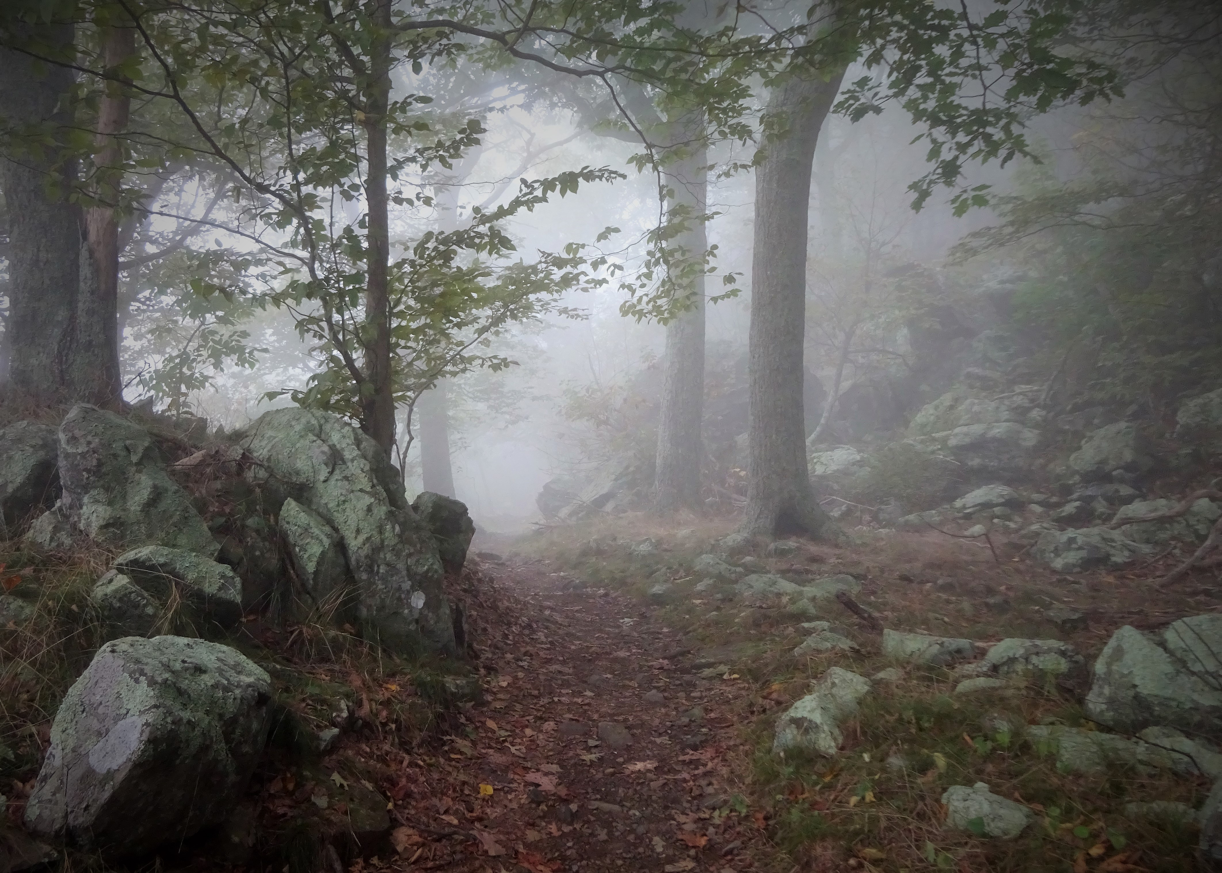
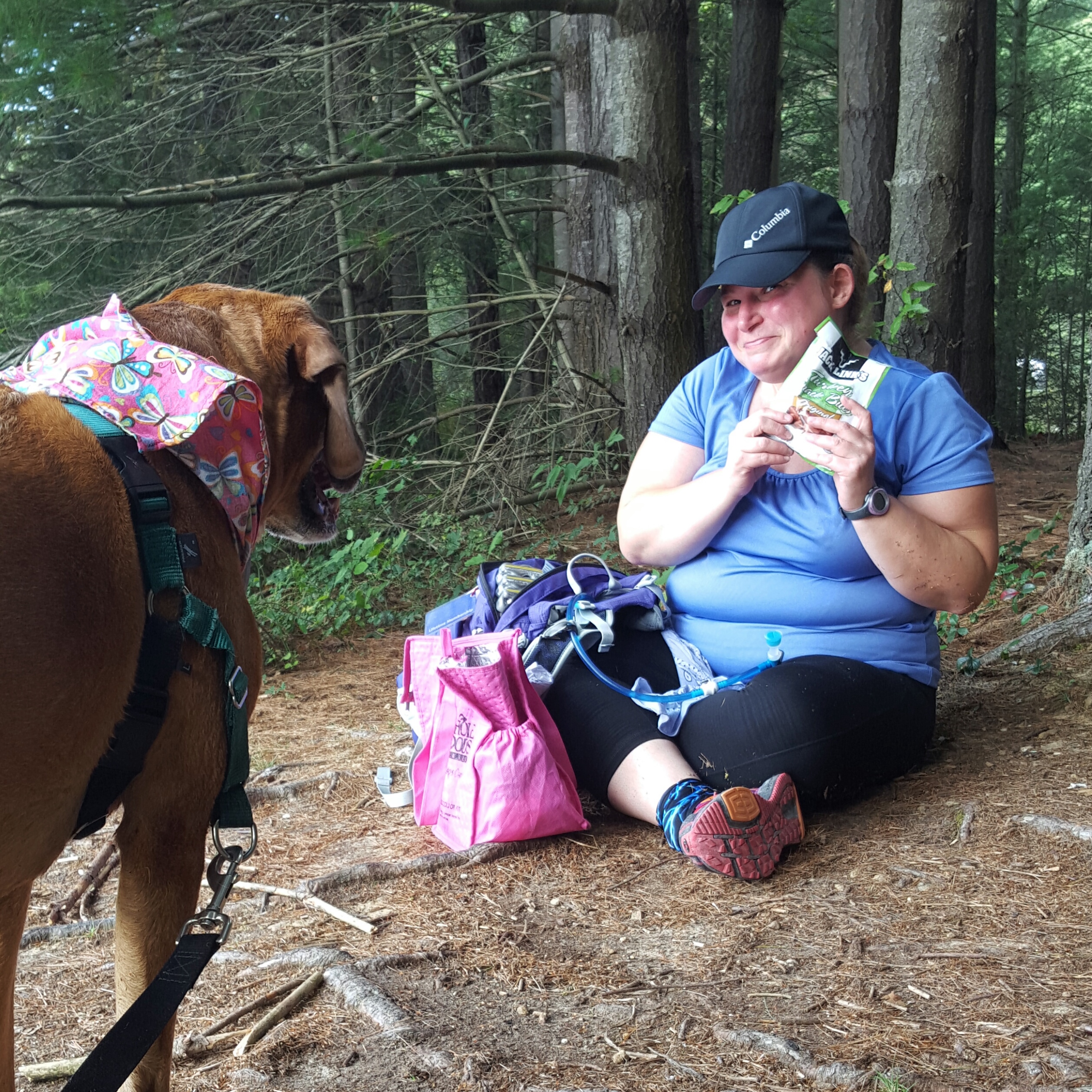
Instead I turned onto the Pine Run Spur.  This was pleasant.  It met up with the Farmstead Loop at the top of the hill which took us to Mountain View.  This little side trail is worth it! Gorgeous view over the meadow to yes, mountains! Bluebirds flitted across the meadow chirping at each other.  We sat on the bench provided and just took it all in.  Lovely!

image

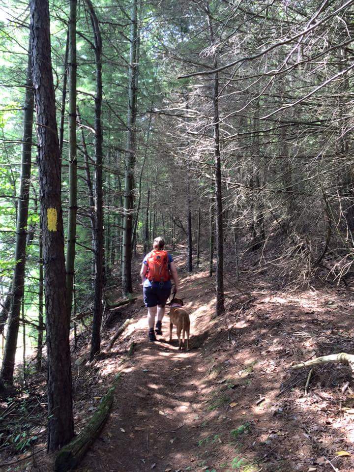
Meandered back to Farmstead, then a few steps later shot off to the left on Jonathan’s Rock Trail.

image

It may be just a rock to you and me…but to Sidekick Pauli it’s a mountain!

After completing the Farmstead Loop,  we circled back around to pick up the Derry loop which brought us back around to the small pond we had passed coming in. 

image

I wasn’t really ready for the hike to end, but I had exhausted the network of trails on this side of the creek!

Trudging back up to my car, I was making plans to come back to reaquaint myself with the rest of the trails at Blueridge!

Happy Mother’s Day…you too Mother Nature! Hike on!

BoobOnARock & Queen V do Flip Flop Festival 2016

Walking to the Flip Flop Festival from Weverton, I was going against the traffic of several hikers that looked like they were out to do something serious. My mind wandered to something my hiking friend Google told me a few years ago (when I was hiking through Georgia).  “You oughta be here in the Spring” she told me,  “hiking south through Georgia is…interesting.”
image

Here in Maryland, the thruhikers I usually see are lean, determined, and move very fast! They have 1000 miles under their belts and have settled in for the ride.  Today, as I strode quickly down the canal to meet Queen V, I passed several clean, not lean, well, okay, some were lean…but not in that “I’ve been beating the trail and the trail’s been beating me” kind of lean.  The backpacks were flashy…can I say that? I felt like I was walking through the REI website…oh yes, and I’ll take one of those…two of these…oh, and how cute is that, he is dragging his pack behind him on a wheelie thingy!  Oh, I wanted to see that guy drag the wheelie thing with his pack up Weverton. 🙂  A little sadistic, yes, I am.

“You’ve got to give a little, take a little,
and let your poor heart break a little.
That’s the story of, that’s the glory of …”  What the hell, Bette Midler’s song from Beaches?  Where did that come from?!!  Walk faster, Bette must be left behind! These hikers would deal or not.  I had to get to Harper’s Ferry…it was now 9:24 am and I was supposed to meet Queen V at 10 am.  I had my phone on airplane mode and was blissfully not getting any of her texts…

image

Tramped over the railroad bridge to Harper’s Ferry at 9:50! Quick stop at the train station, then up the hill to the ATC.  It was getting hot!  By the time I met up with Queen V I was ready to shed one of my layers. Then it was time for some exploring.

First stop, of course, is to get someone to take our picture in front of the ATC.   Yeah, I have like fifteen pictures in front of the ATC…but you know…it’s my Alamo.  So there.

image

We went around back to check out the vendors, and most importantly, scope out the food situation.  The food truck looked mighty promising with its sweet potato and black bean burrito (it was freakin delicious!).
image

Queen V, as usual, being the diva that she is demanded requested sweetly to have her picture taken in various locals…(she is now hounding me to get this post done as quickly as possible).  I did mention that “narcissism becomes her”!  😉
image

There was a workshop at 11:30 am we were going to attend.  I knew the presenter by name only here in blogland…but I am happy to say I have now met Sisu face to face and a nicer guy he could not be! 🙂  He did a great presentation and it was just so neat to meet someone I had only known through comments on this blog.  Here’s to meeting up again sometime, Sisu! 🙂 🙂
image

Oh, and by the way, the weather for this event was just the best!  However, that did not stop me from hitching a ride back to my car (Thanks Queen V!).  Yeah, after that sweet potato & black bean burrito…and a creamsicle…I kinda lost my mojo for huffing it back down the canal to my car.
image

So good luck flip floppers! and all thruhikers!  And even if Maine eludes you, the adventure of the dream did not! Hike on! 🙂

Not Quite Spring, Not Quite Winter! A Stroll in Shenandoah NP

Cruising along Skyline Drive it occurred to me that maybe this hike wasn’t going to be the hike I had conjured up in my mind yesterday.  At that time, I sat on the edge of my bed, maps spread out around me and Sidekick Pauli sprawled  beside me catching rays from the afternoon sun.

Now I found myself facing mountains that still showed vestiges of winter.  I  pulled over no less than three times along the drive just to look, gaze in wonderment, lost in the beauty of Shenandoah.  I decided we would hike where the snow still lingered.

img_20160305_194713.jpg

I want to go there! Right there, on top of that snowy mountain!

I had been headed to Elkwallow Wayside, but stopped short when I got to Overall Run Falls trail head.  Yes!  We ARE STOPPING RIGHT HERE!!!  The trees were all sporting a fresh layer of rime and the trail was perfect with about an inch and a half of dry snow.  Oh, it was gorgeous! Like *gasp* gorgeous!

img_20160305_194849.jpg

Not the best pic…but the only good pic of the rime on the trees!

I took a look at the map and started down the AT to Elkwallow, I would decide whether to backtrack or loop once I got there.  Sidekick Pauli was hiking with me today and is still sporting a pretty good scar down her neck…so it just depended on how she was doing when we got to Elkwallow.

img_20160305_195026.jpg

Oh boy! Into the woods!

The AT to Elkwallow Wayside is a fairly moderate hike with a view that was nice!  Sidekick Pauli scrambled up the rocks and stared into the distance with satisfaction.  Oh, she was definitely happy to be back on the trail! This was our only overlook, although, there were nice forest views along the way.  We passed over Skyline Drive on the AT, then headed slightly up before passing the PATC Range View cabin and descending to Elkwallow Wayside.

img_20160305_195807.jpg

At Elkwallow, we took a detour down to the picnic area…for a pit stop.  While I was, um, otherwise engaged a family had driven up to also use the bathroom. Apparently, this was the only bathroom open in the area.  When Sidekick Pauli and I exited the bathroom they just lost it.  They were gabbing away in a language not understood by me.  They were simply in fits!!  I didn’t get it, what the heck, haven’t they seen something like this before???  I heard their laughter and felt their pointing until we disappeared into the woods.  Haha! Glad I could add something to their Shenandoah memory!! 😀

Sidekick Pauli was loving it!  I decided to loop down to Matthews Arm campground, then climb back up to the AT via the Traces & Tuscarora Overall Run Trails.  The weather had warmed a bit and there was no snow on the Elkwallow Trail down to the campground.  A nice picnic on a damp log awaited us!  Sidekick Pauli gobbled down several of Queen V’s home made doggie treats!!  I made do with a PB&J.  🙂

img_20160305_200311.jpg

I didn’t make it … but I didn’t destroy it either. I enjoyed the oddity of it as I made my way down the Elkwallow Trail.

The birds were rocking out while we sat there in the middle of the otherwise quiet woods.  Lovely to listen to but my butt was getting wet…time to move!

img_20160305_201813.jpg

YAY! we don’t have to rock hop across the creek. 🙂 I think Sidekick Pauli is disappointed…

Soon after crossing the bridge we reached Matthews Arm campground.  We found the Traces Trail after crossing the parking lot.  This trail starts to climb, and the climb goes on, and on.  Maybe it was because I left this piece of trail for last…but man, oh man,  that climb!  Between 800 and 1000 feet!  To say I was happy to reach the snow line would be an understatement! Whew!!

img_20160305_200718.jpg

Ahhh, yes! Finally! Jees…why did that hill feel so long? Oh, 800 feet of slippy, slippy…got it!

I reached the car and began getting ready for the drive home.  Took off the layers, traded out the hiking boots for sandals, did a few not helpful stretches, grabbed the cheezits…

While storing my bag, boots, and clothes in the back of the car, a ranger pulled up.  “Hey, just wanted to let you know there is some weather coming in overnight so we are going to be closing Skyline Drive.”

No problem, ranger! We are ready to go!  Hike on!

C&Ohhhhh Crap! My Feet Hurt! Canal

A couple of years ago I was hiking on the C&O Canal up by Shepherdstown, WV when I crossed paths with a woman who had hiked up from Harper’s Ferry.  I had never thought about hiking to Shepherdstown from Harper’s Ferry.  Since then I hadn’t really ever stopped thinking about it.  I mean, it would be really neat to walk to Shepherdstown and have a great lunch, wouldn’t it?  Well, wouldn’t it??? I finally got the chance to find out! And a few hiking pals willingly agreed to come along. 🙂

We met at the C&O Canal across the river from Shepherdstown, then shuttled to Harper’s Ferry.  Thanks to hiker pal Thelma we were sporting a national park pass and did not have to pay to park at the train station in Harper’s Ferry!  This was a good sign, as were the sunny skies, warm sun and bathrooms in the train station. 🙂

image

We left our hiking poles in the car, joking about how tough this flat hike would be.  Queen V commented on the “strenuous” elevation gain as we walked up the ramp to the railroad bridge that crosses the river to the canal.  Crossing the railroad bridge, we descended the spiral staircase down to the canal and headed north to Shepherdstown.
image

Chatting lightheartedly, we walked briskly and the miles flew by.  At the first campground hiker pal L promptly tried out a “chair” she found.  Dargans Bend at mile 64.9 called us in for a quick break and stretch, then we were off again! Still all smiles!
image
image

The Potomac River was moving fast in the other direction. Small white capped waves bullied their way south, made ever stronger by the recent heavy rains and melting snow. As beautiful as the river was, after so many miles, it made me feel as if on a treadmill.  Walking, ever walking, were we getting closer?  Except for the small brown mile markers that counted  down the miles, there was no way of knowing.

image

Thanks to Thelma for this pic!


Near mile marker 65 Queen V and I explored some old limestone kilns and soon after I was pulled off the towpath once again to explore a cave with Anna Marie!
image

Then we stomped on to Antietam Creek campground.  Arriving at the campground, it was time to sit down and get off our feet!  That flat walking was taking its toll on all of us.  While we sat there at the campground I kind of drifted off into thoughts like, “I should’ve brought another pair of socks…I hope these sore spots on my feet aren’t blisters…shin splints? No not even thinking about that.” then I looked to the blue, blue sky and caught a glimpse of … is that a…yes, oh, then out loud I exclaimed “hey look!!! an Eagle!!”
image

It soared majestically overhead, circling higher and higher, then moved on regardless of how hard we willed it to come and roost in the trees nearby.
image

It was now time for us to move on as well, not too much more now!  We can do this! We passed mile marker 71, then 72.  Wait, wasn’t that supposed to be the last one!  We had come almost 13 miles.  My steps were slow now.  Just one foot in front of the other.  It was getting harder. My legs were stiff, and the threat of shin splints was ever greater.  No, no, no! That will not happen!  I took my head out of the pain and focused on the cold beer and taco salad that would be waiting for me in Shepherdstown.
image

It worked…I slogged that last mile with dignity (as excruciating as it was to lift each foot and put it down on that blasted hard packed gravel covered canal). Arriving at the car I was definitely ready for comfort and cursed my lack of forethought in leaving my flip flops back in Harper’s Ferry.  I fell into Queen V’s brand new car, feeling slightly guilty at leaving mud on the passenger side floor mat.  But then we were moving.  Oh the pleasure of a car after a long, long, walk!

Hike on!

How Quickly the Clouds Change the Sky

I started walking in the gray cold rawness that comes with winter.  No snow on the ground, just last fall’s display littered upon the ground.  Today I walk because I am sad, and worried, and feel like my stomach has been punched.  It is with no real purpose as I fly down the trail except to outrun my thoughts.

img_20160112_204828.jpg

My Sidekick Pauli has a lump.  A lump that is concerning.  A lump that sidles up to her carotid artery.  A lump that grew in a matter of two weeks.  She goes in for surgery tomorrow morning.

This is my hiking companion we are talking about.  My eyes are filling…just stop thinking. There is no need for “what ifs”! Get it together!

The stiff wind blew down my collar and I pulled my coat a little closer.  I wasn’t even dressed particularly well for this hike.  Whatever.  I stopped to look out over the Potomac River noticing a sliver of blue on the horizon.  What a beautiful winter sky.  I tucked my head down and kept forward on the C&O Canal headed for the Catoctin Creek Aqueduct. Fifteen minutes before I had no idea that was where I was headed, but it was good to have made a decision; to have a focus.

img_20160112_204524.jpg

I can’t think about this right now.  I noticed a guy and his puppy coming towards me.  As he passed, the puppy leaped towards me.  I heard him say “C’mon Sally”.  Sally?? I knew it before I inquired with excitement “Sally? Is that Sally Pretzel? !!!”…IT WAS!!!!!!!!  Sally Pretzel is the puppy of one of my hiking friends!  Her husband just happened to be walking her out on the canal today.  It helped me to meet Sally Pretzel.  She reminds me of Sidekick Pauli when she was a puppy!  Little Sally made me laugh! 🙂 🙂

img_20160112_204744.jpg

Heading on I notice the clouds had changed.  There was more blue now.  As I passed the Catoctin Tunnel it felt warmer and I loosened my coat for the last mile to the aqueduct. Down the path that overlooks the aqueduct to stretch a little before heading back to Point of Rocks.

img_20160112_175952.jpg

On the way back the clouds behind me were dark gray, but bright blue skies were in front of me.  I knew those blue skies weren’t going to last, but never mind…I was now hoping to see snow.  A few flakes flew as a train rounded the rocks and clickity-clacked by me.  The passing train made me feel I was walking a million miles an hour.

img_20160112_204619.jpg

As the gray pushed over the sun once again, snowflakes fell more rapidly, then just like that…poof…they were gone, and I was left to walk the final mile in the gray cold rawness that comes with winter.

Hike on.

AT-PA Rt. 501 to Swatara Gap Rt. 72

The last section of Pennsylvania!!! Woot!

It wasn’t clear whether I was going to be able to get this state done before the end of the year.  I was determined, however, and put an all out call to any of my Facebook friends who might want to do this last 12 miles with me…and one of them said YES!!!!

My friend, Lola, and I opted outside on Black Friday!  I had to leave pretty early from Frederick, Maryland to get to Swatara Gap by 8:15 am.  I pulled up beside the iron bridge with time to spare…only to notice that there are new signs declaring cars will be towed.  Well, this is new to me.  The last time I was here it was okay to park on the side of Rt. 72…NO MORE!  So when Lola cruised in behind me a few minutes later we backtracked, going around to the back of the creek, on the old State Road, in order to park in the “real” parking lot.  Just an fyi folks…no parking on Rt. 72 anymore! (maybe it was always illegal…but lots of people did it, including me, and never got a ticket or anything)

img_20151127_192248.jpg

Ready to go! Last section of PA underway!

With one car properly parked, we headed to 501 to begin the last section of PA for me!!! This day was meant to be.  Warm temps, blue skies, …Black Friday?  Felt like an early spring day!

img_20151127_192513.jpg

We were greeted with a fantastic view just south of 501.  After that it was pretty decent hiking (with the understanding that it is Pennsylvania and there are the regular amount of rocks along the way).

A nice sunny spot was waiting for me at the William Penn Shelter.  I took the opportunity to soak up the sun while chomping on a crisp apple…oh the delights of fall.  “What the heck?…Oh, my phone.”  It was in my right pocket and digging into my hip in a way that was none too comfortable, so I rolled to my left hip and yanked it out.  Apparently, my chapstick felt the need to also exit my pocket in a leap for freedom and promptly fell through a crack in the floor of the shelter to the ground below.   The one item I hated to lose.  *sniff*  “Bye-bye chapstick…so sad you are gone.” 😦

img_20151127_193352.jpg

Moving on, the trail resumed the regular rocky until after the old powerline view.   For about a quarter mile there are some bigger rocks which required a bit of rock hopping.  “Come on rocks, dance with me!” I muttered under my breath as I tipped forward, then backwards, on one of the looser specimens.  At this point, I looked to my left and right.  I stopped, calling back to Lola, who was doing a bit of dancing of her own.  “Look at that” I exclaimed, pointing to the woods beside the trail.  “Do you see ANY rocks over there???”  It was a rhetorical question, as there were NO rocks to be seen anywhere EXCEPT where we were walking…teetering…whatever. Oh, Pennsylvania, you amuse me…

img_20151127_193312.jpg

1000 miles going southbound!

It seems my feet have gotten soft since my backpack in PA this summer.  As we approached the steep downhill into Swatara Gap, they were quite vocal in their disapproval of this 12 miles!  When I stepped onto the road, after following the trail underneath I-81, it felt so good! Level ground, no rocks!

Whelp! PA section is complete!

img_20151127_195806.jpg

Yessss!!!! FINALLY FINISHED PENNSYLVANIA!

It wasn’t as hard as I thought it would be, and there are some sections I would love to do again!  I loved this state most for the people who hiked it with me.  Dirigo, Python, Google, CanDo, Queen V, Lola and many other women I met through Trail Dames.  Also, my brother, Albie, who hiked a portion of the trail between Pine Grove Furnace and Caledonia SP with me. He showed me that I could do a 15 mile day! Brothers are awesome!! 🙂 🙂

On to Virginia and softer trails! Hike On! 🙂


Fogged in at Tentsite #43 (Day 2 – Saturday 9/26/2015)

I left this story as Sidekick Pauli and I were preparing for a night in the tent.  She was on her cushy mat covered with a fleece pad and I made myself as comfy as possible on my Thermarest pad. I had my 20 degree bag underneath and my 35 covering us both like a quilt.  It was quite cozy as darkness fell and Sidekick Pauli’s little snores kept me company as I read my book with a headlamp.  The soothing pitter-patter of raindrops soon had my eyes lids drooping, so I called it a night and drifted off into dream land.

Campgrounds!!! Boom-boom-whack-boom…a family had rolled in after dark and by the sound of it were constructing the Taj Mahal.  No need to worry about the bears…back to sleep…

Peeking my head out of the tent in the morning I couldn’t see more than ten feet in front of me!  That was pretty wild. I waited about an hour for a little more light to filter through the fog, then headed to the car. “Let’s go, Pauli!  This is car camping, I need coffee!”  and I found it at the Wayside…gladly paid $3.04 for a coffee they branded as a “large” but would have been classified as a medium (or a “grande” for you Starbucks folks 🙂 )

Need coffee...what a welcome site on a chilly, wet morning.

Need coffee…what a welcome site on a chilly, wet morning.

Then I headed south with the intention of finding a place to hike where the fog was not as heavy.  This turned into quite a quest!  I drove into the southern section of the park and found a few beautiful views.

Southern Section Overlook

Southern Section Overlook

We hiked a little of this and little of that as I drove back north towards Big Meadows, where it was just as foggy as I had left it!  I decided we could walk down the road to Rapidan.  I was NOT going into the Meadow in that fog…good God, I could have been lost for hours!!

I can't see anything!

I can’t see anything!

We had a good time and eventually the fog lifted in the Meadow, so we entered and found many beautiful wildflowers, in addition to an apple tree dripping with apples!  We were ready for lunch soon after stomping up, down, and around Big Meadows.

Walking into the Meadow on the Rapidan Fire Road.

Walking into the Meadow on the Rapidan Fire Road.

This slideshow requires JavaScript.

Heading back to the tentsite I took in the spread of the Taj Mahal campers.  Two huge tents, food everywhere, and the number of red Dixie cups would positively have the Leave No Trace peep’s panties in a twist.  It even made me cringe…seriously, I think these campers produced more trash in two days than I produce in a month.

“Okay…stop judging them!!!” I made a conscience decision to STOP JUDGING them…I was camping.  “Just let them camp, girl! It’s fine…everything is fine!”  So I left it and enjoyed my lunch. 🙂

And it was fine!  Their kids came over and met Sidekick Pauli, and she adored them.  Mom was very nice, as was Grandpa!  How cool that the whole family was getting together for good times outdoors…I love that!

The fog had lifted, but it was still chilly.  Here is the issue with bringing my dog on a rainy weekend…there is not much to do with a dog on a rainy weekend if tenting.  I certainly wasn’t going to tie her to the tree and let her get cold, while I sat in a comfy chair reading my book.  She wasn’t allowed inside anywhere…and we didn’t come out here to hang out in the backpacking tent…so only one thing to do…hike!

I picked up the AT where we had left it yesterday and hiked south to a cemetery, then looped back on a horse trail.  Not a long hike, but long enough to stretch our legs once more before the rain started up.  Which it did, right on cue at 5 pm.  Even so, the tent was a welcome respite and kept us cozy one more night. 🙂  Hike on!

After our last hike of the day...time to relax in the den!

After our last hike of the day…time to relax in the den!

Fogged in at Tentsite 43 with Sidekick Pauli (Day 1 – Friday 9/25/2015)

Tentsite 43 – Big Meadows, Shenandoah NP

I had the site reserved well in advance.  This was planned to be an outing with my nieces “No Bend Barbie” and “Jedi”, but No Bend is finishing up her Master’s in Geology and was way too deep in research to come…so we postponed until next May.

So I figured I would take Sidekick Pauli!  My first solo camping trip and a long time since Pauli has been on an overnight with me.  This would be fun!  We could chill out at the campsite, enjoying the crisp autumn air, watching the leaves fall, and take an occasional hike.  Hey, I even bought a new camp chair for the occasion at the REI sale a few weeks ago!

As our weekend approached I got nervous…too many nice weekends in a row…oh, the probability for a rainy weekend…

Right on cue, the forecast said occasional showers, then rain at 6 PM on Friday night.  Okay, okay, I will get there early and set up the tent.  We can get a hike in  before it starts raining…

Cruising up to Sperryville, Virginia, I glanced at the wall of mountains before me shrouded in white…uh oh…

Well, I will just drive on up to the park entrance and see what is happening.  As my car climbed up, the fog rolled in, and soon I was moving at about 20 mph, hands gripping the wheel, as shapes swirled in and out of the fog in front of me.  Hmmm, It’s not raining…maybe we just need to gain a little altitude, you know, to get above the fog bank.  So I flashed my pass at the gate and turned south on Skyline Drive headed for Big Meadows (still at 20 mph, but now with the addition of the hazards blinking merrily to the sorry souls who dared hug my bumper).

Turning into Big Meadows, I was mollified somewhat.  The fog had lifted a bit and my optimism for an adventure had returned!  Tentsite 43 let’s go!

Great site by the way.  Way back in the woods.  There is a picnic table, bear box and tent pad.  There were also a few little trails behind the site.  These trails made walking Sidekick Pauli late at night very easy!

After setting up the tent, We set out for Lewis Spring Falls.  This trail is a 3.3 mile loop which I was able to reach by walking from my site (a nice plus!).  The fog was again falling through the trees which made my traverse along the Appalachian Trail magical.

All of my previous doubts about staying the weekend disappeared as walked along the AT.

All of my previous doubts about staying the weekend disappeared as walked along the AT.

The trail followed the AT south past the lodge, then a right turn on the fire road, passing an exhausted looking family unit. “Hey, how are you guys?” I cheerfully greeted them…Dad says, “We’re great!”…Mom says, “Kill me now…”  The teenagers were happy though!  I left them to their resting spot and headed on to the falls.

This was going to make that Mom like her hike again! Did I just walk into a fairytale?

This was going to make that Mom like her hike again! Did I just walk into a fairytale?

Whoa…lots of switchbacks!!! It sprinkled a bit, but I had dropped below the fog and could now see distant peaks.  Reaching the top of the falls, everything was wet and the rocks were slippery.  I guess to actually see the falls I would need to descend a little more…but knowing my propensity for taking a tumble and that at the moment I was hiking sans hiking poles (and with a dog)…I decided not to go any further!  I didn’t feel even the least bit sad about that decision either.  Some people just love waterfalls, I am not one of those people.  I like them, they are pretty, but I don’t have to see them in person…unless of course we are talking about Niagra…

An unexpected view on this foggy day!

An unexpected view on this foggy day!

I wondered why everyone was going back up the same switchbacks they came down…then I figured it out.  When you loop, the trail gets pretty rocky.  Holy crap! I hadn’t bargained on this for my easy, afternoon, 3.3 mile hike!! Careful, whew! I didn’t slide and I didn’t fall!!

Back at the site, I proceeded to make dinner.  As soon as I had finished cleaning up and putting things away, then rain started in earnest.  It was 6 pm.

Happiness is a warm puppy!

Happiness is a warm puppy!

We didn’t come out of the tent until after dark so Sidekick Pauli could have a little walk into the woods, so to speak.  Then we were in for good! Into the fog…hike on!

A Morning at Boliver Heights Battlefield

The mysteriousness of a heavily fogged in morning.  It feels both calm and spooky, like something is about to happen.  Battlefields are especially moving in the early morning and add in the fog…well, walking through it, having it swirl around me and swallow me up…left me feeling as if I had entered a magical place where it was possible to transcend time.

image

Looking towards Schoolhouse Ridge

Sidekick Pauli walked with me this morning up the the hill from Schoolhouse Ridge.  I looked back at the car once finding it hard to see in the mist.  I looked back twice and it was gone.  A thick misty white wall moved across the field in no hurry to rise into the sky.  We headed on up the hill and eventually emerged from the fog. How beautiful the opposing Schoolhouse Ridge looked.  We turned back to enter the woods and climb up to Boliver Heights.
image

The climb was gentle and several deer greeted us with a quick glance and a flip of the tail as we made our way up.  Then the beauty of the ridge!

image

Sunrise at Boliver Heights

Looking down to the Potomac & Shenandoah Rivers … rivers still hidden at this early hour.  Absolutely stunning!

image

Looking down into Harper's Ferry

Headed back down into the woods after walking along the ridge enjoying the views. The trail here was a little rough with several blowdowns. At one point I wondered if I had gotten off the trail, but there was a definite path in front of me so I continued.
image

Coming to a fork in the trail, someone had tied ribbons to indicate which way to go. Downhill, well, that makes sense. So down we went! More blowdowns, then into a pawpaw patch we followed the ribbons.
image

image

“Yay!” I thought, catching site of the field as we climbed over our last log. Entering the field, we were about 100 yards away from a farmhouse. I heard a man’s voice yell up to me, “Are you lost?” Um…um…awkward! I didn’t think so, but apparently this was someone’s private property!! After talking, well, yelling back and forth with the guy, we had no choice but to follow the ribbons back up the hill! I don’t know who marked that trail, but ergh.

image

Dead end!!!

image

Back on the ridge, but the fog is gone

A lovely morning to explore, though! And hey, eventually I will find the right trail down the hill! 🙂

Happy Friday and take the weekend to hike on!

Caledonia State Park, PA…Put it on the short list!

Caledonia State Park is quite possibly one of the prettiest state parks near Frederick, Maryland.  The air is scented with pine, the creek bubbles and gurgles as it curls its way through the park, and the towering pine trees leave me with the most serene, peaceful feeling every time I visit.

Labor Day Weekend I was invited up by Queen V.  She was spending the weekend at the park and decided to come out of her tent to hike with me!  I haven’t seen her since the backpack in June and was looking forward to hearing about her hike in Sweden.  One of these days I will go on a hike somewhere in Europe…but until then I depend on my international hiker friends, like Queen V!!

Stopped at the visitor center to pick her up, then headed to the Hosack Run area to pick up the Greenwood Road Trail.  We walked through the woods catching up on the summer and on Queen V’s adventure on the Fjallraven Classic.

BoobOnARock and Queen V take to the trail...oh it's on!

BoobOnARock and Queen V take to the trail…oh it’s on!

We were hiking to the Long Pine Run Reservoir in Michaux State Forest.  September was here and the start of the day had been crisp!  I could feel a hint of autumn in the air!

Queen V is a great person to hike with because it is so easy to carry on a conversation with her as we hike.  I am not much of a talker, but it seemed as if the miles flew by as we gossiped, caught up on each other’s adventures, and generally, just rambled about whatever. 🙂

Lunch by the lake. :)

Lunch by the lake. 🙂

The terrain was perfect for my recovering knee (injured last weekend dodging a bee…).  There were no big step downs, which are still giving me a bit a pain.  But more than that, there are so many pine trees that the trail is pretty soft in spots…love it!  We stopped for lunch in one such spot.  Sinking into the ground we started pulling out our goodies…oh, what’s that? Queen V brought Sidekick Pauli’s favorite…summer sausage!  Lucky, lucky dog!

Oh, it's summer sausage time by the lake! :) :)

Oh, it’s summer sausage time by the lake! 🙂 🙂

Thanks Queen V for the photo! Me & Sidekick Pauli in the Pines

Thanks Queen V for the photo! Me & Sidekick Pauli in the Pines

Rounding the reservoir, we found many places for Sidekick Pauli to get her feet wet. 🙂  My dog is getting older now, 8 years old last May, and while she is not much of a swimmer, she does love to splash!  We rounded back around the lake and took another siesta on the rocks.  Sidekick Pauli made a friend with a very little yorkshire terrier who was just smitten with her. 🙂

Splash!

Splash!

Sidekick Pauli makes a very tiny friend, Rocko

Sidekick Pauli makes a very tiny friend, Rocko

Thank you to Queen V for including me in her Labor Day weekend getaway!  This was awesome!

Grab a good friend and Hike on!