Cacapon State Park – Ziler Loop Trail

Quick summary – A good workout and wear long pants!

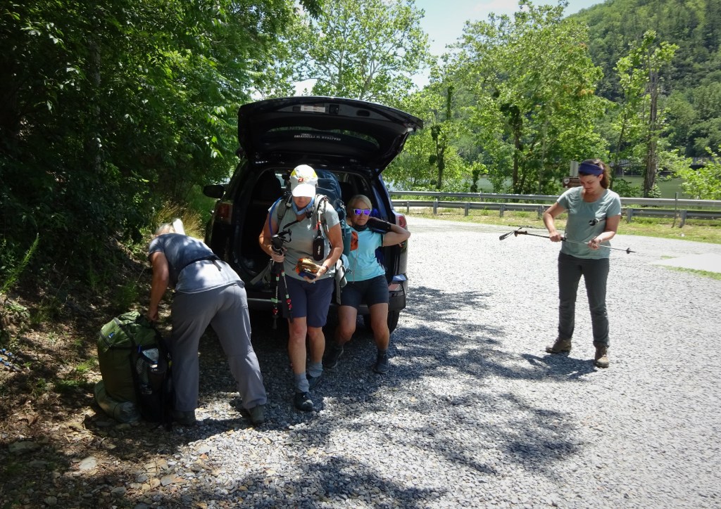
We have had some delicious weather here on the east coast courtesy of the the wildfires out west. The morning I set out to meet friends at Cacapon State Park it was cool and unexpectedly pleasant for July. We met up at the Batt picnic area for an easy access to the trail. We were in luck with a port-a-potty nearby, as well! 😀

A ranger pulled up as we were organizing our packs and stopped to chat with us about the trail. He also gave us a fresh trail map (appreciated) and let us know that Cacapon now offers “glamping” up on the ridge. Good to know!

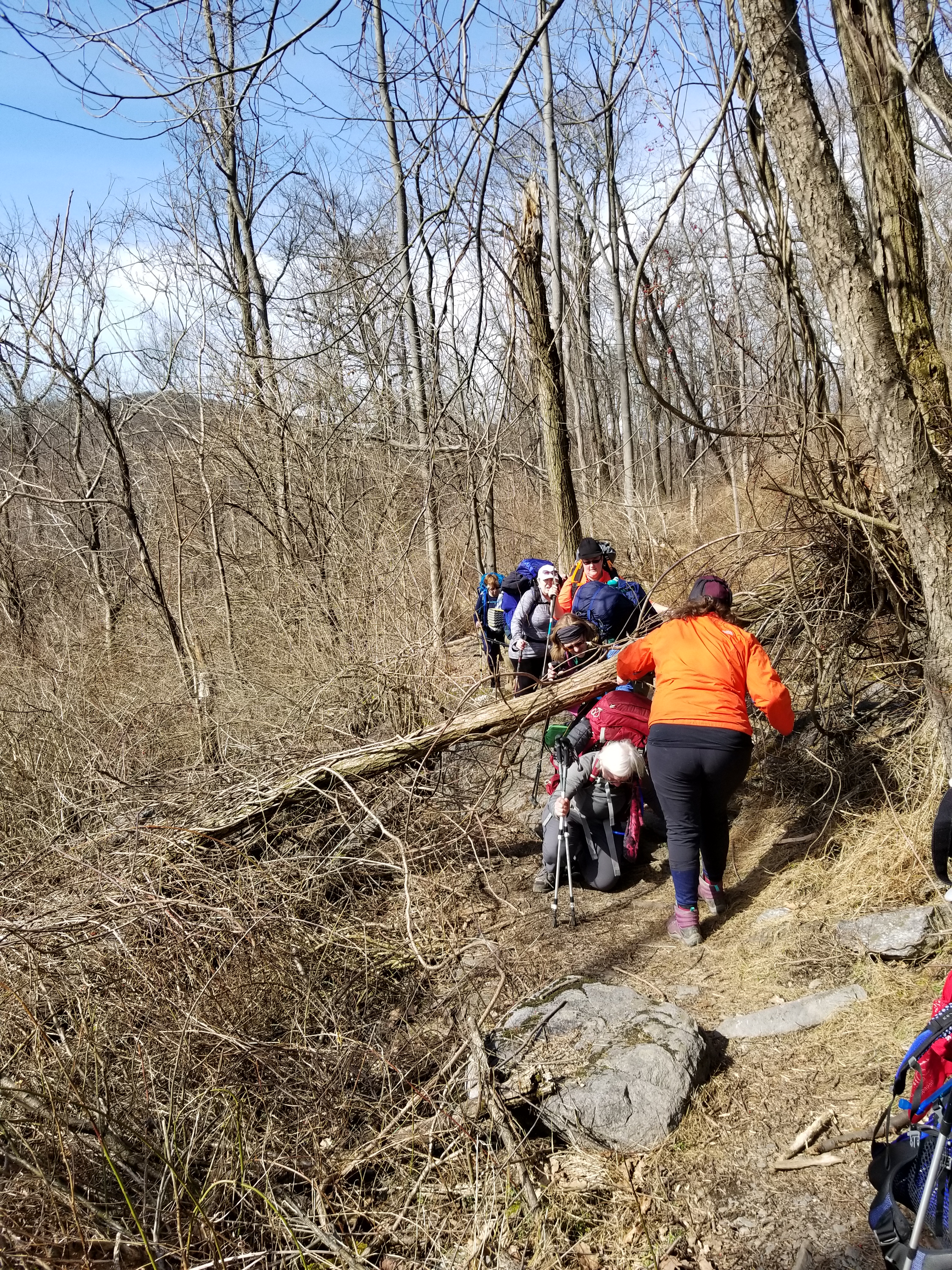
We set off in the glorious early morning fresh air! Oh, it was nice to be in the woods in the early morning! Birds greeting the day, chipmunks scrambling through dry leaves, and my feet heading uphill. Uphill for a mile and a half! It was a steep climb, with a few opportunities to stop and chat. I noticed a nice rocky area one could stop and take a sit down break…we didn’t partake, but I was thinking ahead to a possible Trail Dame hike. That rest area would come in handy for the Dames!

A good place for a break!
Finally a view!

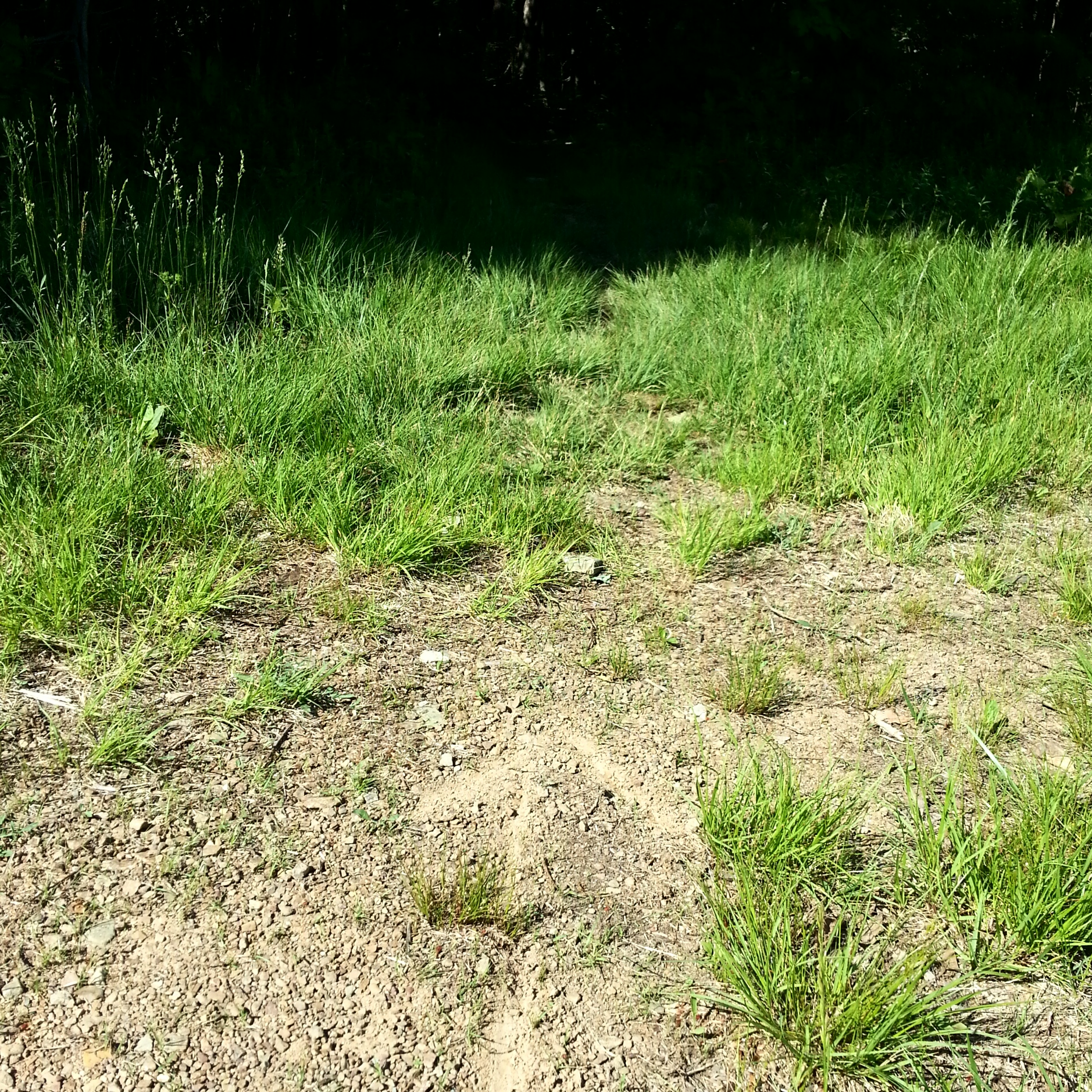
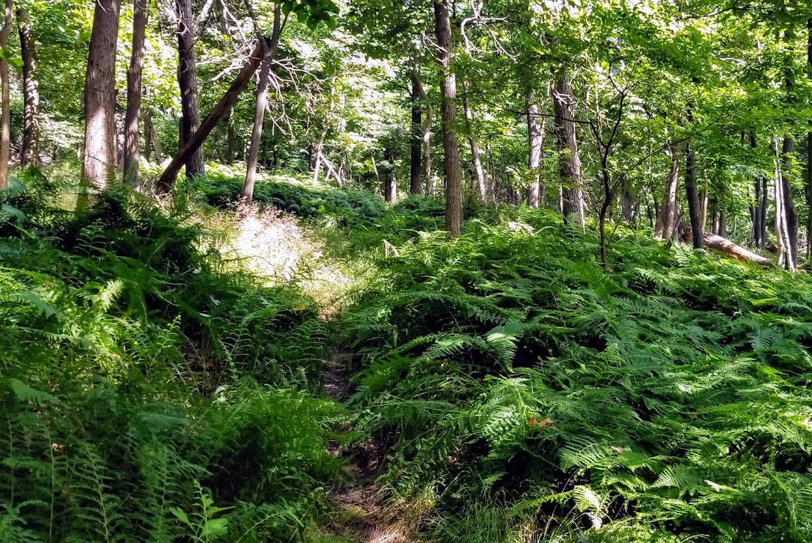
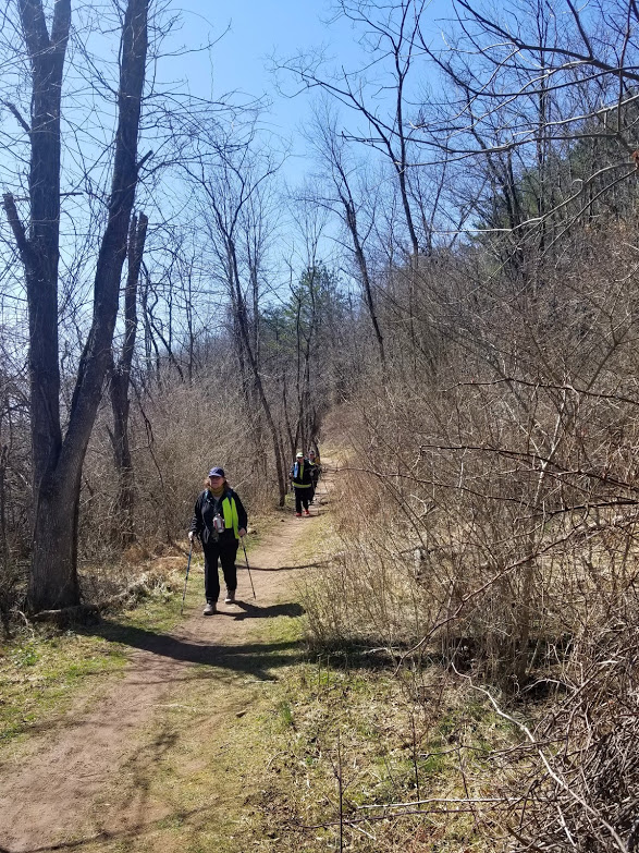
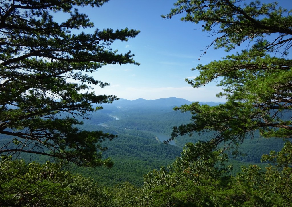
On we go, up, up, up! Once on the ridge the walking was easy, but the trail is incredibly overgrown with grass and ferns. The grass is thin enough to see the trail for a few feet before it disappears into wild growth. We took it slow and lucky me, hiking in the front, got to scope out the brush for any lurking snakes and catch those wispy cobwebs that seem to appear out of thin air! I carried out my task and we escaped any snakes that may have been hiding out. 😀

Junction with Ziler Trail

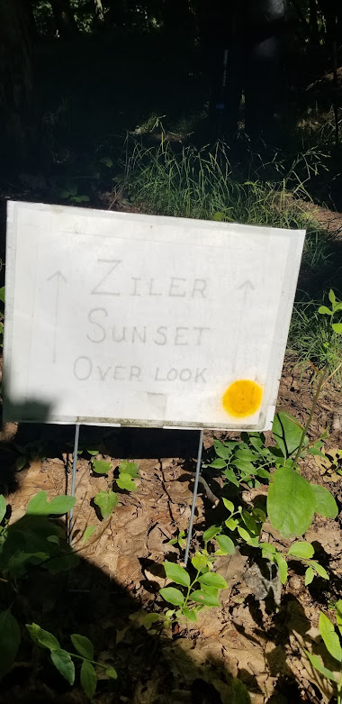
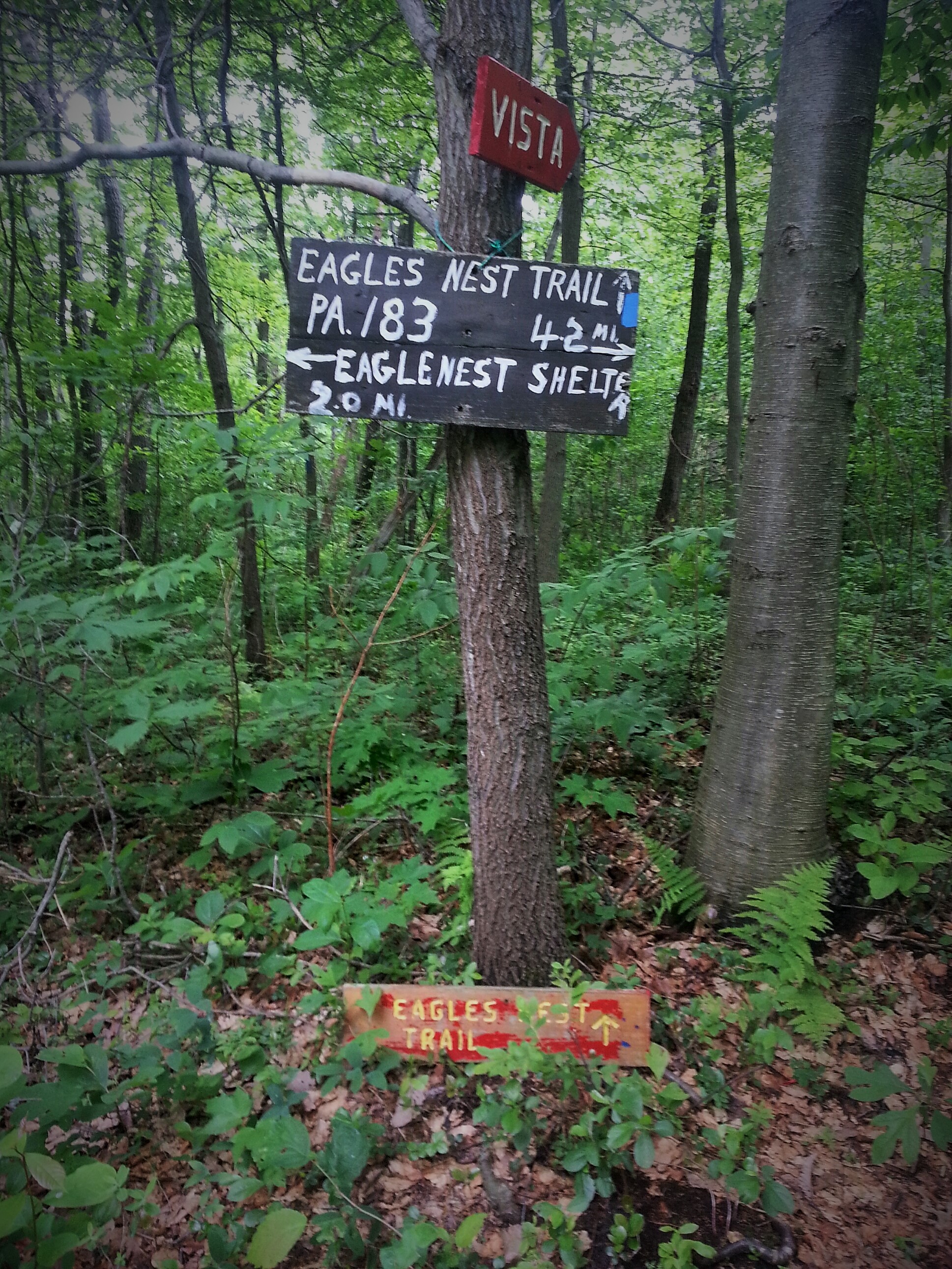
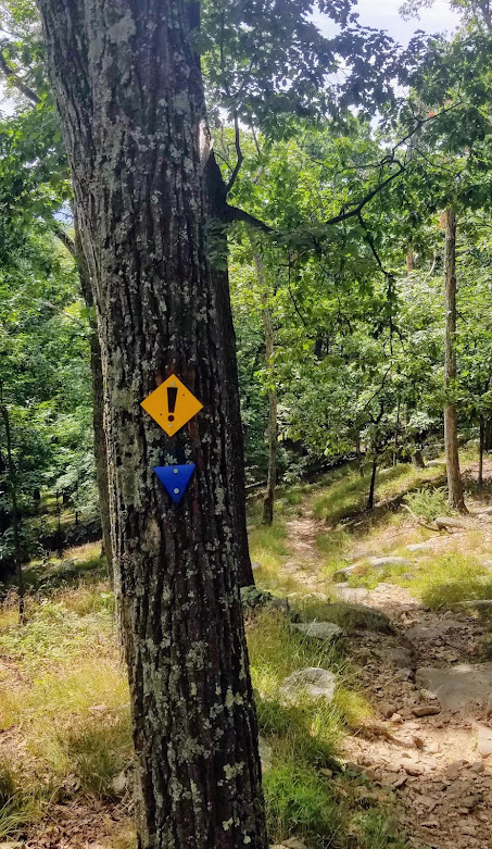
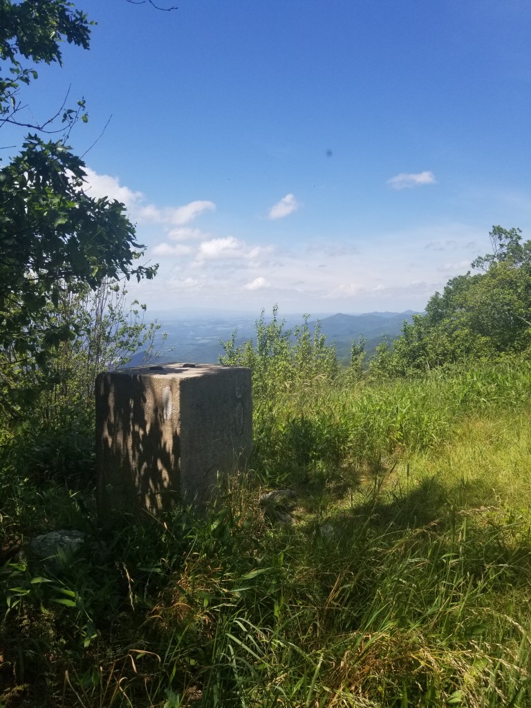
At the junction of the Ziler trail and the Ziler Loop trail, we saw a handmade sign for a view…so we explored it. And nothing. We went left, then right, and backtracked. No view in sight. Maybe a winter view? Or maybe the trail was overgrown and we didn’t see it? I don’t know, but the blazes were not in sight, so I was done! Back on the trail!

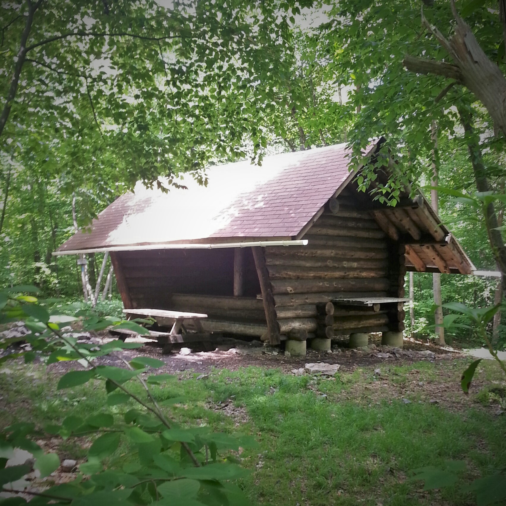
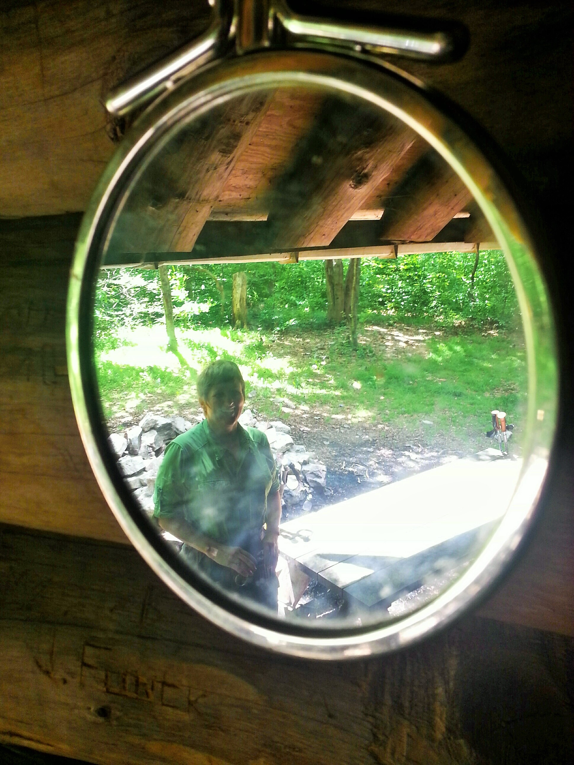
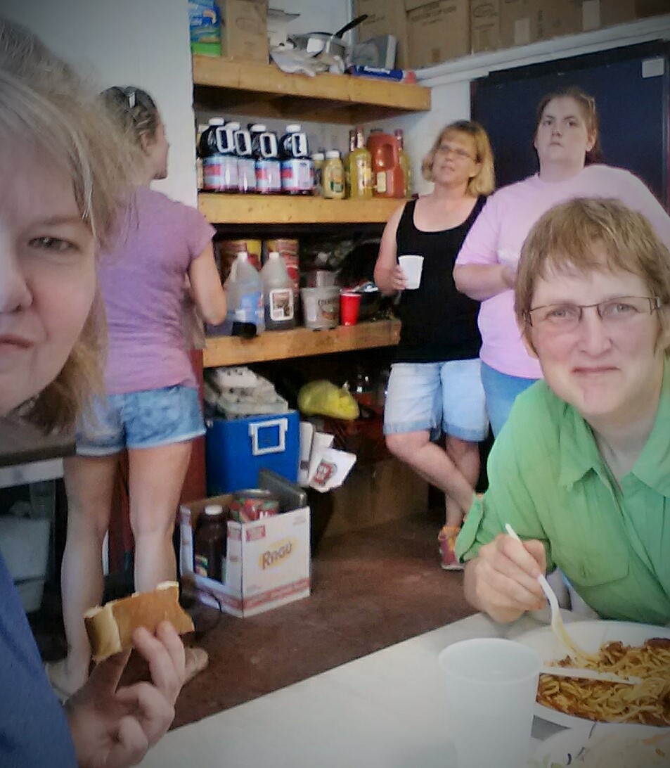
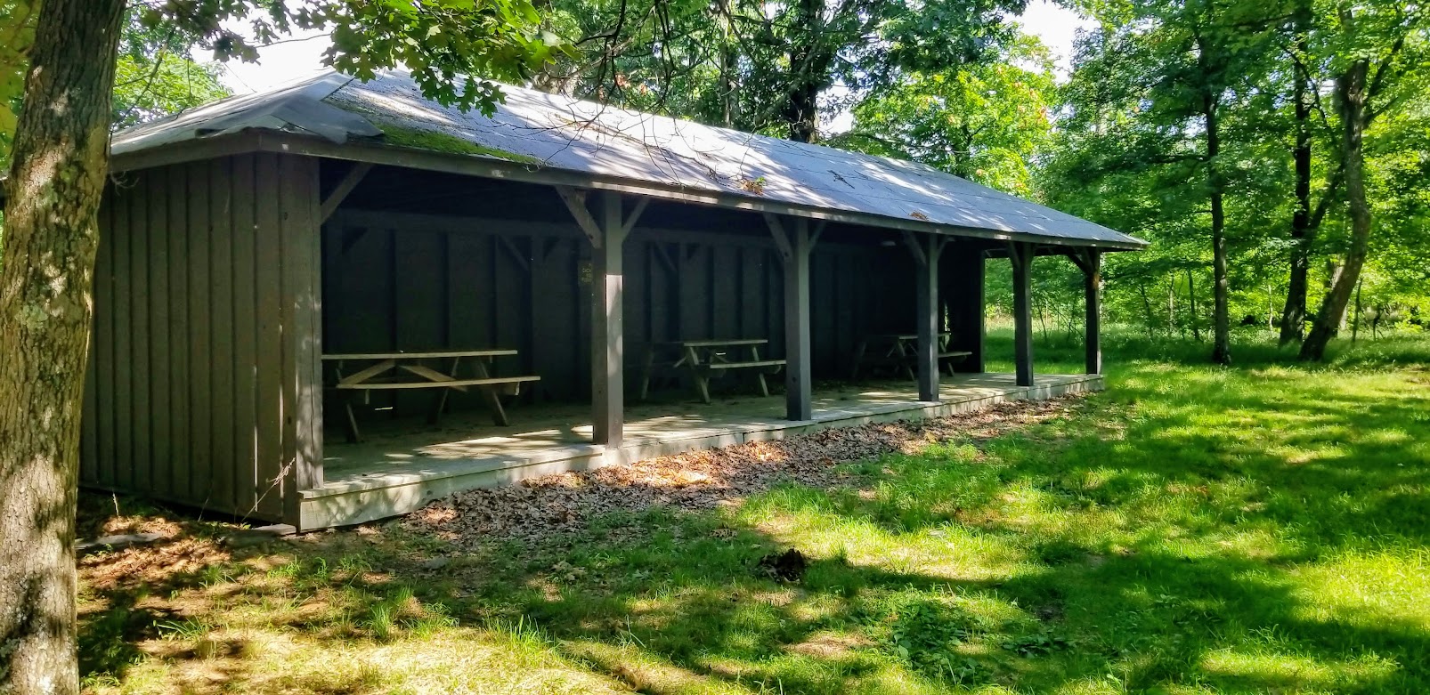
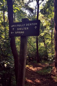
There is a shelter along the ridge which surprised us all. It was time for second breakfast, so we all decided that this was a blessed intervention in our hike through the jungle. 😀 😀 😀 The shelter sits along what looks like a fire road. I am now curious to find out where it goes. That would be easy hiking for some of the newbie hikers in Trail Dames!

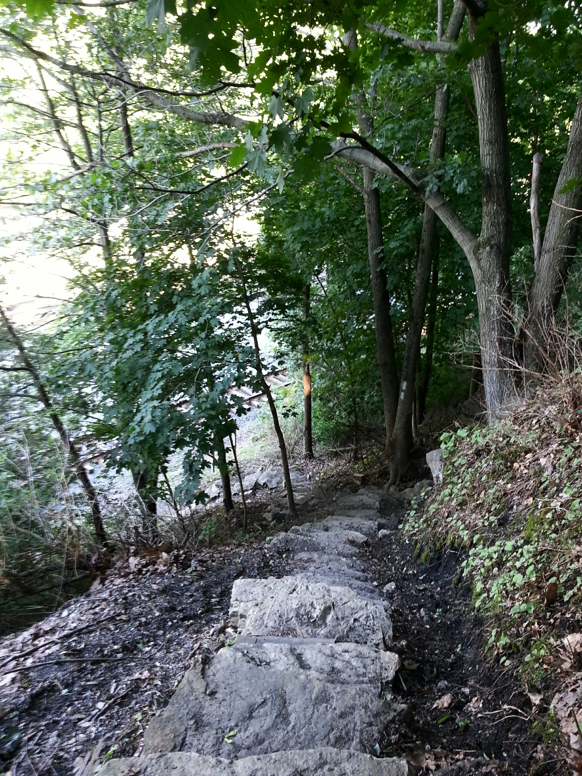
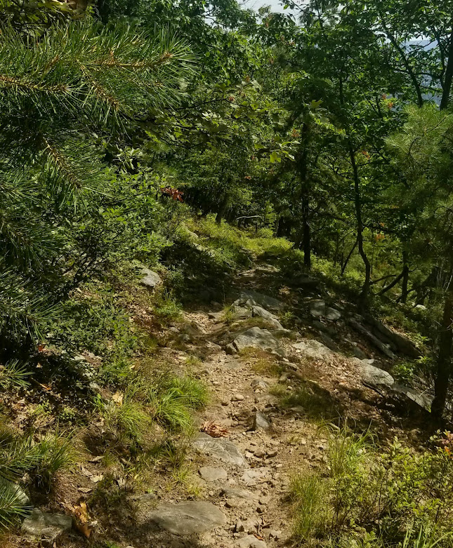
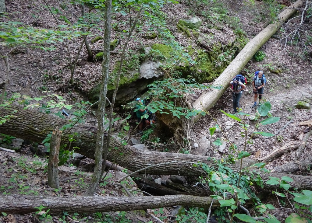
Snack time over and back on the trail we plodded through more high grass. Eventually the high grass gave way to rocks and dirt. The trail now wound steeply down the mountain. It was rocky, with an abundance of those pesky loose pebbles, making the descent a bit tricky. The trail signs were hilariously spot on. 😀

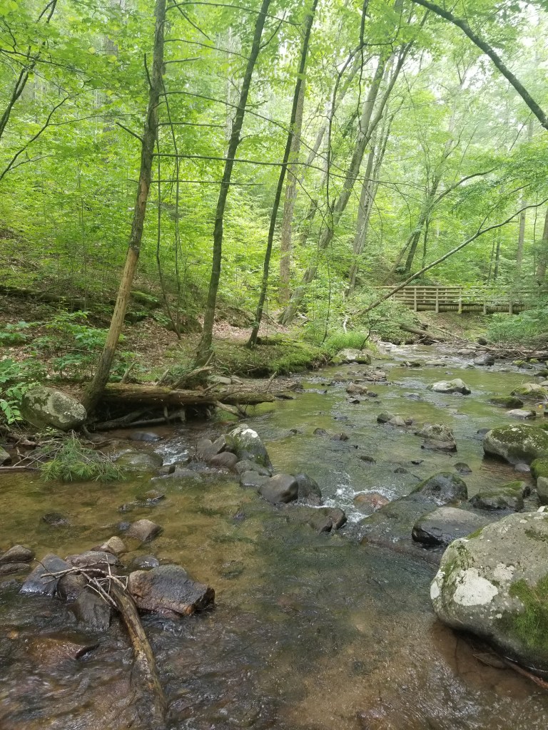
Once down the mountain, the terrain calmed down. Thank goodness…I stretched my neck and rolled my shoulders…ahhh that felt good! Along the last stretch of the loop, we passed the cabin area, saw some pretty impressive rock features, and got to walk on some “Wobbly Bridges” (seriously, they were called Wobbly Bridge #1, #2, etc 😀 ). As we neared the parking area, one of my hiking pals said, “yep, it’s time to get my trail legs back!” Amen to that! 😀 Hike On!

Back on the Trail with the Dames!

Being the organizer of Trail Dames isn’t all fun and games! 😀 During the pandemic, I needed to reduce the number of Dames per hike to 5 (6 tops if we had two hike leaders attending). This was not always supported by all Dames and I heard my fair share of complaints! However, most of the Dames were supportive of the measures taken to ensure the safety of all.

The Dames are picking back up now that vaccinations are increasing! Starting in May, we will increase to 8 Dames per hike, then by the time the hot days roll around, depending on health metrics, we may go back to allowing 10 per hike (our usual). And…shameless plug…if you are a woman OR know a woman in Maryland who wants to get outdoors and hike with a bunch of supportive women, then go to https://traildames.com/Maryland.html to find out more!

Last weekend I led the Dames on a hike around the lake at Rocky Gap State Park. It started rather briskly with temperatures in the freezing range. Of course, our hike started on the shady side of the lake and I quickly made the choice to don my gloves as the cool breeze was turning my fingers into icy pops!

The trail looked like it had been mushy, mucky mud the day before. It was frozen hard for us and we were thankful as our feet stayed dry. The walking was tricky through all the frozen potholes, though! No mind, we were distracted by morning song of the Red-wing Blackbird and the perfect reflection on the lake of a flock of honking geese coming in for a landing. We spotted a Killdeer and Osprey as we continued our path around the lake.

It was turning out to be a beautiful early spring day! Blue skies that make one stop and gaze at the sky, sun rays that warm ever so gently, and the company of a wonderful group of women!

We took a sit down break at the Canyon Overlook. This spot is back among the evergreens. *inhale* Ahhhh…the smell of a coniferous forest! The rocks were still cold, the air was fresh, and my peanut butter and jelly sandwich tasted fantastic! Once we sit down in the forest to eat, it feels like a field trip to me. Like a second grade adventure…and I love that!! 😀

Walking around lakes are deceiving! It always looks shorter than it really is…so many little coves to walk around. The sun was with us on the northwest side of the lake. Evidence of spring was starting to show … little tiny sprouts of green, a small yellow flower hiding in last fall’s leaves, and spring peepers! A welcome sound in these parts!!

Queen V was along for this adventure, which means there is going to be some kind of shenanigan! This time was no different and she had the Dames pose with a Turtle Crossing sign. Completely appropriate for this group of trail crawlers! 😀 So, so glad to be back on the trail with these women!! Hike on!

Trail Dames of Maryland!

AT – VA: James River VA501 to Long Mtn Wayside VA60

Well…this was a post COVID shutdown shock to my system! 😀

After driving down for a little over three hours from Frederick, MD, and another two hours placing cars, we hit the trail while the hot afternoon sun beat down on us. The parking lot at VA501 was easy to find and I was happy to exit the hot pavement and enter the just as hot, but at least shady, woods!

Day 1 we hiked in to the Johns Hollow Shelter. Blessed with a fine running stream, I took a good amount of time refreshing myself before cooking dinner. The shelter is in a delightful location with several almost level places to put a tent. Except, of course, for the place I put mine! But I was exhausted and fell asleep quickly.

View from my slanty tentsite

As usual, I awoke a few hours later after darkness had closed in on the forest. Since morning would not wait for certain things, I finally, after debating for at least 20 minutes, had to commit to getting out of my tent.

Okay, okay…I’m up, I’m out…oh, wow, it is really, really dark.

I made my way across to the privy and happened to look up. There was a perfect crescent moon shining down. It was framed by the upper most branches and leaves of several trees…perfectly timed…well done Mother Nature!

Once back in my tent, I could not fall back to sleep and tossed, turned, and created a ton of noise from my sleeping pad which has not become less noisy with wear FYI. Finally getting into a somewhat decent position I started to doze off. It must have been early…like 2 am…a yip, then a yowl, then a whole orchestrated sonata sung by a local coyote group. Beautiful!

The view from the creek

I know you will find this surprising, but I did not wake up refreshed and ready for a 9 mile day.

Day 2 was an up, up, up day. We climbed about 2000 feet up. It was our first climb and we got up while the sun was still low in the sky and breezes were frequent. With proper breaks here and there we made it to the top without any terrible memories burning in my memory. A beautiful view awaited us!

About halfway up the mountain there was a payoff!

We stopped at Salt Log Gap for a sit-down break. I got just two things to say…1. Someone said there was a spring. If that is true it is so far downhill that you’d be nuts to go looking for it. 2. Careful of the stinging nettles, but if you do get swiped try hand sanitizer on it. That worked wonders on the areas where I was attacked!

The second mountain of the day…ugh. Bluff Mountain is no bluff! The trail went up the sunny side of the mountain and it was a hot afternoon sun. Several thousand breaks later we rounded a corner to find the memorial for Ottie Cline Powell, an almost 5-year old boy who wandered away from his school in November 1890, got lost, then died on Bluff Mountain. His remains were found by a hunter in April 1891. This choked me up and I cannot get this kid out of my head even now. Poor, poor baby. 😦

Summit of Bluff Mountain

I was so glad to get to the Punchbowl Shelter. Such a pretty sight with a pond filled with chatty bullfrogs. 🙂 I went about setting up my tent, minding my own business, when the black flies descended. Oh my gawd, this was awful. Like on level with chiggers awful. I got so many bites. 😦 Bug spray didn’t phase those little suckers one bit. I capped off Day 2 with three ibuprofen and a benadryl.

I am loving my new tent…Big Agnus Tiger Wall UL2. The pond is in the background.

We TRIED to get out earlier on day 3 so we were done hiking earlier due to the heat. A group of five…we did try! And maybe we were out a little earlier??? Anyway, the day’s elevation looked decent and I was optimistically promoting a day that would allow our fired up muscles a day to recover somewhat. Hahahaaaaa 😀

Love this! A boost in the middle of hot exhausting day

The elevation wasn’t bad in comparison, but it still managed to get at me. The heat and humidity was suffocating and I could smell rain. Picking up speed around the Lynchburg Reservoir, yessss! This was good, this was easy!

Rounded a corner…Oh for Christ’s sake. What horse of the Apocalypse are we on now?

A monumental disaster of epic proportions lay before us. A tangle of huge blowdowns over a ravine. Every woman for herself! I decided to crawl under and through it dragging my pack behind me. It worked!

Feeling superior, I temporarily forgot that this was a miserable hike and plodded on down the trail happily the victor. 😀 There was even an congratulatory creek with rushing cool water about a mile after. Huzzah!

The day got long again and my feet were screaming with every step once we reached the bridge across Brown Mountain Creek near the shelter. I wasn’t the only one having physical turmoil and we were glad to be done for the day.

Brown Mountain Creek

The Brown Mountain Creek area is fabulously wild and gorgeous. In the early 1900s, a community of African American sharecroppers lived here. I looked and found evidence of homes long since abandoned. I am surprised and disappointed that there is no roadside history sign about this community at VA60. I went Googling for information once I got home and found “Brown Mountain Creek – Before the AT”.

I settled in for the night, best sleep on the whole trip under a big old oak tree. I had some quite disturbing lucid dreams about little Ottie. I woke up suddenly during one of those dreams to a lightning bug blinking his light as he passed my tent…a good sign. I got up and looked out ….ohhhhhhh…*sharp inhale*…the lightning bugs! I was mesmerized, and after the dreams I had, a little emotional.

The last day was a short hike out to VA60. Sitting in my tent, early in the morning, while the lightning bugs were still blinking, I wrote:

I am humbled by these mountains. Blisters on my heels burn with every step. Black fly bites have formed hard spherical mounds that itch like the dickens. Stinging nettles brushed my legs with a touch that was anything but gentle. My COVID shutdown body is tired and demoralized. Another day my mountains.”

Now healing, beer in hand, and looking forward to another day…Hike on!

I Think It May Be Spring!

Thank goodness, right? If your winter was anything like my winter…ugh.

Father Winter was a big tease with lots of potential, but no big exciting events. In Maryland, we would get icy mix, a little snow, then it would melt and we were left with a few damp, chilly days in the mid-40s. Brrr…rrr

Thank you Goddess of Spring for finally taking control!

Last weekend, I led a “newbie backpacker” trip. We had 4 new and 5 experienced backpackers. The newbies had completed two shakedown hikes prior and felt somewhat prepared.

We began our adventure at Shippensburg Road trailhead on the Appalachian Trail in Pennsylvania. Saturday started as winter…very cold and windy! We got moving!

As we hiked the seasons turned. A lovely day indeed!

In general, we took this stretch slower, and with more breaks than I would take if I were going alone. Which makes perfect sense for new backpackers. They had plenty of time for adjusting the pack, stretching, resting, and enjoying the woods!

We rolled into Tom’s Run Shelter mid-afternoon, plenty of time for the newbies to set up.

It was a cold night and one newbie had not brought the recommended 20 degree bag. She learned and will pack accordingly next time. Sometimes, we have to learn the hard way. 🙂

Spring rebounded on Sunday! The trail was a slight disaster with tons of water flowing down it and many blowdowns that had to be climbed over, under, or around! Our newbie, who hadn’t slept much due to being cold the night before, just about petered out on the last hill of the day. We got some extra food in her and took it slow…she was determined to finish! She dug deep and conquered the last hill!

Everyone finished sucessfully at Pine Grove Furnace State Park with smiles (and a few emotional tears). I am so proud of these women! We stick together, push through our fears, learn from our miscalculations, and always Hike On!

AT – VA Rt.725 to Jim&Molly Denton Shelter (and back!)

Here I am at my desk preparing for the semester, but thinking of the trail!  It is a needed diversion to calm my nerves as I head into a semester fill with many unknowns.

My mind is wandering back to last weekend when I completed a big, three new miles on the AT in Virginia.  This is the crux of the solo hiker…no shuttle means an out and back hike.  But…Excitement of stepping on a new section of trail overrode any misgivings I might have had about retracing my steps! I turned my car towards the Virginia state line, Sidekick Pauli riding shotgun.  🙂

The parking area off of Rt. 725 is quite pleasant and shady.   Hmmm…2:30 in the afternoon.  Starting mid-afternoon is not usual for us and created its own challenges in terms of the heat and our energy levels.  After crossing Rt. 55, up the hill we went, headed south to the Jim & Molly Denton shelter.

wpid-wp-1439837355866.jpg

The lull of the afternoon had me drifting off into trail daze soon after starting down the soft dirt path.

So I don’t remember if the Bee Lady’s dog rushed us before or after the train tracks, but it was shocking none the less. I yelled up the hill, “I have a dog!!!”  I heard a young woman call to the dog, but of course, the dog was too excited to stop.  Sidekick Pauli, always on a leash, gave a snarl as this young, energetic, white dog came crashing down the hill and right into, then onto her.

The woman, who was calling out louder now (in a way that told me she had NO control), rounded the corner and I could see she was carrying a child.  Luckily, the dog was not aggressive in a “I am going to kick your butt” kind of way so Sidekick Pauli got over her initial annoyance and tolerated the dog until we passed.  After passing, the young woman and I talked a bit.  Her son had been stung by a bunch of ground bees…ouch.  She described where the bees had been and was quite worried that we would get stung if we continued.

Okay, I forgive the Bee Lady and her dog (and hope her son is okay).  On with it!

Soon after stepped across Railroad Tracks

Soon after stepped across Railroad Tracks

On up the hill we went, enjoying any breeze that managed to reach us on this muggy afternoon!  Then an older gentleman came towards us with a full pack.  He asked if I had run into the Bee Lady.  I replied that indeed I had and wondered whether the bees were going to be a problem.  Turns out he had checked it out and apparently the bees had gone back to the ground and were not on the trail.  “You have a trail name?”  “They call me Chicken Farmer.”

Well, Chicken Farmer’s story hollowed out my soul.  My eyes watered as he told me his wife had died on June 17 (my anniversary).  His son came to watch the chicken farm so he could retreat to the woods along the Appalachian Trail.  Starting his hike in Port Clinton, he had come south to Harper’s Ferry to visit with friends.  That morning he had again set his feet in motion starting at Chester Gap near Front Royal, then headed north.  I bid him safe travels and again headed up, with a heavier heart and a desire to drop everything and head back to Hoosierland to see my Mom & Dad.

Are there ANY trails without rocks??? Sidekick Pauli is happy regardless!

Are there ANY trails without rocks??? Sidekick Pauli is happy regardless!

Ahhh, we were nearing the top of the hill, I could feel it and I welcomed it. Finding a nice rock to sit on, Sidekick Pauli and I stopped for a long water break.  Tops of mountains are so peaceful.  There is always a breeze that pushes the treetops aside and finds its way down to the weary hiker. 🙂 A chill went down my back as the wind met with my sweat soaked shirt. I enjoyed it…I can definitely tell you I enjoyed that moment!

Once over the ridge, we were excited to see a large field.  We ran a few steps, channeling Maria from “The Sound of Music”, until the reality of a 92 degree day brought us back to our steady plod, plod, plod.  There were several lovely butterflies, even a monarch, that joined us in our trek across the field. 🙂

wpid-wp-1439839388890.jpg

A little road walk between the hills.

Then it was down to a road crossing, then up again to the Jim & Molly Denton Shelter.  I was just plain, old hot at that point, so arriving at the shelter was a happy moment!  Two college guys were hanging on the porch as we walked up.  Pauli was happy to make their acquaintance and I think they were happy to meet her too!  I hung out for a while at the shelter, drinking even more water, and talking with the guys.  Envious, I was! Oh, to be young and on the trail for however long you want to stay out…no responsibility, no timeline other than the beginning of the semester…

Well, the afternoon was quickly heading into early evening and we had to get back to the car.  The crickets sang to us and the cicadas chirped.  Shadows grew longer as we walked slowly back.  No need to rush.

Hike on.

AT-PA Rt183 to Port Clinton 6/6/2015

I’m back Pennsylvania!

Thank goodness I found a hiking pal in PA! It has been a lot of fun hiking these last couple of sections with Cindy, trail name “CanDo”.

This time around, I got to the parking area off Rt. 61 in Port Clinton with no major drama, just a little rerouting around Harrisburg due to roadwork.  It is a nice little lot south of the town and has a blue blaze to the AT.  As soon as I got the car backed into a spot (beautifully I might add), a text came in from CanDo.  “I’m in the Rt. 61 lot.”  Ummm…but I am in the Rt. 61 lot and it was clear she was not.  This was soon sorted out…two lots, different sides of the highway.  My lot was deemed the nicer choice to leave a car, so CanDo picked me up and we headed down to the Rt. 183 gameland parking lot.

Pulled in, gathered our packs, then headed up the gameland road to get to the AT.  It was 8:45 and 15 miles were ahead of us.  I like smaller goals, so I set my sights on Eagles Nest Shelter, about 6 miles in.

Intersection of the Gameland Road and AT...right turn and off we go!

Intersection of the Gameland Road and AT…right turn and off we go!

A deer jumped to the side of the road flicking his white tail before disappearing for good into the woods.  Good morning to you too, little deer!

Reaching the intersection with the AT we also disappeared into the woods, taking a right, headed north.  There were no climbs initially, just a few rocky spots, so we soon found ourselves passing Black Swatara campsite and spring. The campsite looks to be large enough to serve a group comfortably.  Someone has handcrafted a gorgeous sign for the site!

image

It was a wonderful day for hiking! The rain had finally cleared out leaving us with a morning of cool temps, blue skies and refreshing breezes! The trail was a regular amount of rocky as we stomped on towards Eagles Nest shelter.

Only another two miles until the shelter!

Only another two miles until the shelter!

Eagles Nest Shelter has windows and gutters!

Eagles Nest Shelter has windows and gutters!

The shelter was 0.3 miles off the trail, which meant we added a little over a half mile to our trip by stopping for lunch there. We opted to pass on another 0.1 mile to see the view since we would get an overlook further down the trail.

What a super respite!  We lolligagged for about 45 minutes before heading back to the AT. I took off my boots, laid back on the shelter floor and propped my feet up on the wall. Ahhhh!!!

This shelter even has a mirror!

This shelter even has a mirror!

Taking a break fooled my mind into thinking I hadn’t actually hiked this morning. So starting out after lunch was like starting anew on a 9 mile day hike, not the 15 we had originally undertaken. “I got this!” I said to myself.

The woods was still carpeted with thick ferns, but now the mountain laurel was beginning to bloom as well.  Just gorgeous pockets of mountain laurel blossoms brightened up the darkness of the forest.  We walked through admiring all of it!

Another little break along the trail.

Another little break along the trail.

The miles were just melting away and I still felt good.  The guide book warns of the severe rockiness of the last six miles.  I found the guide book to be wrong in this case.  There were some spots of heavy duty rock hopping, but most of the trail just seemed like regular old Pennsylvania rocky!

Now this ... this is one of the REALLY rocky sections! :)

Now this … this is one of the REALLY rocky sections! 🙂

Feeling pretty triumphant at Auburn Overlook.

Feeling pretty triumphant at Auburn Overlook.

The hardest part for me was the steep downhill into Port Clinton.  Slow go there for sure.  My knees and thighs were relieved when we were in sight of the bike trail at the bottom of the hill. Then another short down on some very suspect steps and we were at the Port Clinton trail depot.  And since we had not had enough walking on rocks all day long…we proceeded to tramp all over the ballast to look at the trains!! Go figure…we are nuts!

Trail comes out to Fire Road, then turns back into the woods...almost missed this arrow!!

Trail comes out to Fire Road, then turns back into the woods…almost missed this arrow!!

Yay! Reached the rail trail!!

Yay! Reached the rail trail!!

The final assault, I mean descent, to the depot.

The final assault, I mean descent, to the depot.

IMG_20150607_075917 (2)

As we left the train depot, a guy stops and asks, “hey, you two know about the all you can eat spaghetti dinner?”  WHAAAAAAT?!!!!!  Oh, this was the best end to a hike ever!

Oh Yeah!!!!!

Oh Yeah!!!!!

All You Can Eat!!!! Yesss!!!

All You Can Eat!!!! Yesss!!!

All You Can Eat Spaghetti Dinner…$8.

Feeling like real hiker trash…priceless!

Hike on! 🙂