Elkwallow Picnic Area, finally…after two hours in the car! Sidekick Pauli was whining to get on the trail, I was waiting for two backpackers to finish with the privy. Ahhh…finally.
On the trail at 11:07am…wow, it was windy! I stopped to check I had everything I wanted at 11:10. 🙂 I always feel like I am forgetting something.

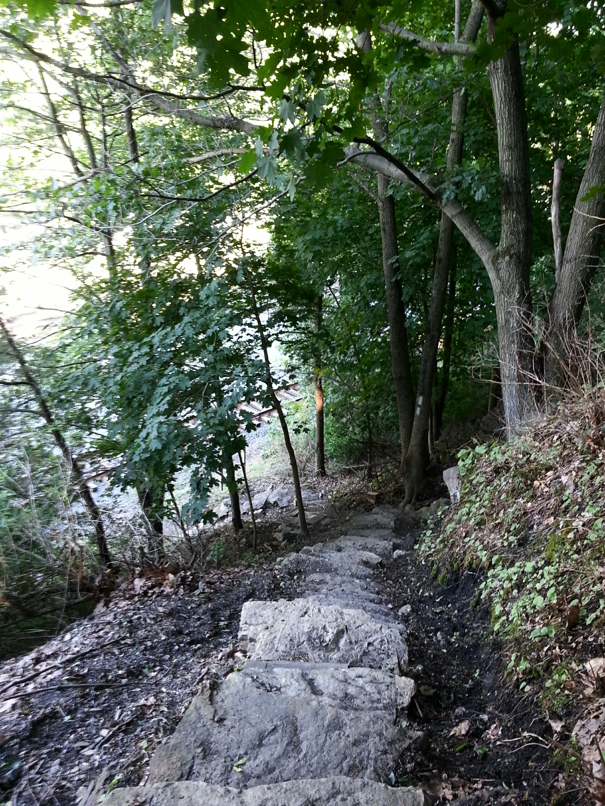
Always nice when the trail head has a privy!
We cut around the back of Elkwallow Wayside where there is a little store, gas and bathrooms during the main season. Today, however, nothing was open. Turning right onto the AT, we crossed Skyline Drive and began our first climb of the day ascending 500 feet up to the Piney Ridge trail. As I drove to the trail head this morning, the thermometer in my car kept rising and falling as I wound my way down Skyline Drive. When it showed 39 degrees, I worried I hadn’t brought enough layers. Well, as I plodded up that first hill my fears were put to rest! Plenty warm with that sun out…and the occasional gusts of wind became a welcome occurrence.

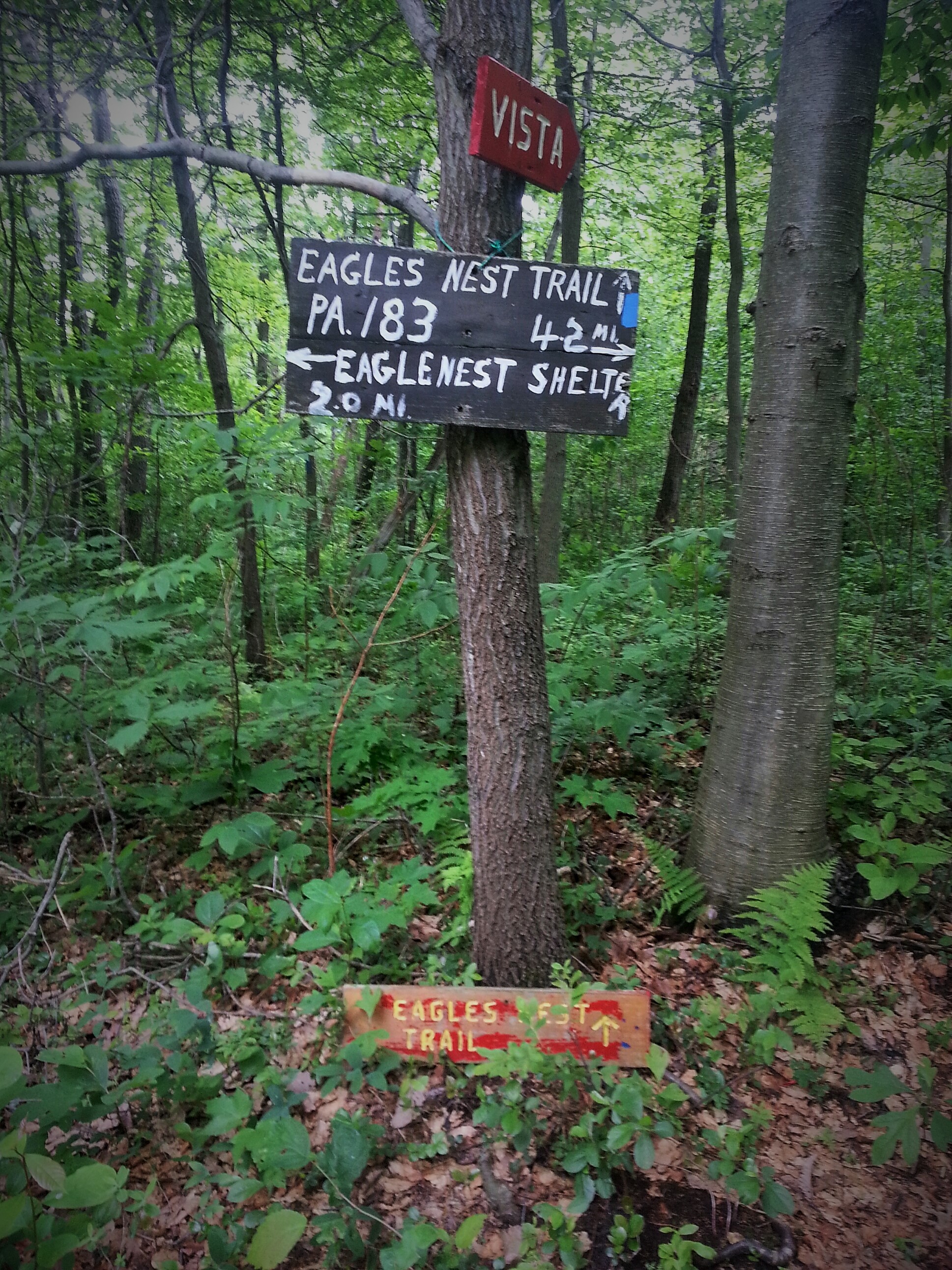
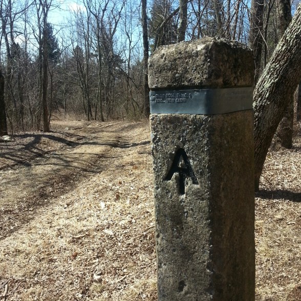
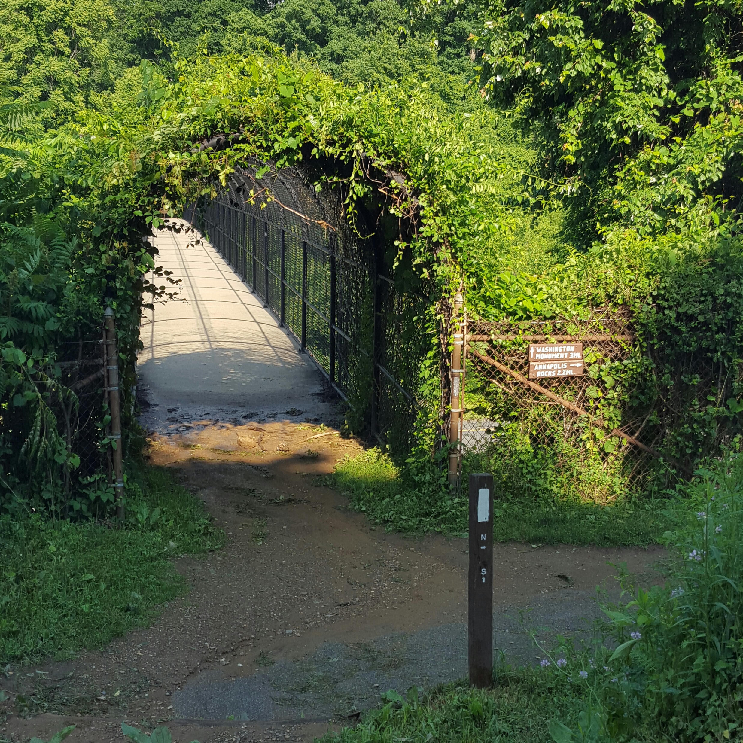
Turn off for the Piney Ridge trail.
At the turn off for the Piney Ridge trail is a another trail (looks like a driveway in the picture above) that goes to the PATC Range View cabin. This would be an excellent place to stay as there are many good loops you could hike in this area! Made a note since I am a PATC member!
The Piney Ridge had some areas of Pines, but was mainly a woodland trail. I was able to get a view of the surrounding mountains through the trees which was a nice bonus to being on the trail so early in the Spring! Spring, I can finally taste it!!! 🙂 🙂
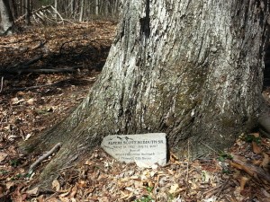
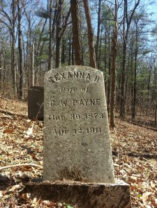
The Piney Ridge trail drops, rounds a mountain, then meets up with the Fork Mountain trail. Along the way down, I happened to glance to my right and saw something odd sticking up…I went to investigate and found a little secret cemetery! What a beautiful spot. I murmured many a “I’m sorry” as I stepped on graves, over graves and around graves to read the tombstones left intact. I don’t know why I feel a need to talk to tombstones, but I do…who knows…maybe the spirits are still around and I would rather be on good terms! When I left, I said “Thanks for welcoming me, I enjoyed this place” and felt an immediate warmth fill me.
Back on the trail I felt I was no longer alone. Just before the Hull School trail there was a big old tree. As I approached, on this very windy day, I asked the tree to hold on to all of its branches while I passed beneath it on the trail. It was gracious enough to grant me my wish. Another hundred yards up the trail I heard a massive thud behind me…the tree could hold no longer…a huge branch lay across the trail where I had just walked. Thank you spirits of the mountain!

I love visiting old cemeteries!
-
-
This is awesome.
-
-
Interesting name!
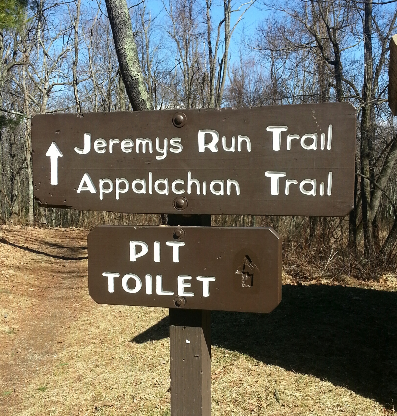
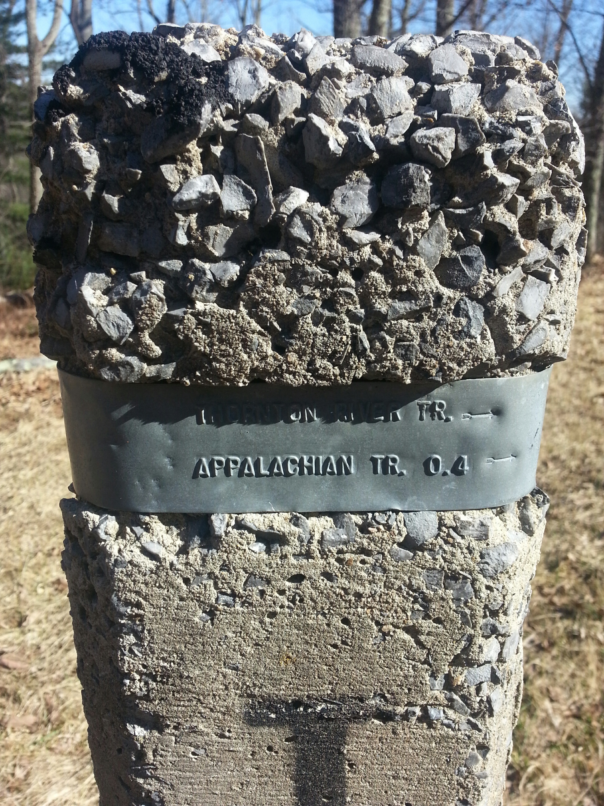
A quick break was welcomed at the intersection of the Hull School trail. We had descended 1000 feet since stepping off the AT. Reading the cement trail marker I saw we had only 0.8 miles to go before getting to the Thornton River trail where we would begin to ascend back to Skyline Drive.

Approaching the intersection of the Hull School Trail. Dead center is Fork Mountain!
A right on Thornton River trail…I was already thinking about the river crossings…you know what I forgot? River crossing shoes…way to be prepared…ergh. The first crossing was just not possible. It was deep, it was fast and all the regular stepping stones were covered with rushing, whitecapped water! So I bushwhacked upstream and found a place where a bunch of downed branches and logs had formed a dam. It looked pretty sturdy…so I tucked Sidekick Pauli’s leash into her harness and said “Let’s go!” I have NEVER been more reliant on my dog to do the right thing…she was a ROCKSTAR!!! As I climbed up precariously, I could see her picking her way up onto the dam of branches, then walking across one of the larger logs with amazing balance and dexterity to reach the other side. She then walked down to where I was crossing and waited for me to make it across. I love this dog, the best!!! 🙂 🙂 🙂
-

-
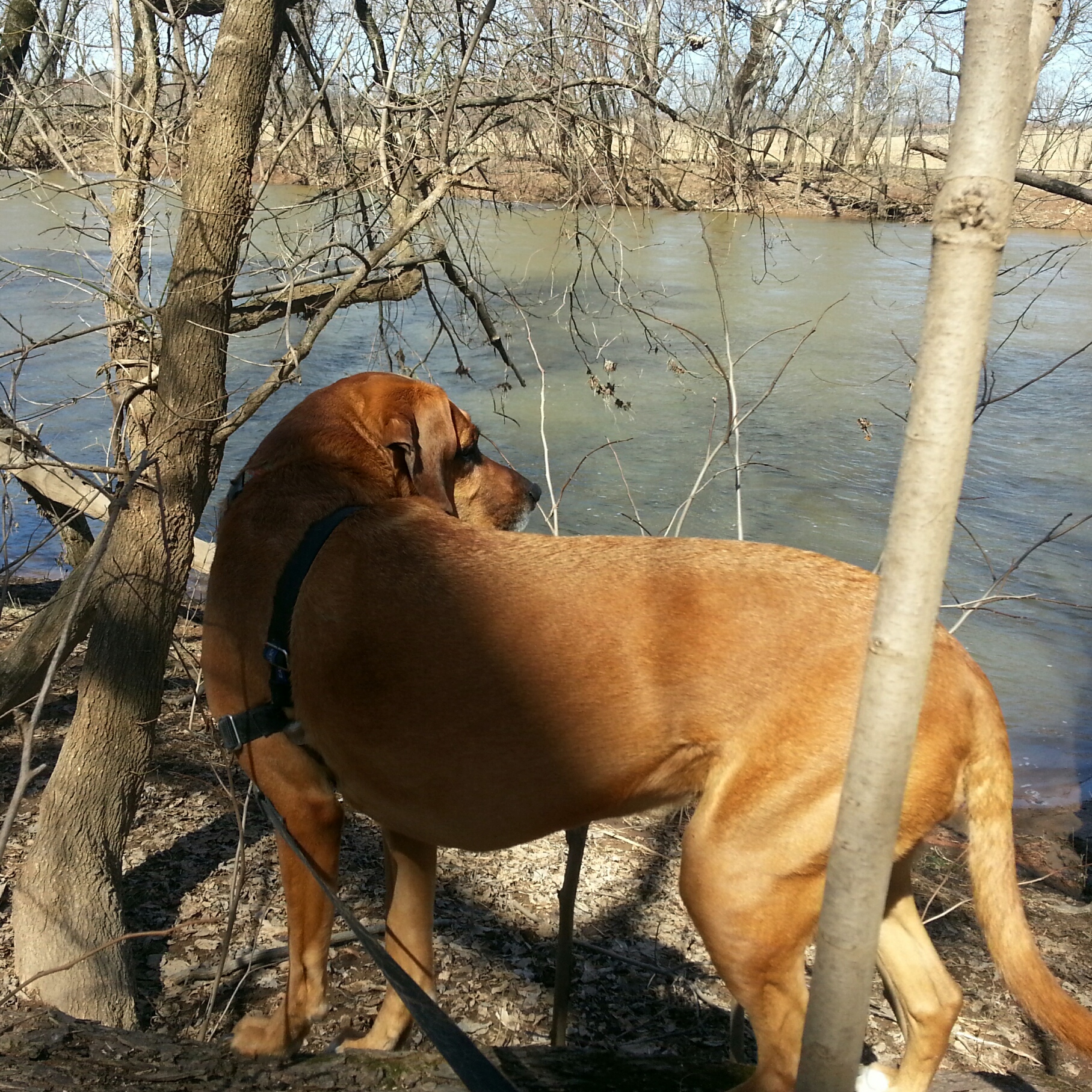
Sidekick Pauli found a spring!
-

-
I didn’t take this pic until after I made it past my first crazy crossing!
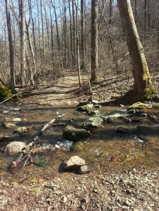
So on up the trail we went…BOOM! Another crossing already??? This one wasn’t as bad, but all the stepping stones were still covered with water. So I stopped and looked for a better place to cross…found one, then slipped, and the water rose to mid calf…so much for not getting the boots wet! The cold water felt good on my aching feet, so what the heck, I stood there in the middle of the river for a brief moment before climbing out on the other side. Then it was slosh, slosh, slosh up the trail. The next two crossings were uneventful and then the river became a stream, became a trickle and then was all the sudden gone altogether! Ahhh, Spring in the mountains. 🙂
-
-
Last water crossing…yay, stepping stones!
-

-
Cool old car on the side of the Thornton River trail.
Once reaching Skyline Drive I had planned to access the AT again and follow it back to Elkwallow. I had wet boots and my legs were tired from the extra bushwhacking! Taking the AT would have meant another 2.5 miles to my car. After 8.5 – 9 miles …UMMM…I don’t think so!!!

When I saw the AT access was almost another 1/2 mile in the opposite direction…I literally said HELL.NO. and road walked back to the car!
So I turned to the right, slowing making my way down Skyline Drive and back to Elkwallow with my super dog, Sidekick Pauli, at my side…
Hike on!


 As you can see I actually have it fully packed this morning. It’s a good idea to check the total weight before slinging the pack on for that first big climb out of Port Clinton, PA! Here is what is in the pack:


")